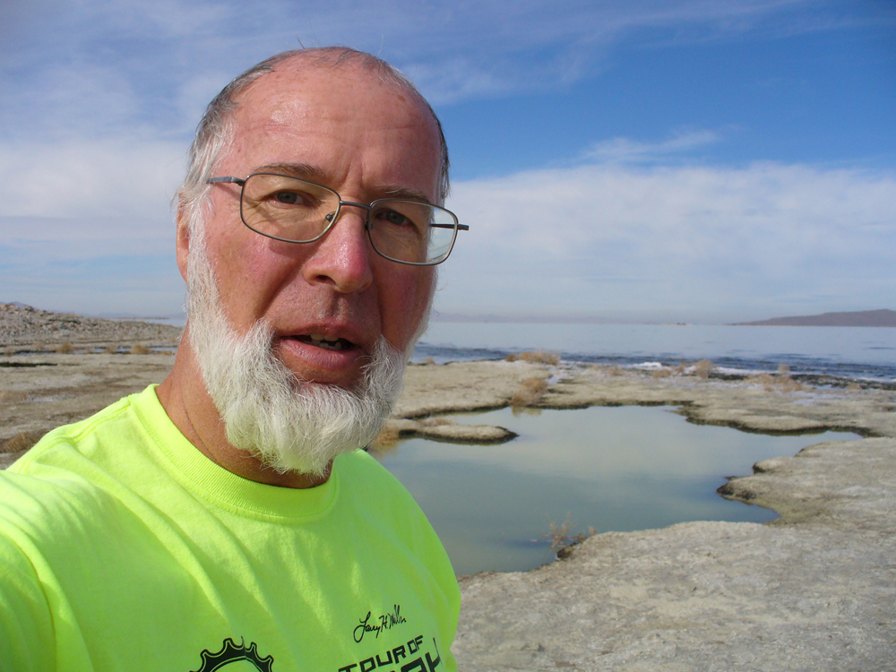
By Mel Bashore —
I don’t know what it is that draws me to think up and attempt bike rides that seemingly have never been done by anyone ever before. There usually is a reason, a good reason, why such bike rides have never been done before. Number one in the Reason Department often has something to do with degree of difficulty. Two years ago I tried to become the first person to bike from Canada to Mexico on the beach (see Cycling Utah, March 2014 issue). On that solo ride, I rode on the ride-able beach for the entire state of Washington before halting my attempt at the Columbia River. I stopped there because of the danger in having to ride on my loaded fat bike on narrow, busy highways when rocky cliffs on the beaches blocked my path and forced me inland. I decided that it wasn’t worth dying to accomplish this feat—and that it could be done safely if I employed a support vehicle. This is a ride that I still look forward to undertaking again to ride the beaches of Oregon and California.
Since that sandy West Coast beach ride, I have been thinking about riding my fat bike around the Great Salt Lake on the shoreline. Doing a Google search, I couldn’t find any reference to it ever having been done before. I did see that others have gone around the Great Salt Lake on roads, but couldn’t find that anyone had ever ridden around it on the sand. That was just enough to get me drooling about the possibilities. It’s curious that I never seem to think that there may be a good reason why one of my cockamamie ideas might never have been attempted. But I’m not wired that way.
One of the factors that caused me to begin thinking about circumnavigating the lake is that it was presently at a very low level. That would make the circumference of the lake smaller than usual and provide a more expansive (and possibly drier) riding surface. I began looking at the lake on Google Earth to see what the shoreline looked like. I printed off several maps of the lake to take with me, adding notes and named geographic features.
In my naiveté, I thought I could average nearly the same 9-10 mph speed that I was able to do on my fat bike when I rode the coast of Washington on the beach. Unfortunately, two important things that I failed to think about were that (1) I was helped on my coast ride by a very hefty tailwind and (2) the Pacific Ocean’s beach sand was a uniformly smooth surface. The absence of those two factors on my Great Salt Lake circumference ride changed the whole complexion of doing this ride in a timely manner.
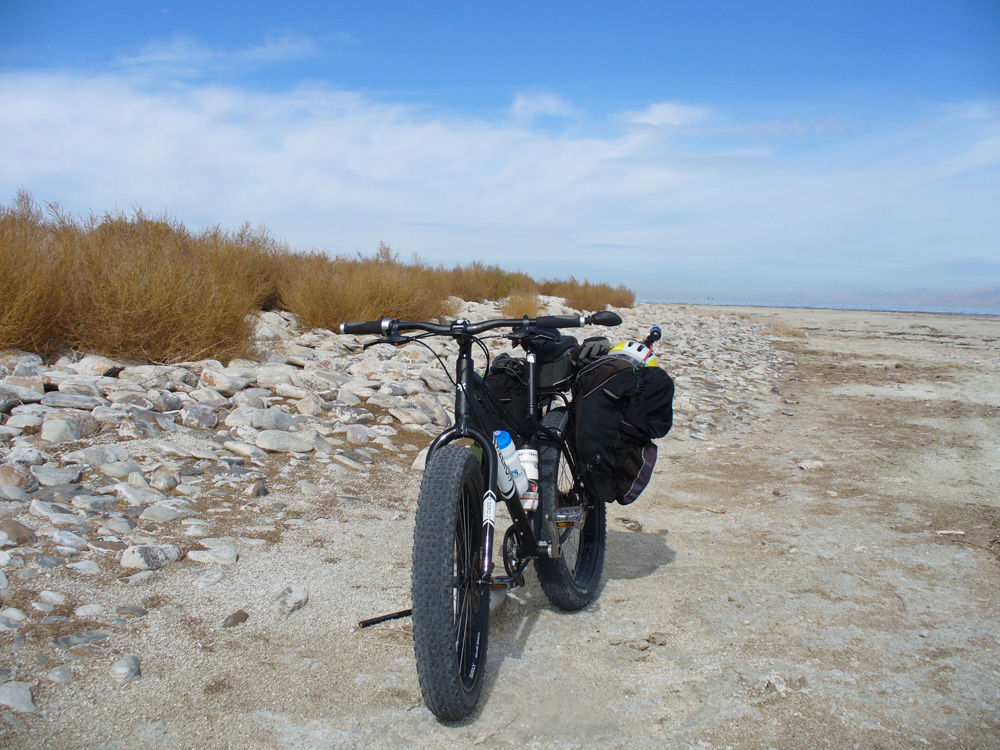
So it was that on October 22, 2014, I set out from the Great Salt Lake Marina on my fat bike. One of my sons has a sailboat that he berths at the marina. Using his marina parking pass, I left my car there on what I hoped might be a 3-4 day swing around the perimeter of the lake. I packed sufficient supplies and water in my panniers to last at least that long.
I also realistically told my wife that this was an exploratory experiment. I might find out that it was much more difficult and challenging than I foresaw. In that case, I would retrace my steps and return to the car. I simply did not know without making an initial foray.
After letting the marina caretaker know what I was planning, I set out from the parking lot on the part-paved/part-dirt road leading to Black Rock about 1.5 miles west of the marina. Black Rock was surrounded by a myriad of small water inlets stretching out in scattered fashion to drier-looking beach some distance to the west. Not knowing if the sub-surface could support me without sinking up to my hubs in muck, I turned back to get on the Union Pacific railroad right of way. It was marked private property, but at the moment I simply rationalized my dilemma and pedaled on that dirt road west about five miles to a place where I could easily get off the embankment onto the sand.
Upon my return to the marina two days later, I learned that Black Rock is the better, more legal, access place to the beach. The departure from Black Rock should be made by pointing your bike directly towards the Stansbury range of mountains that are south of I-80. If you point your bike in the direction of Stansbury Island, you will end up in a mucky poor situation. Every fresh water crossing I made on the south shore was accomplished without incident. The bottoms were all firm sand. With the current water level so low, none of the maps that I had, reflected in any way the present shoreline of the lake. I was on an excursion of discovery.
The riding surface on the south shore was very smooth and hard-packed. There were no other bike or ATV tracks. This was very much untouched. I even stumbled on an old weather balloon that may have lain there for years. I cut off the radiosonde, packed it with me, and mailed it back in its postage-paid mailer to the Weather Service upon my return home. A slight breeze off the lake brought lake insects, mosquitoes, and a disagreeable smell. I donned my mosquito-net hat, sprayed repellant, and otherwise enjoyed the ride. As soon as I rounded the southwest corner of the lake and headed northward, the smell and bugs left.
It was also at this point that I began running into evidence of other human traffic. There were many ATV tracks in evidence. I was passed by half a dozen ATVs, all traveling together back and forth to some location in the distance. They all had small-wheeled wagons trailing behind their ATVs. They were friendly and gave me a wave each time they passed. After about nineteen miles, I caught up with them while they were huddled around a large pile of white sacks. They were hauling the sacks of brine shrimp, which they had harvested by hand rakes. They told me that they rarely see other people out on the flats.
A few miles after leaving them, I reached the Morton Salt pumping canal, which led out into the lake. I rode on its canal bank road west about a mile to the trio of pumps, at which place I was able to cross over the flats north of that canal. This canal is situated on the southeast corner of Stansbury Island. On my return journey, I met a Morton Salt security guard here. He saw me off in the distance, a very foreign sight in these parts. He was curious to hear my story. He kindly wanted to make sure I had enough food and water. He also wanted to know if I’d spotted a very mean cow, which local ranchers wanted to capture. I hadn’t. In fact, I hadn’t seen any wildlife and only a couple of birds. The only people I met were the security guard and the brine shrimp harvesters. Although the landscape is bleak, it is not without its own brand of beauty. Sunrises and sunsets bordered on spectacular.
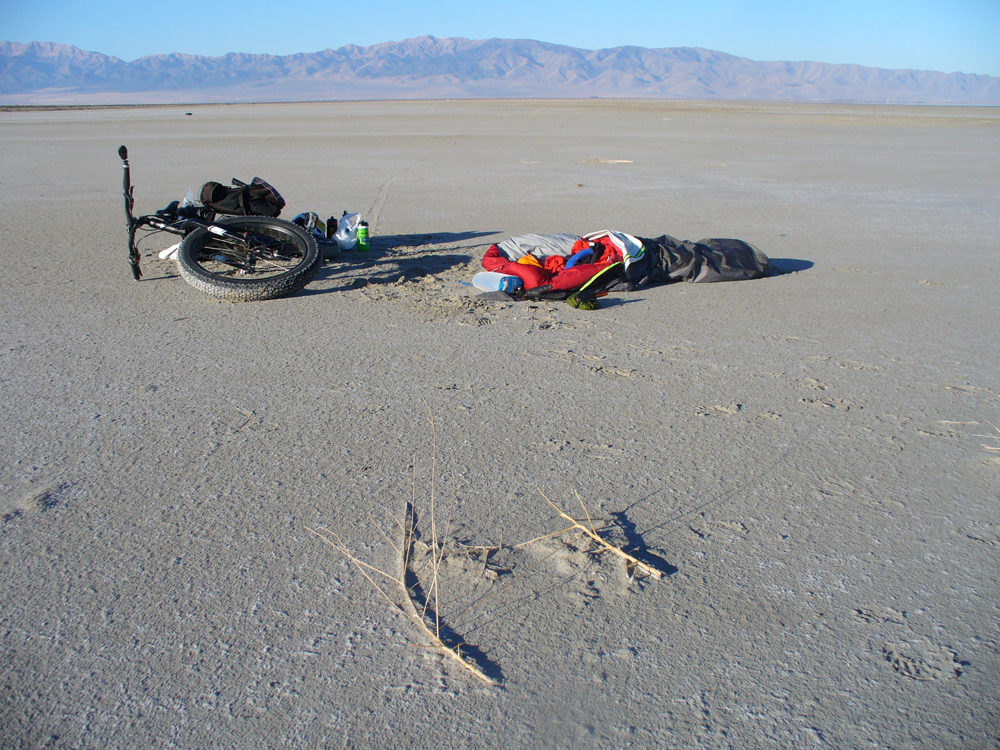
About a mile north of the canal, I bedded down on the flat sand next to some big logs, after about a half day pedaling 23 miles. It was disconcerting to discover that my air mattress went flat. I wasn’t able to find the leak (even when I got home) and spent two nights on the hard playa. The next morning I awoke to a beautiful morning light playing over the east flank of Stansbury Island. Although chilly, the stunning scene made me want to get up and continue exploring northward.
I learned in coming and going to the north point of Stansbury Island, that the best riding sandy surface generally lay about a half- to three-quarters of a mile east of the base of the island. Unfortunately on the way north that morning, I ventured too far eastward toward the shoreline and got on some very rough ground. Although the ground closer to the base of the island is moister, it is also smoother. There are several fresh-water springs along the eastern flank, which seep out onto the sand. One of them had a quick-sand type bottom. When I had to cross that short stretch of brackish muck, I had to pedal quick and hard to avoid getting stuck. The Morton Salt employee told me that the springs along the base can be used in a pinch for drinking in a survival situation. I was packing plenty of water. I returned to the marina with two-thirds of my water supply intact and food enough to last another 2-3 days.
I had taken plenty of supplies because I did not know if I might be able to get around the entire lake, or if I would have to cut it short and simply backtrack to the starting point. Only twice was I able to get the bike up to 7 mph, and that only for stretches of about a quarter of a mile. Generally I poked along at about 4-5 mph. Headwinds, lack of tailwind, and a riding surface not conducive to speed bedeviled me. It was challenging to pick out a decent surface. Sometimes the places that looked dry on the surface, hid a slushy underbase that ground me down to a crawl.
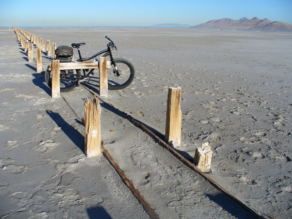
It took me 32 miles of pedaling to reach the north tip of Stansbury Island from the marina. There were piles of brine shrimp, brackish tide pools, and a rocky, exposed lake bottom at that point. In times of higher water, there is a switchback road leading up and over that northern point to the west side leading over to evaporation ponds and U. S. Magnesium’s operation.
In this 3-day exploratory outing, I learned that if I want to circumnavigate the lake (and I do), I need to accomplish it over the course of different days and from different starting points around the lake. I have it planned out. Or another option would be to partner with someone and use two cars. In that way, I wouldn’t have to pedal out from the starting point and then return back the same way to get to the car.
I also learned one other very important lesson on my return journey. The shoreline of the Great Salt Lake is an easy place to get lost. When you are at the same level as the lake, you can’t see what may be beyond a distant point of slightly-elevated land. It is irksome and frustrating to go for several miles in a direction, which you think will take you to the right destination, only to discover that you have a big part of the lake still between you and where you want to go.
After crossing the Morton Salt canal, I chose to take a beeline straight to the marina rather than following my bike tracks back. Somewhere on the southwestern corner of the lake, I passed over my bike tracks and got off on some large peninsular area jutting into the lake. I was following lots of ATV tracks and thought it would lead me on a more direct route back to the marina. It didn’t. It took me eight miles out of my way and into a slushy salt area. When I finally found my way around that southwest corner of the lake, it was several hours after dark with my flashlight growing dimmer. I had to bed down for a second night on the hard-pack. My hips were taking a beating.
A week after making this initial exploratory foray, I returned to the Great Salt Lake to pedal the lake’s southern shoreline east of the marina. I parked at the new Saltair, the facility constructed in 1981. I rode 3.6 miles east from there to the Jordan River. The best riding surface in that stretch lay between the site of old Saltair and the river. I tried crossing the river and stopped at a quick-sandy island mid-river. Rather than continue crossing to its east bank at that place, I thought I might try to find another way to get to the shoreline east of the Jordan River in order to ride that stretch of shoreline. After making that decision, I headed back to the new Saltair. I then rode from that place to the marina. Although only 1.6 miles in distance, this was by far the most difficult riding surface of any that I have yet done. It was a quagmire with seeps and creeks to traverse, many with mushy bottoms. I had to snake back and forth, looking for the best places to ride. Numerous times I simply had to get off the bike and push across a mud-sucking creek bed. Let’s hope that this is the worst riding surface on the lake.
Now that I have begun this project, I have to see it through. It’s the way my mind is wired. Any reasonable person would probably chalk this initial exploratory foray up to experience and put this quest out of their mind. But it’s another year. Parts of the shoreline yet to be ridden beckon. There’s no point in wishing things were different in my Reason Department because they’re not. No doubt there will be more ramblings and wrong turns, more mud-sucking creeks, more quagmires. No doubt. More later.