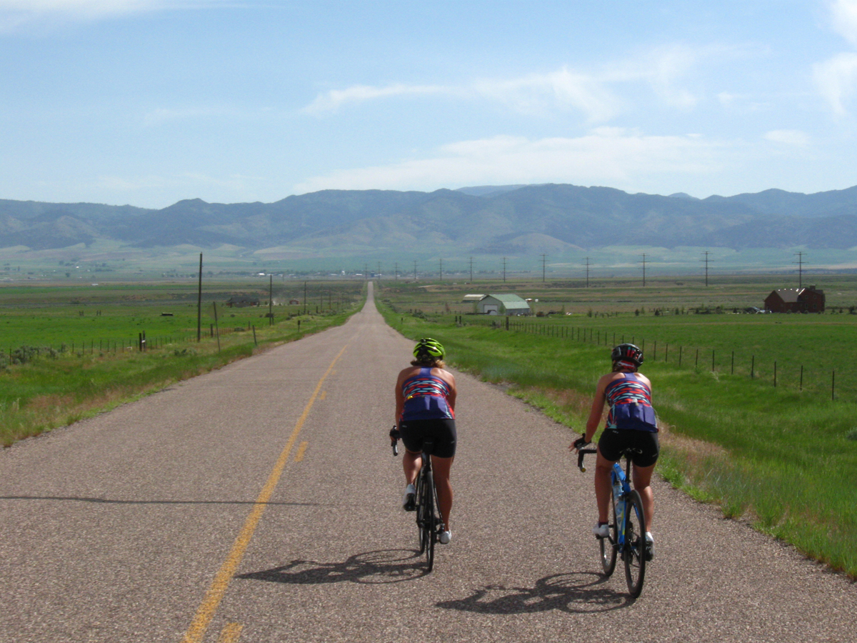
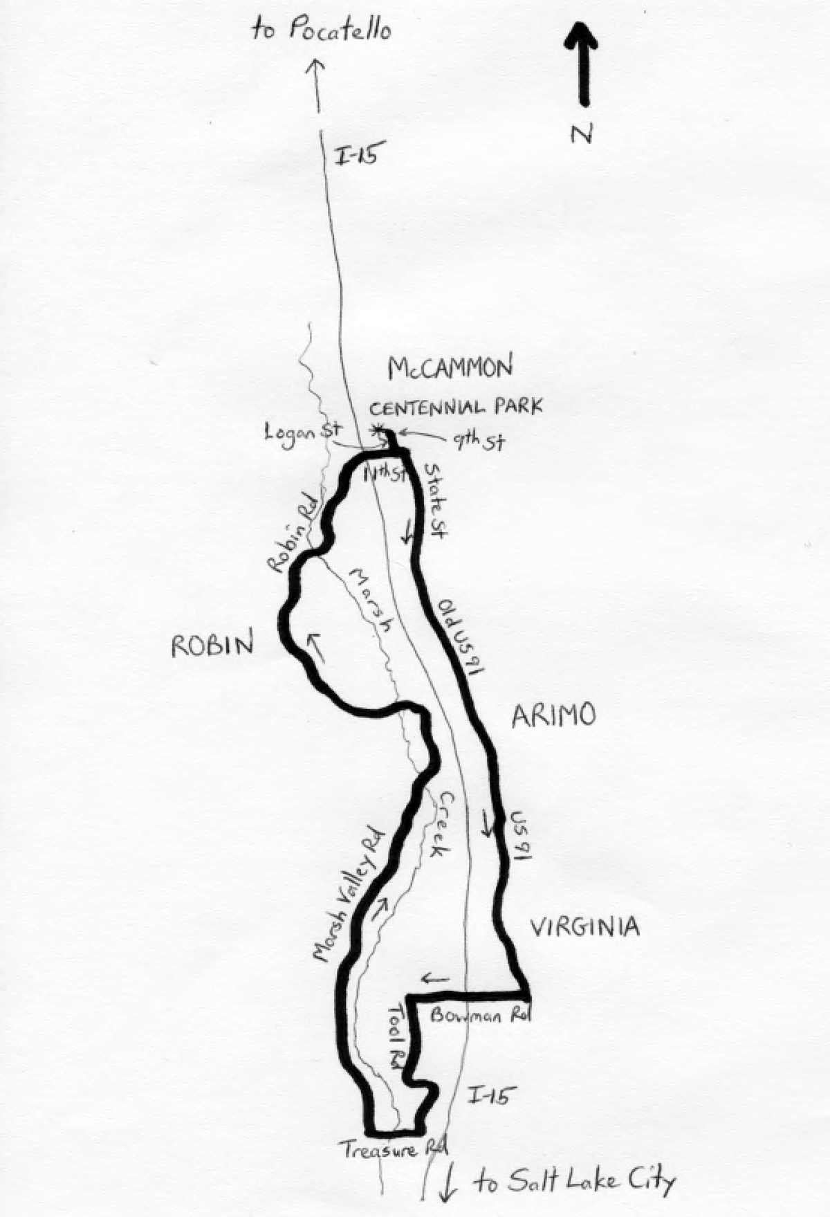
The Marsh Valley Cruise is a 40.1-mile, clockwise loop tour of Idaho’s Marsh Valley. The valley is a lightly-populated agricultural region, with its northern end located 15 miles south of Pocatello. There is plenty of movement through the valley, along the I-15 freeway. But, with I-15 as a speedy alternative, traffic is light on the valley’s surface streets, making them ideal for bike riding. The elevation differential is only 253 feet, although a combination of false flats and wind can add some difficulty to the pedaling. The route remains within the corridor between the Portneuf Range on the east, and Scout Mountain (and other high points) of the Caribou National Forest on the west. The starting elevation is 4,779 feet.
 Start the ride in McCammon. With a population of just 810 in 2010, McCammon is actually the largest settlement along the entire ride. So, get that urban feeling here before venturing off onto the valley roads. From Centennial Park – the address is listed as “Bannock Street,” but the park is accessed from Logan Street, at 9th street – turn right onto Logan and head south. At the end of Logan, turn left onto 11th Street, followed by a right turn onto State Street. State merges with Center Street at the 2.15-mile mark, remaining as State Street, and then becoming Old U.S. Highway 91. The ride leaves McCammon and enters the rural valley. Most of the ride is admittedly nondescript, passing a mix of cultured and undeveloped fields. The best scenery is of the mountains on either side of the valley, and of Marsh Creek, which the route crosses. As for Old U.S. 91, this was the predecessor of U.S. 91, which, in turn, was the predecessor of I-15. The old route is no longer through, merging with U.S. 91 in places; but, segments of the old highway exist in Idaho and Utah.
Enter Arimo at mile 6.05. With a population of 355 in 2010, this is the second-largest city along the route. You will be in and out of Arimo very quickly, as you head south on the old highway. Bear right onto County Road at mile 10.45. At the end of County (mile 10.6), turn left onto U.S. 91, and continue heading south. The highway has a wide shoulder. Enter and leave the tiny community of Virginia. At mile 12.35, turn right onto Bowman Road and head west. Bowman passes over I-15 at mile 13.1. At the end of Bowman (mile 14.15), turn left onto Tool Road and head south. Tool curves left, and then right, eventually running immediately adjacent I-15. At the end of Tool (mile 17.85), turn right onto Treasure Lane and head west. At the end of Treasure (mile 19.2), turn right onto Marsh Valley Road and head north. You are now heading back, although this road’s curves and small rolling hills make it a more interesting ride than that along 91. Cross Marsh Creek at mile 27.6. At mile 29.8, turn left onto Arimo Road and head west. Cross over Marsh Creek again at mile 30.05, and begin a gradual climb (2.6% grade) that continues for the next mile or so. Arimo descends, and then climbs again, gradually. At the highest elevation of the ride (4,877 feet; mile 33.65), avoid going too far west by turning right onto Robin Road. Robin continues the northward trek.
Robin descends gradually (1.6% grade) for the next three miles, to the ride’s lowest elevation (4,624 feet; mile 36.4) – cross over Marsh Creek. Be sure to stay on Robin Road as it curves northward and eastward, through the valley. Stay left at mile 38.1 to remain on Robin. Cross under I-15 at 39.25. Enter McCammon just beyond the freeway. Robin curves to the right, becoming 11th Street. Turn left onto Logan Street; as you head north, look for Centennial Park on the left. End the ride here. History buffs may be interested in visiting a couple of buildings in McCammon which are on the National Register of Historic Places: the McCammon State Bank Building at 206 Center Street, and the H.O. Harkness State Building, at 105 South Railroad Avenue. Both are located to the northeast of Centennial Park.
Starting & ending point coordinates: 42.647569oN 112.194267oW
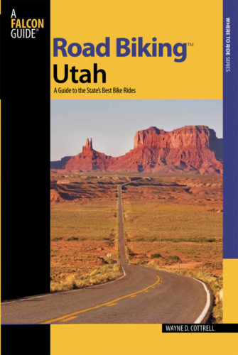
For more rides, see Road Biking Utah (Falcon Guides), written by avid cyclist Wayne Cottrell. Road Biking Utah features descriptions of 40 road bike rides in Utah. The ride lengths range from 14 to 106 miles, and the book’s coverage is statewide: from Wendover to Vernal, and from Bear Lake to St. George to Bluff. Each ride description features information about the suggested start-finish location, length, mileposts, terrain, traffic conditions and, most importantly, sights. The text is rich in detail about each route, including history, folklore, flora, fauna and, of course, scenery.
Wayne Cottrell is a former Utah resident who conducted extensive research while living here – and even after moving – to develop the content for the book.