By David Collins — Northern Utah is blessed with iconic geography, famous resorts and gentrified mountain towns. Although these rides include stunning scenery, they often feature hidden gems and forgotten highways and byways – a cyclist’s dream – filled with unforgettable imagery, points of historical interest and quirky pit-stops.
Extended shoulder seasons are usually the best time of year to ride most of these routes but depending on your skills and equipment, you might be able to ride nearly year round. Be weather aware, riding conditions can swiftly change.
Excursions and explorations are part of the fun of unsupported bicycle touring at your own pace. Mileage estimates are approximate and may vary depending on your tracking system and whims of the ride. Be sure to tell someone your plans and allow them to track your location using a smartphone or other device.
Solo or unsupported distance cycling often presents potentially dangerous situations related to terrain, weather, equipment, traffic, navigation and mental awareness. Even experienced cyclists must plan carefully and use wise judgment to successfully mitigate inherent risks of the sport or terminate a ride before it turns injurious or deadly. If you are new to the sport, or have never ridden a bicycle 100 miles in a single day, learn the ropes with a seasoned buddy or local riding club before giving one of these routes a go.
Make sure to check maps, plan your route, and check local road conditions before you go.
Time to fill water bottles, stuff gear bags, click in and start pedaling northern Utah’s top century rides.
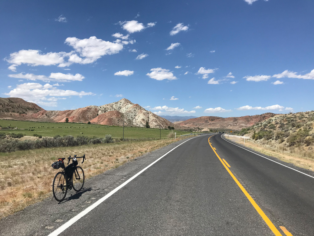
Mt. Baldy Loop
- Route: Nephi, Manti, Gunnison, Nephi (one way loop). Hwys 132 to 89 and back on 28. 100 miles.
- Terrain: Mountain pass, long sloping valleys, loop around San Pitch Mountains, arid rolling plains.
- What to See: The first few miles climb a lovely alpine canyon up to a high plateau, then the ride steadily moves through the gates of small town America including Fountain Green (home of Lamb Day), Moroni (Norbest Turkey HQ), Ephraim (junior college town), Manti, Sterling, Gunnison, Fayette and Levan; sheep and turkey farms; mountains—Mt. Nebo (highest mountain of the Wasatch), Mt. Baldy, San Pitch; Manti La Sal Forest; sandstone and red earth formations, cliffs and plateaus; rolling arid plains; Yuba State Park (features small lake on remote desert shelf).
- Selfies and Photo Ops: Mt. Nebo backdrop (two or three miles from the opening climb, turn around and look back at the rising sunlight on the mountain); giant sandstone Welcome to Fountain Green sign as you enter town; Mormon Manti temple; a huge Gothic and Colonial Revival building built before the turn of the century—it sits on a big hill in the middle of town; various viewpoints from Manti through Sterling to Gunnison (14 miles of stunning geology, water and farmlands); stark beauty of the arid terrain somewhere on the desolate stretch between Gunnison and Lehi, lavender farm (see Still Have Legs section below).
- Wildlife: Porcupines, jackrabbits, frogs, coons, deer and elk, snakes and lizards, birds of prey and waterfowl.
- Best Post-Ride Eats: Lisa’s Country Kitchen in Nephi. Sit at the bar under the giant picture of wintering moose and eat a hot open-face roast beef sandwich, with all the fixins. Be sure to order a side of sautéed mushrooms too.
- Still Have Legs, Lungs and Sunlight? Turn east at Moroni and catch the Relic House Museum in Mount Pleasant—site of the final treaty (signed on September 7, 1872) that ended the Black Hawk War between Ute Indians and early Mormon settlers (adds about 10 miles to your total). Or—begin or finish 10 miles north in Mona. As you roll southward, you’ll ride past a lavender farm. With a backdrop of Mt. Nebo and foreground of lush lavender, you’ll think you’re in France, especially if the lavender is in bloom.
- Note: Entry into The Nebo Loop National Scenic Byway awaits cyclists on this route too. It’s a strong climb that begins shortly after the entry into the canyon in Nephi. Look for the scenic byway turn off sign and don’t miss Devil’s Kitchen if you go that way instead. Be careful though, the climb is followed by a dangerous and technical descent into Payson.
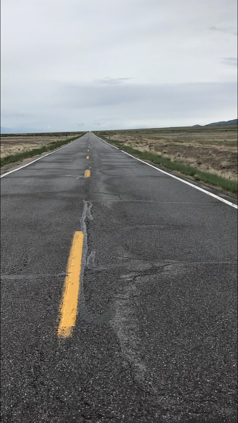
Over the Basin
- Route: Heber City to Roosevelt (one way). Hwys 40 and 191. 101 miles
- Terrain: High mountain pass (8,000+ ft.), winding canyons, rolling flats, long steady grade climbs and descents.
- What to See: Daniel’s pass winding up an alpine river past huge stands of quaking aspen trees; Strawberry Reservoir (home to world-class fishing); Starvation State Park—a breathtaking blue lake in a stark and spartan setting (think Mediterranean blue in the middle of a desert wilderness); Duchesne (regional township), Uintah and Ouray Indian Reservations and the Uintah Mountains (home of the highest mountain in Utah) rising in the distance and rimming much of the ride across the Uintah Basin of foothills, canyons, patches of desert, oil fields, and irrigated farmlands.
- Selfies and Photo Ops: Roadside creek in the canyon leading up to Daniel’s Summit; scenic overlook on the northeast shore of Strawberry Reservoir; bridge at Starvation; laser cut town sign on the eastern boundary of Duchesne; various deserted homesteads and out buildings (think ghost town); Split Mountain and ancient Native American petroglyphs and pictographs in Dinosaur National Monument (see Still Have Legs section below).
- Wildlife: Elk, deer, birds of prey, buzzards, fox, coyotes, prairie dogs, trophy fish, mountain goats and black bear (in Dinosaur National Monument—see Still Have Legs section below).
- Best Post Ride Eats: Frontier Grill. Hot plate food in an informal setting (friendly to cyclists). Get the homemade scones with your beef or chicken dinner. Runner up: Marion’s. They serve hard ice cream shakes and malts in steel cups at the counter-like your grandpa used to drink at his local drug store.
- Still Have Legs, Lungs and Sunlight? Ride an extra 50 miles to Dinosaur National Monument east of Vernal (north of Jensen). The seven-mile ride in the park is worth the effort and nominal $7.00 entry fee. Stunning views of dramatic cliffs, the Green River and easily accessible ancient Native American petroglyphs and pictographs await. If 50 miles is too much, stay overnight at the Frontier Hotel in Roosevelt (free breakfast at the Frontier Grill included) and visit the park the next day. It’s a keeper.
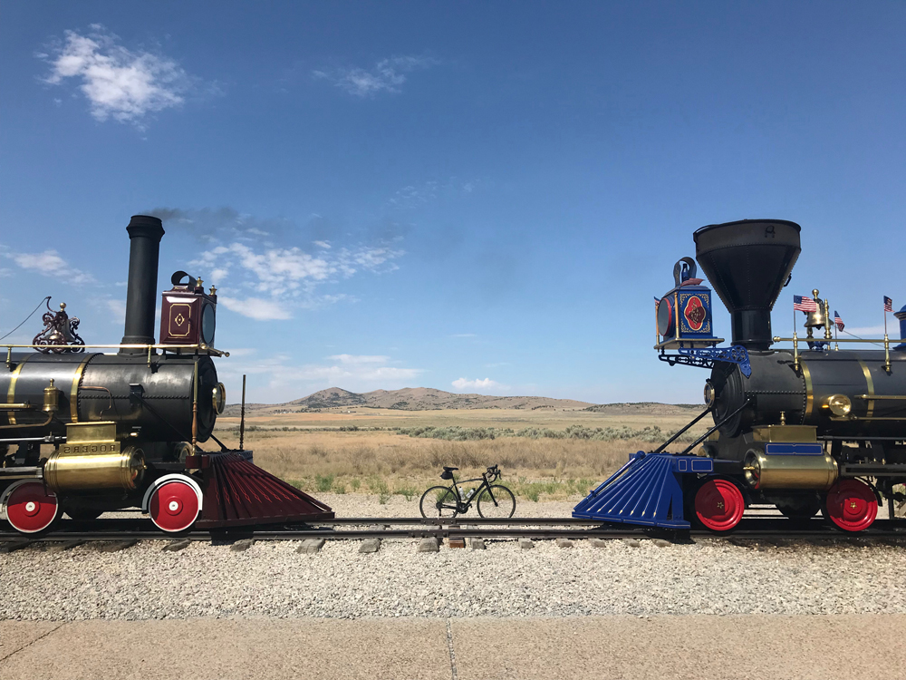
Golden Spike Empire
- Route: Weber State University, Ogden, North Ogden, Brigham City, Corrine, Golden Spike National Historic Site Visitor Center (and back). Harrison Blvd. to Hwy 89, west on HWY 13 in Brigham City, left onto W 7200 N, follow signs to monument. 120 miles
- Terrain: Urban/suburban start followed by rural plains, bird refuge and a small mountain pass.
- What to See: The premier attraction on this ride is the spot where they drove the Golden Spike—in fact; the whole region is named The Golden Spike Empire. In 1869, the last railroad spike was hammered into place here, connecting the country from coast-to-coast. Stop by The Big Fill—the name of an earth-moving project to fill a nearby ravine (not far from the visitor center and marked by informative roadside signage). It’s a great way to learn more about the days leading up to the final connection of eastern and western rails. Be sure to look around as you ride by Willard Bay and through the wildlife bird refuge, the number of bird species that join your spin might surprise you. Early on you’ll ride in the shadow of the massive Wasatch Mountains (including Ben Lomond Peak); turning westward, you’ll pass through the Promontory Mountains preceded by salt marshes, puddles, ponds and arid fields all jumbled together — wet and dry dance together to form a unique stretch of memorable scenery.
- Selfies and Photo Ops: About nine miles west of Corrine, where the road eastward disappears on the horizon into mountains and foothills; Public Shooting Grounds sign in the refuge; Salt Creek Waterfowl Area sign; all the stuff in and around the Golden Spike National Historic Site Visitor Center (you might even see a working steam locomotive); working antique sign at Maddox Restaurant in Brigham City (a rotating 50’s era gem); Northrop Grumman’s Rocket Garden (see Still Have Legs below).
- Wildlife: Waterfowl, migratory and nesting birds, birds of prey, deer and elk, jackrabbits, squirrels and chipmunks, snakes and coyotes.
- Best Post-Ride Eats: University Broiler and Grill in Ogden. Get the double lamb kabob with all the trimmings (or a rack of babyback ribs). Be sure to get a hummus and pita plate on the side too. It’s Mediterranean food served in a casual atmosphere. Hard to beat the quality of ingredients and friendly staff.
- Still Have Legs, Lungs and Sunlight? Take a little detour north at Lampo Junction and check out the Rocket Garden at Northrop Grumman’s base—the rocket display is free to the public and includes a space shuttle booster and patriot missile (10 miles total there and back).
- Notes: The visitor center is cyclist friendly and has a great place to refill water bottles. Limited snacks and treats are also available. This ride is about 200 kilometers, so when you’re done, you’re a bonafide Randonneur.
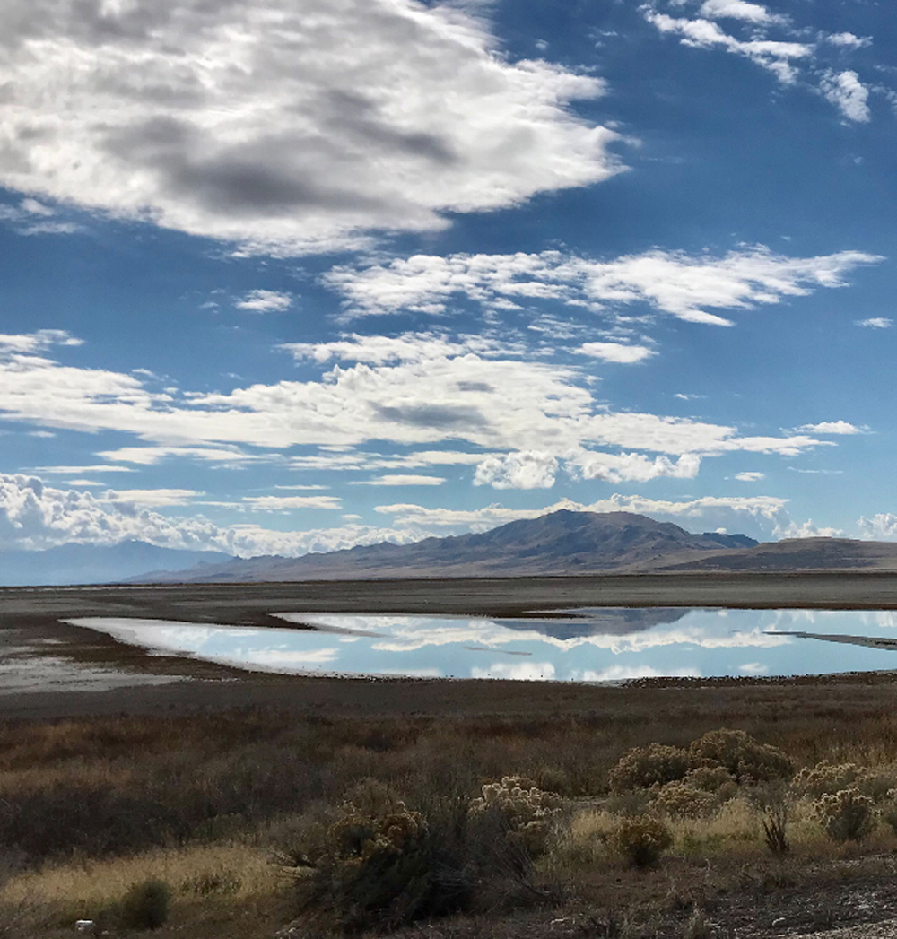
Antelope Island Deux
- Route: Route: Jensen Nature Park in Syracuse, Antelope Island to Fielding Garr Ranch, visitor’s center loop and back (X2). Due to lighting and weather conditions, it’s usually like two different rides more than the same ride twice. 100 miles
- Terrain: A few miles of suburb followed by flats with a mildly undulating spin on the island punctuated by a slight riser.
- What to see: From the midpoint of the causeway across the Great Salt lake, look back and see peaks of the northern Wasatch lined up for your viewing pleasure. From that vantage point, it’s hard to believe more than two million people live on the east shore. The only evidence of people is a periodic passing car or two (maybe a few more on weekends, but the island is a largely forgotten or unknown spectacle, even though it is one of the crown jewels of Utah’s state parks). The historic Fielding Garr Ranch is at the turn around point on the island—self-guided tours through the old pioneer ranch are short and informative. Animals, animals, animals—keep your eyes up and constantly scanning, the chance of seeing many of the animals mentioned below is high. Birds, birds, birds—most of the ride passes through the interior of an important Hemispheric Shorebird Reserve, temporary home to dozens of long-range migratory birds and quite a few permanent nesting species too. The route also includes a close-up look at Camera Flat, a scenic spot featured in the epic Hollywood silent movie Covered Wagon. A stampeding herd of bison was filmed nearby for the famously hyped movie released in 1922 (look for the landmark sign). Grasslands, rock outcroppings and shoreline vistas dominate the ride, and the 6,596’ Frary Peak can’t be missed about halfway through the island portion of the ride on the west side.
- Selfies and Photo Ops: Beginning at the seven-mile causeway bridge, throughout the island portion of the ride, memorable backdrops and scenic landscapes appear. The ride is a photographer’s dream and evolves throughout the day as the light changes. In addition to world-class natural settings, stop by an important memorial along the way; it’s on the north side of the road, just as the causeway meets the island. In 1992, five Army Rangers from the 75th Ranger Regiment and seven airmen from the 1st Special Operations Air Wing died when their MH-60G Pave Hawk helicopter crashed in bad weather about 100 yards off the shoreline during training exercises.
- Wildlife: Bison (the oldest continuous herd in America), pronghorn, coyotes, foxes, snakes, lizards, jackrabbits, deer, water fowl, brine shrimp, birds of prey, bobcats and badgers.
- Best Post-Ride Eats: The Bird in Syracuse. Best chicken tenders around and the mashed potatoes and gravy puts pep back in your step. This trendy little joint serves up tasty chicken in the Maddox family tradition. Simple menu, but the fare will comfort your soul indeed.
- Still Have Legs, Lungs and Sunlight? Ride north to Roy and walk around the Hill Air Force Base Aerospace Museum-about. Admission is free and an authentic SR-71 Blackbird is one of the historic aircrafts on display (the classified super-sonic spy plane from the cold war era. After all these years it still looks like something out of a futuristic science fiction novel).
- Note: Be sure to check local news about the insect/bug hatch. If you ride during a live hatch, you should bring netting for your head, otherwise your bike ride might quickly turn into a buggy ride.
Army and the Old West
- Route: Lehi, Cedar Fort, Fairfield, Stockton, Tooele (and back). HWYS 145 to 73 to 36. 102 miles
- Terrain: Two smaller mountain passes, flat and undulated valleys, mountains and foothills surround most of the ride.
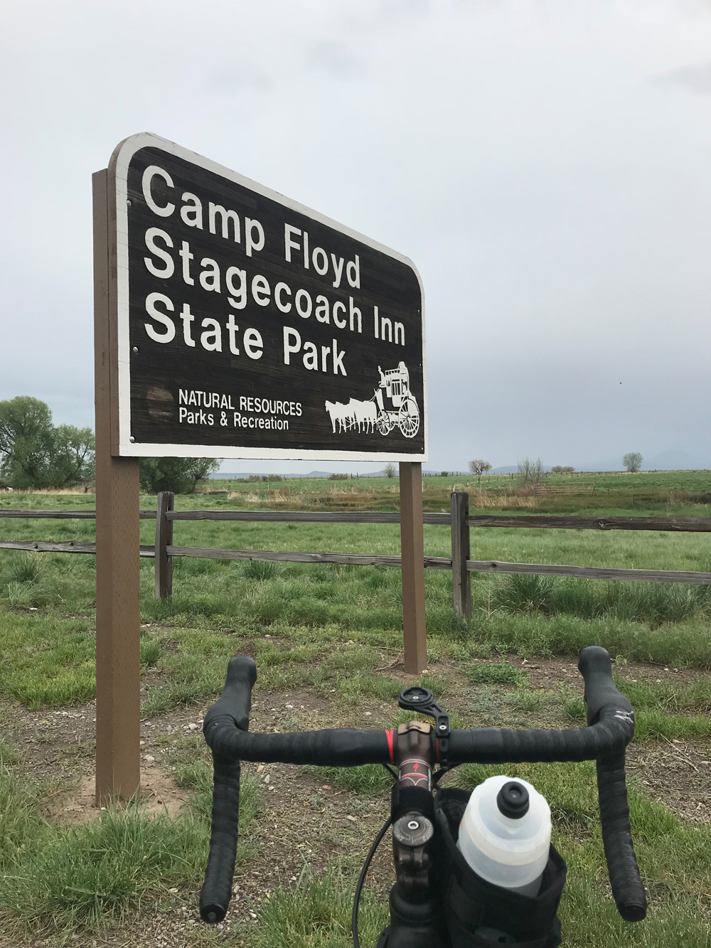
- What to See: Camp Floyd in Fairfield; at one time a third of the United States Army was stationed at Camp Floyd to put down the “Mormon threat” in Utah territory. Diplomats successfully deescalated tensions and eventually most of the troops were reassigned to duties related to the Civil War. The camp is gone, but be sure to check out the small state-operated museum (they sell cool Camp Floyd patches for young scouts, but you can talk them into selling one to you too). Across the street from the Camp Floyd Museum is Stagecoach Inn, which served as a stagecoach stop and a Pony Express station. Period items and décor are on display and visitors can take a brief self-guided walking tour through the historic two-story inn. You’ll ride past miles of U.S. Army Depot property with intimidating STAY OUT signs posted along the way and you’ll get an up-close view of the Oquirrh Mountains from the east side and then the west (through Rush Valley), including two 10,000 ft+ mountains: Flattop and Lowe Peak. The historical train depot complex in Tooele is worth peeking in on, it sheds light on the area’s train/transport and mining heritage.
- Selfies and Photo Ops: Kitschy Cedar Valley Airport sign topped with a folkish model airplane; a few of the army depot STAY OUT signs are striking enough to make an interesting backdrop; long roads into infinity (throughout Rush Valley); Oquirrh Mountains foothills and peaks; various Pony Express trailheads and stations in the area; Camp Floyd and the Stagecoach Inn (see What to See above).
- Wildlife: Birds of prey, deer, squirrels and chipmunks, snakes, coyotes.
- Best Post-Ride Eats: Mo Bettahs Hawaiian Restaurant in Lehi at Thanksgiving Point. Their slogan: Pono Every Time. Get the big Pulehu Steak Plate with rice and macaroni. You’ll be singin’ praises of humble Polynesian food and your pedaling legs will be filled with tasty post-ride recovery proteins and carbs.
- Bonus: Mid-Ride Treat: Bonneville Brewers in Tooele; brewers of Antelope Amber Ale (and others). This microbrewery and restaurant has local charm and killer specialized burgers served on brioche buns. If you’re still riding, lay off the beer but try the Mac and Cheese Burger or the Bonneville Horseshoe.
- Still Have Legs, Lungs and Sunlight? At Tooele, take highway 112 to Grantsville (about 20 miles there and back) and visit the Donner Reed Museum. Learn details about the challenges the Donner Reed Party met on the trail across the Great Salt Lake Desert in 1846. Along the way, they abandoned gear and animals in their desperate attempt to survive the crossing and their journey westward. Related artifacts are on display.
- Note: Since you’ll be riding on both sides of the same mountains, you’ll probably run into some wind along the way (seems like the windward and leeward sides of those mountains often flip flop), so be prepared for taunting headwinds and welcome friendlies that like to switch places throughout the day.
David Collins is a cycling enthusiast and amateur randonneur. Follow him on Instagram @rockypumpkin.