By John Summerson — Simply put, some places just contain more hills than others as California has some of the most advantageous terrain on earth for riding uphill on a bike. A long coastline is met by mountains along much of its length. The state also contains an elongated central valley which lies at a very low elevation and is surrounded on many fronts by steep ranges. A large population ensured that multiple roadways were built to access significant portions of its elevated topography. The result is that California contains the greatest concentration of difficult road bike climbs in the United States and by a large margin. In fact, there are nearly 150 category 1 or higher rated ascents within its border, more than quadruple any other state.
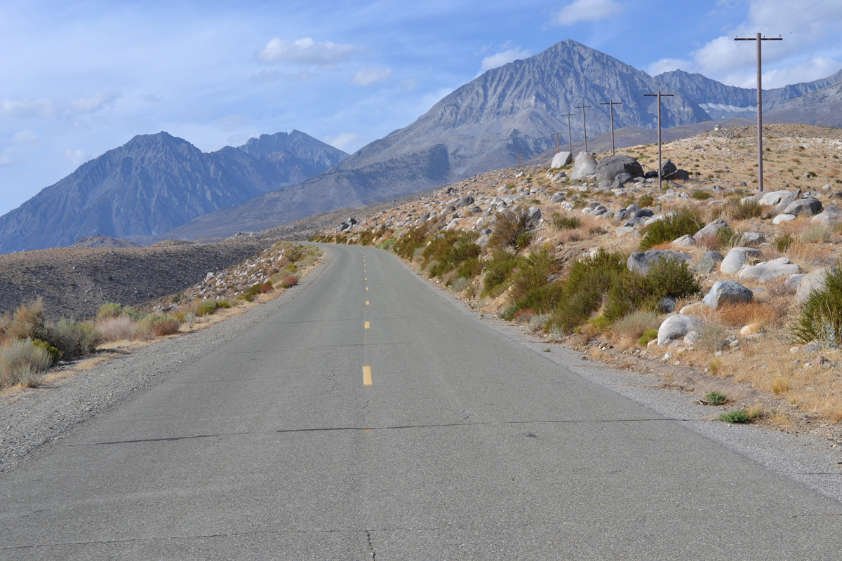
For those looking for a particular challenge, most of the really big climbs in the Golden State are located on the eastern side of the Sierras. The region is home to some of the most difficult paved ascents in the U.S. One of these is Glacier Lodge Road situated in massive Owens Valley near the Nevada border. While not the most difficult in the area, at 9.8 miles in length and with an average grade of 7.2%, it is still a beyond category rated hill. To get to its start, at the junction of Route 395 and Crocker Street in the small town of Big Pine, head west on Crocker for 0.6 miles to begin by continuing west on what is now Glacier Lodge Road.
See map – https://www.bikemap.net/en/r/10859276/#10.58/37.1455/-118.37
You initially head southwest, easy at first with views of big mountains in the distance. The road is narrow all the way up but there is usually little traffic on the route. The grade slowly gets a bit steeper but there are no surprises over the first several miles as you ride through fields of boulders and scrub brush. Use the mostly easy slope over this section to get warmed up. Soon you find yourself riding along a drainage. There are a few large pines in the creek bed which begin to give the climb an alpine feel.
Just before you reach the three-mile mark, the road swings to the right as it crosses Big Pine Creek. The turn is the beginning of a big S bend and steeper pedaling. Quickly you are riding over the most challenging segment on the hill. This has the effect of popping you up onto a somewhat bare ridgeline with some views back towards climb start. As you complete a left-hand switchback, the grade tics up a bit more and the mountains come back into view. You then ride on or near the top of the ridgeline for a while. Soon you are carving along, some distance above the creek below, the pedaling having eased but not by much. The next few miles continue as challenging climbing, steady but stout grade.
The pitch slowly eases the further you go, now headed due west. Just beyond mile 7, you reach the bottom of the drainage again and ride among pine trees, a bit of shade here or there if needed as you pass the boundary of the national forest. There are a few campgrounds along this section of the road so there is a bit more activity at times. Sharp peaks are really close now and the upper section of the ascent is one of the most spectacular in the U.S. Soon the grade eases further and the climb eventually dead ends at a small parking area for hikers at just under 8,000 feet of elevation. Although there are some cabins at the top, keep in mind the lodge is no longer there. It burned down some years ago although reportedly there are plans to rebuild. Now it is time to enjoy the descent but keep in mind the middle portion is one of the quickest around so watch your speed as needed.
To see a video of the climb route –