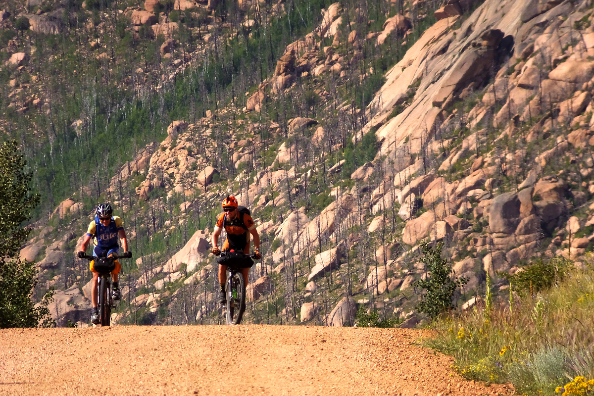
By Adam Lisonbee – The streets of Durango, Colorado were empty. The black sky was speckled with stars. A few street lamps glistened in the pre-dawn night. Shop windows glowed dully. Above the rooftops the dense foothills of the La Plata mountains surrounded the sleeping town with a deeper shade of dark. Nervous mountain bike riders were gathered downtown. Some of the riders looked more relaxed than others. Many were making last-minute adjustments to backpacks, bikes, and other gear. The 2013 Colorado Trail Race was just moments away.
[Editor’s Note: The 2020 edition of the Colorado Trail Race is anticipated to start on July 26. For more information, visit https://bikepacking.com/event/2020-colorado-trail-race/]
Bong.
The clocktower overhead broke the silence. The sound of shoes clipping into pedals clicked through the crowd. A few riders whooped or hollered.
Bong.
“Who’s ready to ride?” shouted Stefan Griebel, a rocket scientist from Boulder, Colorado, who organizes the Colorado Trail Race each year. A few more riders shouted in affirmation. Many were silent.
Bong.
Slowly, wheels started to roll forward. Headlamps bobbed in the morning dark. Riders rang the bells on their handlebars, a few spectators clapped and shouted. “See you in Denver!”
Bong.
Four o’clock. July 21, 2013. Rookies and vets alike now faced the same indifferent mountains and the same brutally difficult trail. Past experience would benefit the vets, while ignorant enthusiasm would press the rookies onward. Each rider now rolling across the pavement was embarking on days worth of pain and suffering, euphoria and joy.

The forest was lush and green. Morning dew glistened on the tree branches and tall grass. On the high horizon, the first light revealed the treeless summits of the mountains–mountains that the trail would climb up and over in short order. I had to force myself to stop and eat. I needed my wired nerves to calm down, and time to remind myself that this was no ordinary race. Passing or being passed 15 miles into a race that traveled 550 miles was superfluous. I sat on a fallen tree and ate my homemade rice cakes, enjoying the inaugural sunrise of this grand adventure. The trail above me climbed steeply onto the slopes of Lewis Mountain and Snowstorm Peak. Up, always up.
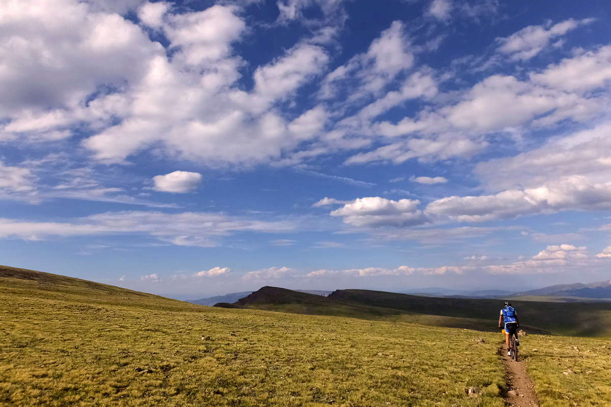
Ty Hopkins, my riding partner, and I refilled our water bottles at Taylor Lake, and then began pushing again. High above the lake and the pass, Indian Trail Ridge awaited. Another iconic name, and another place I had daydreamed about riding across. Indian Trail Ridge. Even the name sounded exotic. At 12,000 feet, the ridge is high. And it’s covered in loose boulders and rocks. The trail at the top was faint, only followable via sporadic cairns.
The loamy trail ducked in and out of the trees, flirting with the steep drop-off of the mountain. Clumps of riders strung out across the trail. Interactions with other riders were more seldom and brief. The race was unfolding along the map. The fastest riders were gone, rushing over the mountains, chasing record books. The rest of us plodded along, settling into our 550-mile pace.
The euphoria and the adrenaline faded. The cold reality of what lay ahead, accompanied by a swiftly moving rainstorm, dampened the optimism and joy. “What have I done?” I wondered. The miles rolled slowly by. Silverton, Colorado, the first resupply point on course, was hours and many rugged miles away. My bike was over-packed with food I didn’t want to eat. I was tired. Homesickness rippled through my spine.
The sun was low when I hiked over Rolling Pass. Wildflowers sparked across the meadows in the waning light. For the first time in hours, I smiled. The pass, the flowers, the setting sun—it was all overwhelmingly beautiful. The rising moon split the skyline. Cornhusk lilies crowded the trail. The sun dipped behind the high peaks. Pale, blue light filled the mountains. Ty was waiting at the pass. “I don’t want to play this game anymore,” I announced. He looked as tired as I felt, but he preached patience. “Let’s get down into some trees,” he suggested, “and we’ll find a nice place to camp. I’m exhausted, too.” We descended off the pass and into the trees where we set up camp for the night.
I heard the voices before I opened my eyes. The others were stirring. They sounded energetic and happy. It was still dark out. I stayed still. Maybe if I pretended to be asleep, no one would rouse me from my bed. A stove hissed. Jeff and Cameron, riders we had shared the campsite with, were getting ready for the day.
A few minutes after daybreak, Ty and I were pedaling through the morning light and across the open meadows above Molas Pass. We were both grumpy. We both felt uncertain about the immediate future. But we were moving. “What do you think?” I asked Ty. I was conflicted about how I wanted him to respond. Did he want to drop out in Silverton, or continue? Our race hung in the balance. He responded without hesitation. “Don’t say quit.”
“We could buy tickets for the train,” I said, “and ride back to Durango.”
He laughed. I wasn’t really joking.
Instead, we bought giant breakfast burritos, pedaled out of Silverton, and made our way toward Stony Pass Road, a steep cut through a massive glacial path and into the high reaches of the San Juan Mountains. We were 215 miles from the next resupply, and 465 miles from Denver. But we were both happy. We left the small mountain town hoping that after the first overwhelming day of the race, we were adapting to life on the trail.
The highpoint of the Colorado Trail is the Coney Summit, 13,270 feet above sea level. The trail at the top was velvet. It rolled gently up and down the wrinkled hillsides, and across razor’s edge ridges. The world unfolded into layers of cirques, massive calderas, canyons, and purple peaks with names like Redcloud and Sunshine. Green walls sloped downward, split by blue ribbons of flowing water. Lake San Cristobal mirrored the watercolored sky. Far below, spruce and pine grew in thick formation, adding deeper greens and browns to the emerald sea. The day finally ended at Slumgullion Pass, ten miles beyond where we had hoped. It had been a good long day on the Colorado Trail. “That was an amazing day!” I said. “The best I’ve had in a long time.”
Tall pine trees filled the sky. I was in my bag, staring up at them. The pale moonlight made sharp silhouettes of the trees. Stars blinked. Someone stirred. Light from a headlamp bounced off the tree trunks. “Time for breakfast.” A few minutes later I was packing my bike, gulping down food, and getting ready for another long day on the Colorado Trail. I had high hopes for the day. Ahead of me was the La Garita Wilderness detour, and a chance to cover many miles over easy-riding dirt roads.
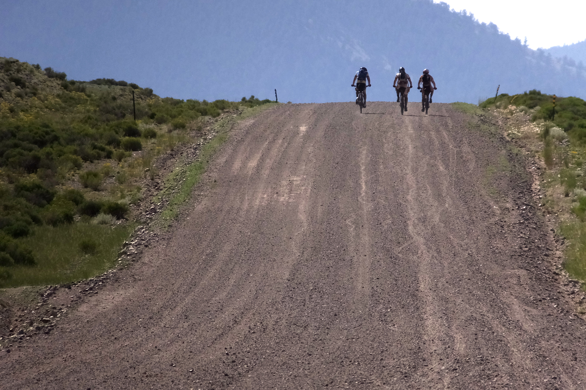
The miles came and went. Ty and I climbed up and over Los Pinos Pass and descended into Colorado’s high mountain valleys. Ranchland and empty plains untangled themselves from the mountains. We plunged into an ocean of sagebrush. The road was smooth, flat, and straight. The morning sun turned warm. Dust parched the air. The San Juan Mountains were far behind.
CT racers claim that Sargents Mesa is haunted. Maybe it is. On the day I crossed its rocky top, there was a procession of palid, hopeless things that vaguely resembled men. Their eyes, once vibrant with vitality and color, were gray and lifeless. The light had gone out of them, replaced with the blank, empty stare of the walking dead. Nobody spoke. Our eyes said everything there was to say. Mouths were too dry, parched, and burnt for words. The endless rolling plateau was waterless. The sun beat down on us with merciless endurance. Angry, aggressive mosquitos found us easy prey. And still, we pushed our bikes. I dove deeper into the abyss than ever before. My mood, like the air, was sour. I hiked in angry silence, marveling at the absurdity of this mesa, this race, and my own audacity. “A bike has no place on this trail!” I moaned.
We hiked through a grove of aspen trees. I hadn’t seen an aspen tree since Los Pinos Pass. Immediately, I felt better. The softly swaying branches and twinkling leaves filled me with light. I paused, and soaked up the pocket of life and energy. I smiled through the pain and blackness. I watched the sunset illuminate the crowded peaks, turning them blue and purple on the horizon. The world melted into technicolored brilliance. I knew then, in that small stand of quaking aspens, there was nothing but me preventing me from pedaling to Denver.
During the night, a few more riders hiked by our camp. They went silently through the trees and up the hill. They, like me, like all of us, were hurting. But forward, upward, they walked and pedaled. I felt a new kinship with my fellow racers that night as we put the haunted, joyless expanse of Sargents Mesa and the Cochetopa Hills behind us. We had each suffered deeply, but we did not let the mountain, or the wily demons lurking in the trees, beat us.
“You awake?”
“Yeah. What time is it?”
“Four. Let’s get moving, and finish this hike in the dark.”
“May as well.”
When the sun had finally climbed over the Sawatch Mountains, Ty and I had left behind the bouldered, vertical trail, and were riding silky singletrack through spruce forests and mountain meadows. The first light of the day spread like wildfire, revealing the brilliant range and valleys in warm optimism. I paused for a photo. “You’ll thank me later,” I told Ty, when he urged me onward. We pedaled across Silver Creek and Marshall Pass. I stopped for water at a bubbling spring spouting out of the sidehill. “You go on,” I told Ty. “I need to spend some time here and get myself rehydrated.” He pedaled away up the trail.
I filled a bottle, and drank it. And then filled it again, and drank that. I slowly ate breakfast, and then drank another bottle. After 20 minutes I packed up, and started to pedal again. I reached the Monarch Crest Trail, and spent the next several miles riding some of the best singletrack in Colorado. Any thoughts of quitting vanished in the brilliant morning light.
That day was spent riding trail that contoured through dense, rubbly forests full of dark pine trees and rounded boulders. The Colorado Trail sneaked in and out of countless drainages, climbed over ridges, and curled through aspen trees that stood lean and tall. We made tracks, riding away from a chasing storm, and toward Buena Vista and its bounty of fresh food and clean sheets.
Buena Vista, Colorado is a small town surrounded by big mountains with elevated names: Harvard, Princeton, Yale. Coasting into the heart of the city however, it didn’t feel small. The stoplight, the traffic, the neon signs at the bars, motels, and restaurants, reflected an attitude of hurried, civilized luxury. I had left Silverton three days earlier and other than the small store at the hot springs, hadn’t encountered any permanent human presence at all. Pedaling through town, marveling at all the options for food and comfort, was wonderful.
The day aged. Ty and I had a choice. We could quickly resupply, and move on. Or, we could linger, rent a motel room, and sleep in a bed. It was an easy choice. We checked into a motel, and sat down for dinner at Pancho’s. We slept in a cramped, drafty room at the Topaz Lodge. It was palatial. The needed stop allowed us to clean and reorganize our bikes and gear, restock our food supplies, and enjoy unhurried frosty and fried indulgences.
In the morning, after more food from Pancho’s, we were pedaling again. We rode alongside the Arkansas River and toward more mountains and more trail. The new day brought a sense of adventure and energy—energy that would be put to good use as we made our way toward Leadville, Kokomo Pass, and Copper Mountain ski area.
Gray clouds floated around the treeless peaks. The glassy water of Twin Lakes reflected them with perfect symmetry. Singletrack wove through the aspens, ponderosa, and sage. We climbed above the lakes, and into the fringes of the Mt. Massive Wilderness. Another detour loomed, but not before we spent hours riding smile-inducing trail on the shoulders of Mt. Elbert. At midday we rolled into Leadville, Colorado. Rain arrived in town at the same time we did. With packs and bellies full, we hid from torrential rain.
Leadville was bustling with tourists. An old man with a long white beard, wearing a coat and top hat, wandered the streets. He worked for the Chamber of Commerce, a small taste of history and flavor. He fit in with the old building facades and the boardwalk, where hurried families and window shoppers dodged the rain.
“How far away is Kokomo Pass?” Ty was talking to the old man in the coat and hat.
“Not far,” he told us.
“In which direction?” Ty wasn’t lost. He wanted to know if we were about to ride into more stormy weather.
“It’s that way,” he said, gesturing toward the wall of purple clouds.
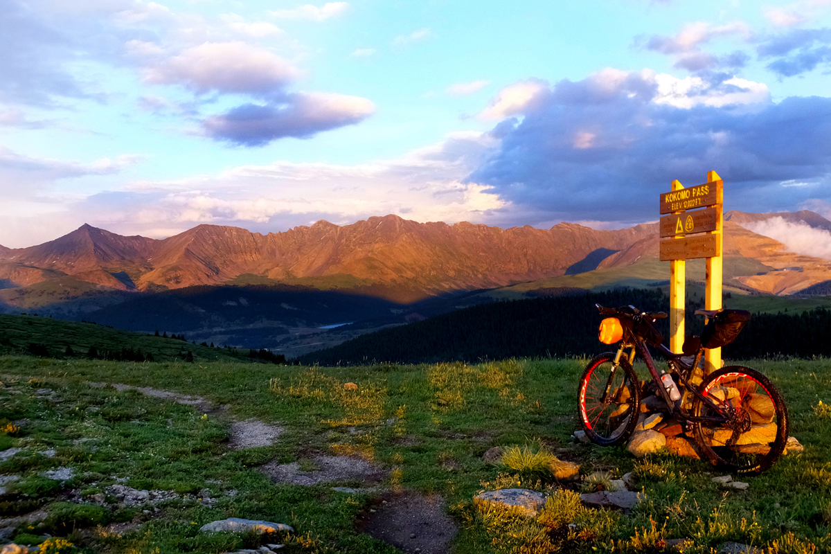
A few hours after leaving Leadville, it started to rain again. The storm loitered overhead, following our route. A crack of thunder sent us diving into the trees. I crammed myself into a small pocket of spruce, and hoped any lightning missed them, and us. We left the trees in full rain gear, and continued walking up the hill. Thunder boomed. More rain fell. Kokomo Pass was only a few-minutes-hike above us, but we hid in the last of the trees, waiting out the storm. I huddled in between the trunks of closely growing pines and ate the cold, salty, fried chicken I had carried with me from Leadville. “Once we reach Kokomo,” Ty said, “there are three miles of trail to Searle Pass. From there, it’s all downhill to Copper.” The rain faded, the sun pushed its beams of caramel-colored light through the clouds, now pulling apart like cotton candy. Distant peaks were dark in the stormy, evening sky. The world melted into golden brilliance.
By now, the violent mood swings I experienced on the Colorado Trail were routine. But that didn’t make them enjoyable. After the sun went down, and the perfect light faded into night, it got cold, and we were wet. At Searle Pass, 12 slippery, rocky, and muddy miles, all downhill, separated us from Copper Mountain. The descent would have been fantastic in broad daylight, and without 17 hours of pedaling behind us. In the cold, wet, and dark night, with loaded bikes, fatigue gnawing at our brains, it was miserable. I flicked on my light. It didn’t turn on.
Ty disappeared into the gloom. I blindly dug fresh batteries out of the bottom of my pack. When those were installed, I flicked the light on again. Nothing. “Damn it!” I tried another set of batteries. Dark still. I started hiking in the dim glow of a back-up light. Ty, by now, must have been sipping hot cocoa at Copper Mountain, wondering where I had gone. I called his name. No reply. I growled in anger. “Hopkins!” After an hour of hiking and fiddling with my lights, I finally got them to turn on. Ty was angry when we reached Copper Mountain. I had delayed us an hour. We were hungry, soaked, and miserably tired. And there was no place to sleep.
It was my turn to talk Ty off the ledge. “Let’s just find some trees, and get in our bags.”
“Where at?” he growled.
“Anywhere. It’s late. We’ll get an early start. No one will know we were here.”
“I guess.”
The next morning we rode to the nearby convenience store, hoping to get enough food to last us until the finish line, 150 miles away. We were 45 minutes early to the store. Our moods darkened even more. I reorganized my pack while Ty cleaned his bike. We still weren’t talking much. Neither of us had slept well; we were still wet and cold. An employee from the store came outside to flip switches behind a closet door.
“Does this mean you’re open?” Ty asked hopefully.
“Nope. Not until 7 am.” The employee was too cheerful to be delivering such vexing news. He seemed to be enjoying our plight. He went back inside and locked the door behind him. We waited silently on the curb.
At exactly 7:00 the lights came on, and the clerk pushed open the door. “Come on in!” At that same moment, Cameron, Jeff, and Ian, three other CT racers, walked through door. We hadn’t seen them in days.
“Ha! You guys are here!” Jeff yelled.
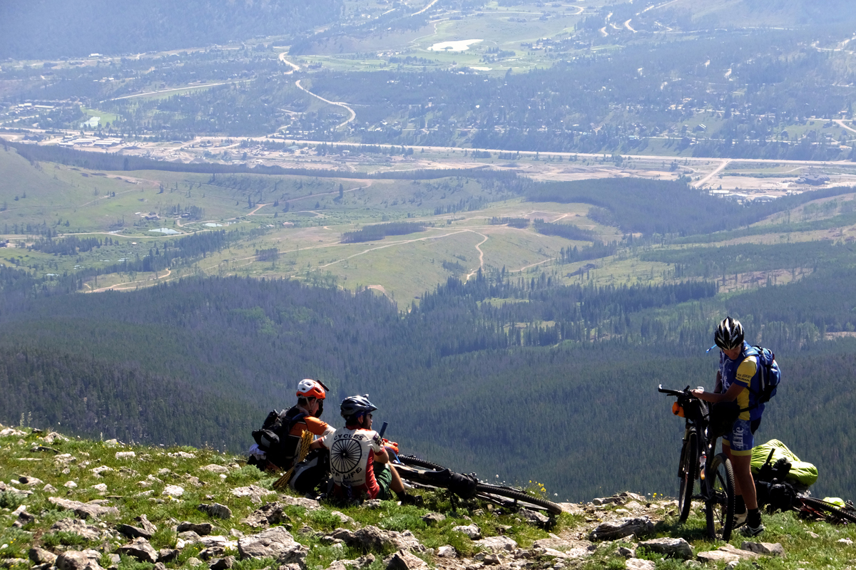
The happy rendezvous lifted everyone’s spirits. We left Copper behind, and began the long, steep, and brutal push over Ten Mile, part of an abrupt ridge of peaks that separated Copper Mountain from Breckenridge. At the top of Ten Mile we gazed down, down, down into Breckenridge, where’d we be passing through, (but not close enough for easy resupply) after a long descent, and a little more climbing. Beyond the small town more mountains layered the horizon—mountains we would have to climb.
Insects buzzed in the heat. The sun was boring holes into the ground. Ponderosa pines grew in thin stalks, like rows of soldiers. We were well above Breckenridge by now, slowly inching up the trail to Georgia Pass. I pedaled away from the group while they ate lunch. I wanted to keep moving. I had to keep moving, or they’d leave me too far behind. “You’ve got to eat, Adam,” Ty said.
“I’ll eat while I pedal,” I replied.
Golden light dripped from the trees when we finally reached Georgia Pass. Clouds clung to the skyscraper peaks, and stretched across the green, fertile mountain valleys of South Park. At Georgia Pass is one of the CT’s most popular trail markers. The tall wooden pole, CT triangle nailed near the top, divides the continent. Looking back to the west, and the way we had come, the mountains unfolded endlessly. The valley far below was blurred by distance. The long approach was covered in dense forests. Ahead of us, a similar sight stretched eastward and happily downward. I set off down the opposite side of the pass, knowing that the riding was almost all downhill to Kenosha Pass, Highway 285, and the homestretch of this incredible journey.
Around 10:30 pm, we were all beyond tired. I struggled to walk in a straight line while hiking a steep segment of a smooth dirt road. My head snapped from side to side while I fought the fatigue. I used my bike like a crutch, propping my body upright. “I need to sleep,” I told anyone who would listen. “Anywhere will do.”
“We can’t stop here,” Ian said. “There is a bar nearby. We can get some food there.”
“A bar? We are in the middle of nowhere,” I said. Surely the darkness, and the accumulated fatigue, had Ian confused.
“No, it’s here. I read about it,” he insisted.
The route we had to take around the Lost Creek Wilderness was new to the CTR in 2013. We were as likely to find nothing, as we were a bar. A few more climbs came and went, and there was no bar in sight. Fatigue was eating at my head. My feet were numb. My legs were dull and slow. I tried to count how many calories I had stashed away in my bags. 800, maybe 900. At most, 1,000. Not enough for 130 miles, even if some of those miles were fast dirt roads. The temperature dropped, the high plateau turned chilly. The trees were walls of blackness. The moon rose above the mountains.
“If we stop now,” I pointed out, “we can get a fire going, and have a nice warm camp tonight.” Nobody stopped.
“We can’t be far now,” Ian said. “Start dreaming about hot food!”
I had been dreaming about hot food for a week. I grew more and more skeptical about Ian’s bar. But nobody wanted to risk missing it, if it did exist. Mile after mile revealed no bar. We were finally on the verge of pulling over and lying down when we rounded one more corner, and climbed one more rise. There were lights. Bright, neon lights. Music blared from the glowing oasis.
“No way!”
“It’s real!”
“And it’s still open!”
“Sit down, and let me get you guys some drinks. Pizzas will be out in a few minutes.” His name was Pat, and he was the owner of the Stagestop Saloon.
“I don’t want to go back outside,” I said to him. “If I do, I’m afraid this will all disappear, and I’ll be back in the cold, pushing my bike.”
He laughed. “I’m real. I can promise you that!”
Pat insisted that we camp in the beer garden. We laid out our bags under the tarped canopy, larders and bellies full. I burrowed into my sleeping bag, still unconvinced that the saloon was real. I wondered if I’d ever be able to find it again. Ian broke the sleepy silence. “I told you there was a bar.”
We set out from the saloon as the first light of dawn crept over the surrounding mountains. Finishing the CTR had never felt so far away. Jeff and Ty rode away from me. Cameron and Ian disappeared behind. I rode alone, thinking only of the finish line. “Don’t stop. Keep moving.” I rode farther and longer between breaks than I had all week. I skipped places to refill my water bottles. Finishing was the only thing that mattered. Stopping delayed that. “Don’t stop!”
I crossed the Gudy Gaskill bridge and the South Platte River in the late afternoon. I was 17 miles from Denver. “Seventeen miles. Seventeen miles. Seventeen miles!” I fell into my own world, focused on moving, and only moving. After a long descent, and more chanting, just one more climb remained. But it wasn’t a long climb. And it wasn’t very steep, either. I started looking for Lenny’s Rest, a trailside bench that I knew was at the top of the hill. When I reached the bench, I wanted to sit down and enjoy the moment. “No time, go!” I pedaled by unceremoniously, and burst from the trees onto Waterton Canyon road. Six miles, all downhill, of smooth graded dirt were all that was left.
Six days, 15 hours, and 15 minutes, after leaving Durango, I arrived in Denver. Ty and Jeff were waiting in the trailhead parking lot, grinning stupidly. I sat down in the gravel and looked up at Ty. “Well,” I asked him, “now what?”
Some of what you need to know:
- Race website: https://bikepacking.com/event/2020-colorado-trail-race/
- Forum discussion: bikepacking.net
- CT website: coloradotrail.org
Plan for 4-9 days on trail
Hike-a-bike is abundant. Plan to walk 60-100 miles of the route.
Reliable resupply (from Durango):
- Silverton: Mile 88
- Buena Vista: Mile 300
- Leadville: Mile 350
- Copper Mountain: Mile 400
Limited resupply:
- Mount Princeton Hot Springs Resort: Mile 280
- Stagestop Saloon: Mile 450
- Apple’s Camp: Mile TBD
Water is abundant on trail, but carry some form of filter/purification.
The trail is well marked, but a GPS and paper map are very helpful.
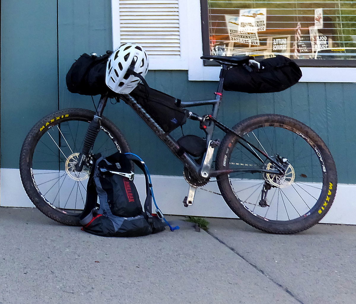
Adam Lisonbee’s Gear List
Bike:
- Cannondale Scalpel 2
Bags:
- Revelate Sweet Roll handlebar bag w/ Pocket add-on
- Revelate Feedbags on handlebar
- Jannd Frame bag
- Revelate Pika seat bag
- Camelback Volt LR 13L
Sleep:
- Lafuma Warm N Light 600 sleeping bag
- Outdoor Research Auroa bivy bag
- Big Agnes Clearview pad
Electronics:
- Garmin eTrex 30 GPS
- Fenix PD32 flashlight x 2
- SteriPEN Adventurer Opti UV water purifier
- Fujifilm F900exr camera
Repair:
- Tubes x2
- Tire boots x2
- Tire lever
- Patch kit
- Chain links x2
- Sealant 4 oz.
- Valve stem x 2
- Multi-tool
- Zip ties x 10
- Brake pads x2
- Hand pump
- Chain lube
Clothing:
- Ride shorts
- Ride shirt
- Rain jacket/pants
- Silk long underwear
- Down vest
- Socks x3 pair
- Shoes
- Ride gloves
- Cold-weather gloves
- Wool stocking cap
- Arm warmers
- Knee warmers
Safety:
- First-aid kit
- SPOT beacon
- Paracord
- Colorado Trail Databook
Personal:
- Toothbrush/toothpaste
- Floss
- Chamois cream
- Lip balm
- Dehydrated towels
- Sunscreen
- Bugspray
- Toilet paper
- Credit card/cash/ID
Food:
- Potato chips
- Soda
- Candy bars
- Beef jerky
- Rice cakes
- Burritos
[…] Cycling Utah article – https://www.cyclingwest.com/racing/mountain-bike-racing/the-colorado-trail-race-a-bikepacking-advent… […]