Major roadway work is being planned for Mill Creek Canyon in Salt Lake City, Utah. Will this include a bike lane and motor vehicle speed calming measures or will it increase vehicle speeds and eliminate any possibility in our lifetime for shoulders for non-motorized use? The answer to that is uncertain and you have less than a month to help influence that decision.
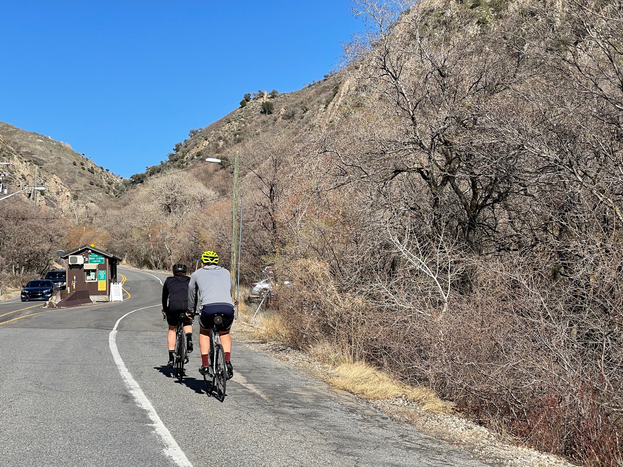
Mill Creek Canyon, between Parley’s and Neffs Canyons on the Salt Lake East Bench, is a unique resource for Salt Lake Valley residents. Beginning only a few hundred yards from I-215, the canyon contains a 9 mile paved road, miles of trails including high quality single track and quiet Wilderness, wildlife, cool summer temperatures, a non-motorized connection to the Wasatch Back, private cabins, and 4 ½ miles of paved road that is closed to motor vehicles 8 months out of the year and groomed in the winter for nordic skiing, hiking, dog-walking, and riding. The canyon is free of commercial recreation served by a state highway and resort villages. The canyon is also getting more popular, with users forced to turn back due to parking filled beyond capacity, long lines to get out, and heavy traffic all common on weekends. The result of our collective attraction to the canyon is snarled traffic, deterioration of the roadway, and a threat to the health of the creek.
Changes are coming to Mill Creek that will affect us all. Last summer, a Federal Lands Acquisition Program (FLAP) Grant was awarded to improve the transportation facilities providing access to Federal land in the canyon in response to an application from the Forest Service, Salt Lake County, and Millcreek City. $38 million dollars worth of work based around the roadway was identified and the decision was made to begin with a $19.6 million project for improvements to the upper half of the roadway, above the winter gate. The project partners, the 3 requesting groups and the Federal Highways Administration, anticipate using a 2ndFLAP grant in the next round of funding to complete the portion of the canyon roadway below the gate.
The following is a list of the work anticipated:
- Widen and resurface the road, with a goal of making a 29’ wide paved surface from the winter gate to Elbow Fork (1.4 miles) and a 24’ wide paved surface from Elbow Fork to the Big Water Trailhead.
- Improve the parking and large vehicle turn-around ability at designated trailheads and picnic areas. This will include more off-road parking and the elimination of roadside parking, with no net change in total parking.
- Roadway and stream channel realignment at Thousand Springs
- Extend recently installed box culverts and other creek-oriented structures to improve roadway safety, fish habitat, and address concerns with the historic and aging bridges.
- Install a conduit within the shoulder of the road to support future road and parking conditions monitoring and emergency communications.
The process has begun, starting with an open house Nov. 9, with the following timeline:
- November 9 to December 9, 2021: Public comment period
- January 2022 to December 2023: Public comments will be reviewed, a draft project design will be developed based on technical analysis, and environmental surveys and documentation will be completed.
- 2024: The design will be completed and approved, work contracts will be issued, and work will begin on the project.
- Summer 2026: Work will be completed
The steep, narrow nature of the canyon combined with the space occupied by the creek present some big challenges. It’s not clear that there will be room to create 29 and 24 foot roadways without impacting the creek or requiring excavation that would radically change the nature of the canyon bottom.
Of particular interest to cyclists: the initial design proposes widening the vehicle lanes to at least 11 feet for the entire length of the road, adding a 5 foot wide bike path to the 1.4 mile stretch from the winter gate about half way up the canyon to Elbow Fork, and eliminating any bike lane or shoulder from Elbow Fork to the end of the road. To put that in perspective, the current lane width varies from about 8 ½ to 11 ft below the Big Water overflow lot, with the average estimated to be about 9 ½ ft. Nine and a half and even 9 ft wide lanes are acceptable in low speed areas like Mill Creek according to traffic engineering sources, but so far the design team has been focused on increasing the lanes to 11 feet wide. While the speed limit in the upper portion of the canyon post-project hasn’t been set yet, the wider vehicle lanes, improved sightlines from vegetation clearing, and some road straightening will all increase the natural speed of cars in the canyon. While public safety and bicycle issues are listed in the project goals, the engineers have concluded that there will not be room for an official 5 foot wide bike lane in the top 3.6 miles of the canyon and that the 11 ft lanes are likely to eliminate the possibility of any shoulder. Increasing vehicle speeds in the canyon and removing any shoulder for non-motorized use would likely be a huge step backwards for cyclist safety and enjoyment. The project designers have made no commitment to talking steps to protect non-motorized roadway space has been made and, in fact have made the claim that wider lanes and higher speeds will increase the safety of non-motorized users without providing any rationale or evidence.
Is a bike lane or shoulder to accommodate non-motorized users more important to you than faster cars or restoring a historic bridge? Now is the time to make your feelings known
If you use Mill Creek Canyon and are concerned about increasing vehicle speeds and decreasing space for those who ride, walk, and run in the canyon, you have to until December 9 to get familiar with the project and submit comments describing the changes you would like to see in the Canyon. The project design team needs to hear from you. Some points to bring up in your comments:
- Studies1 show that increasing lane width increases speed at which motorists feel comfortable driving. Conversely, decreasing lane width has been clearly shown to reduce vehicle speeds.
- Increasing vehicle speed without providing at least a 4 foot uphill bike lane or shoulder will greatly increase the likelihood and severity of collisions between cars and bikes and pedestrians.
- Even adding a 3 foot striped shoulder and adjusting lane width accordingly would likely make Mill Creek Canyon safer for non-motorized users.
- Wide lane advocates claim they are needed for emergency vehicle access. Not so, says Unified Fire Authority figures and Salt Lake County Search and Rescue leaders. And since the maximum width of emergency vehicles is 8 ½ feet, are 11 or even 12 foot lanes really needed?
- The speed limit in the upper canyon should be no more than 25 mph
| Now is the time to voice your opinions about this plan. Plans for the road are being developed and the planners are listening to canyon users. The public comment period ends on December 9, 2021.
If you use and value Mill Creek Canyon and have an opinion on the future of non-motorized use of the canyon road, it’s important that you speak up before December 9, 2021. |
To learn more about lane width and safety:
- Lane width: the effect on the safety of cyclists in urban areas, by A Schramm, and A Rakotonirainy Centre for Accident Research and Road Safety- Queensland
- Narrower Lanes, Safer Streets, by Todd Litman
- Traffic Safety and Human Behavior: Second Edition, edited by David Shinar (Google eBook, $141.99)
Maybe a gondola would be a better solution ???????