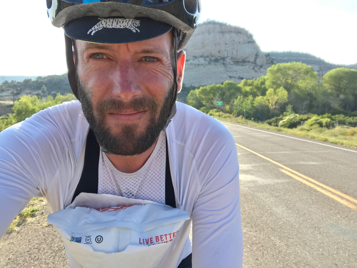
By Sean Quill — I get a text Thursday afternoon; it reads “possibly idiotic:” But there’s no question mark? Instead, a link. I click and see a big loop through an area of southern Utah I have never seen. My mind begins to make excuses; “it’s been a long week—not enough water—where are my bags in the garage—the smoke—the weather—goat heads—it’s Labor Day weekend!?”
My thoughts wrestle for a half an hour as I tried to logically find an excuse with google searches; “weather is good—sh*t—smoke should clear—that’s good—plenty of water—everyone will be in Zion.” Hmmm. This could be like, fun?
I reply; “I like idiotic…”
Thirty-six hours later I’m mooning the locals, trying to pull up my bib shorts outside the elementary school in Loa, Utah. Borderline criminal, I stretch my shirt down and shimmy them up hastily while a light breeze teases the awkwardness. It’s 10AM Saturday morning and I’m looking at the concerned face of a woman I barely know. I smile with trepidation. Her expression doesn’t change.
“Is that all the water you’re bringing?!” She asks.
I nervously laugh, “Uh yeah, haha.”
Her expression doesn’t change.
What have I gotten myself into?
Soon after my GPS mapping skills were deemed completely backwards and totally useless; she hands me a liter of water. My nerves relax and then return full-face as I try to finagle it onto my handle bar bag. It fits; kinda. I kick a leg over the hoods and spin the pedals; the front tire rubs immediately. She takes it back.
Good start dude.
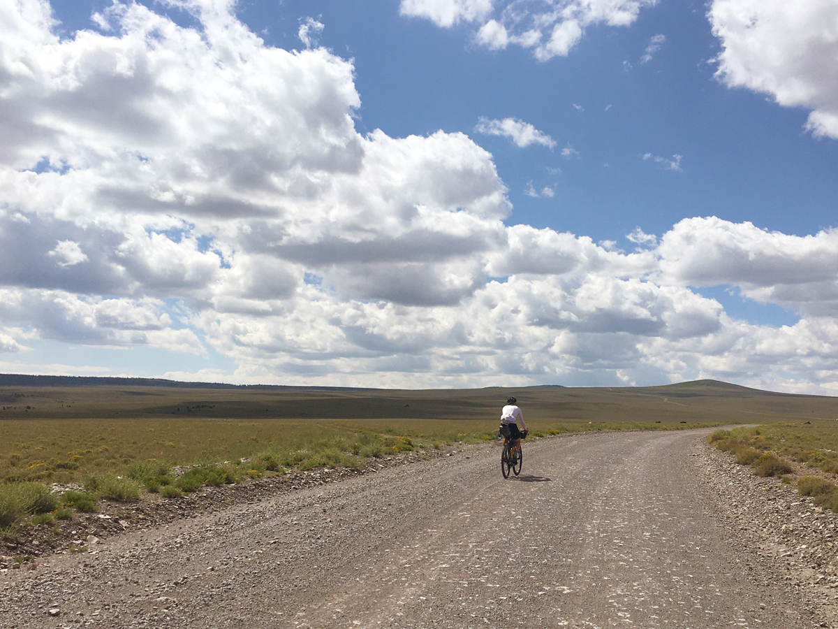
We head south. On the road out of town a four-wheeler and a few dirt bikes pass us on the road out of town, then abruptly turn back where the pavement ends. We both question each other if we were headed towards trouble but the gravel at the start of Big Rocks Road is smooth and dry—the ditch—appropriately named.
Hmmm.
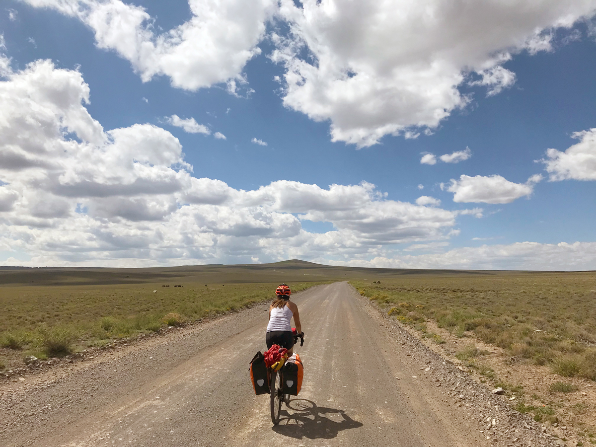
The immediate landscape is a harsh mix of dark basalt boulders pressed against the sea foam green of silver sagebrush as we begin to climb onto the western flank of Boulder Mountain. At our heels, the tilted sandstone and shale slowly disappear. The road gets rough. Washboards knock Leisha’s rear wheel loose and we stop. “Holy crap this is heavy,” I tell her, gripping the frame as she straightens the wheel. She laughs, “Yeah! I’m carrying all the water!”
The rolling hills give way to a long steady climb into wide open fields. This is flavor country. A single tree stands alone in the distance. “Too bad the only shade is so far away,” she says. Fifteen minutes later sparse low clouds begin to evaluate our layers. On and off, zipped up, zipped down, until we reach the Dixie National Forest where they stay on. We stop for a second breakfast. Desert verbena and sparse Indian paintbrush wildflowers increase the contrast until it abruptly ends. Camouflaged men and women relax serious faces, smile and wave as they pass by slowly, as to minimize the spread of dust. We wave back. “Must be hunting season,” I say.
As we press on the landscape continues to change—from the grasslands of central Nebraska to the aspens of Steamboat Springs—topping out at just over 10,000ft. Progress is slow. Methodical. Cows lay in a field gazing with lazy interest.
The lumpy, up/down descent toward Posey Lake begins. The surface is chunky and loose with intermittent washboards descending; climbs are short and steep. “I saw 12% on the last one,” I say. No reply. We hear a convoy of ATVs approaching in the distance and pull off. I continue to remind myself on the descents that there’s no cell service, I’m probably an hour and a half away by air from the nearest trauma unit, with a near full ICU. We stop, shake off the tingles and snack.
At Posey Lake Campground we look for open sites. There’s only one right by the bathroom. Leisha objects. I don’t strikethrough.
Looking at the fee sign, returning the slip I ask:
“Why don’t they charge an even number?”
“So they get a six-dollar tip,” she says.
Hmmm.
We hog the water station for ten minutes, watch campers set up tents–giggling knowing the day is almost done-use the bathroom; then ride a mile down the road.
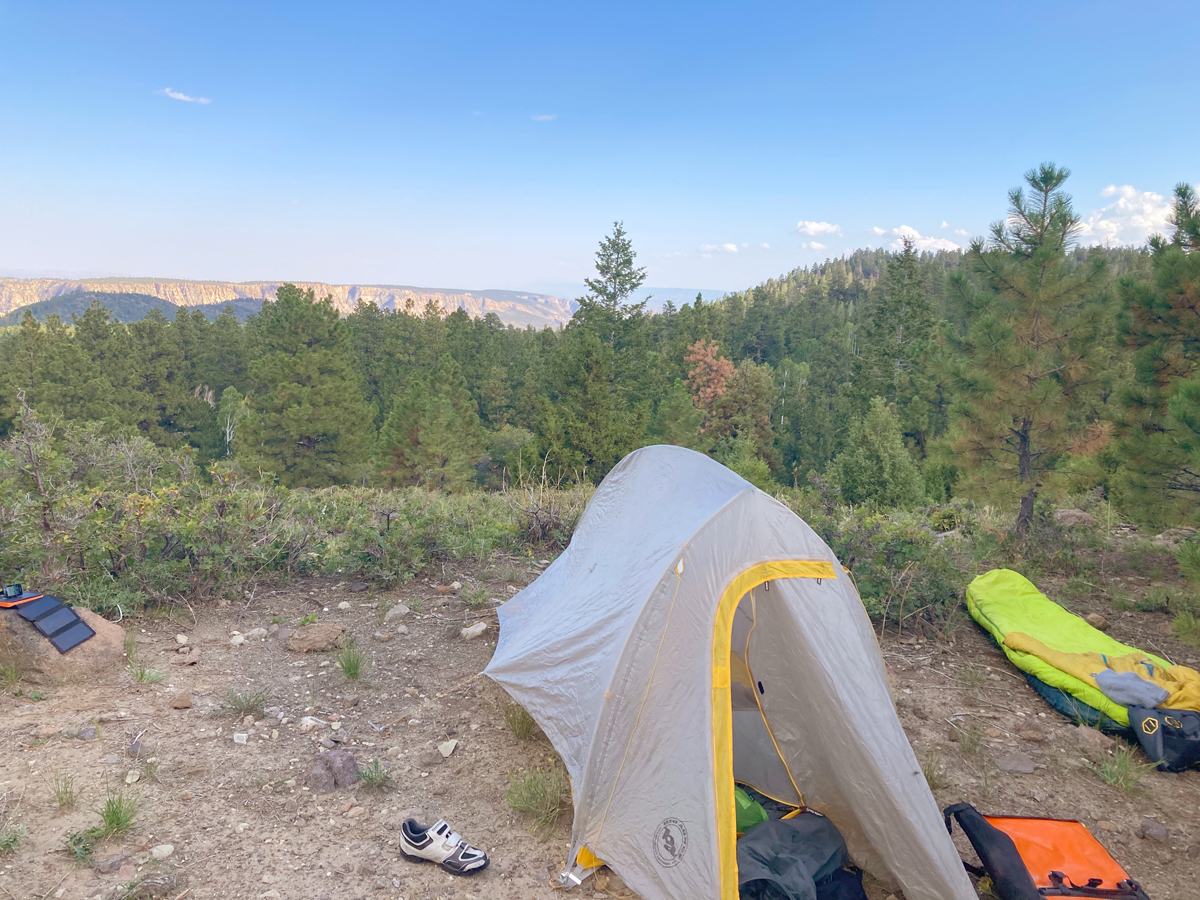
We set camp on a flat spot off the edge of a sharp curve. It’s got a magnificent view of the white cliffs across the Escalante River Valley, but it also looks man-made—to make it easier to winch out a vehicle that didn’t negotiate the turn. “Sure,” I say, withholding my last thought. She then tells the story of a bear that destroyed her last tent.
Hmmm.
I sleep under the stars. She watches the sunrise.
Packed up but not loaded, I ride up to grab water and use the restroom, drop a $5 in the tip slot and head back down. Upon return, Leisha’s already loaded and on the road. “You’ll catch up,” she says.
Sunday morning, coming down.
The canopy opens around the curve just past the junction of Devils Backbone. “Now it looks like Utah!” I shout with excitement upon contact. “Sure does,” she says, smiling back.
The eroded red and white sandstone cliffs give way to light grey limestone and andesite faces scared by the periods of continuous cleaving. Junipers cling to near vertical walls. “This is Arizona,” she says. “I was thinking California,” I retort.
We skip the slot canyon and miss the non-existent sign for the petrified national forest-—hitting tarmac—smiling about the boost in spirit and speed. The promise of hot food and coffee in Escalante is motivating. I point to an open sign on the way up the hill. She goes sweet; I choose savory. It’s been a long 20 months for her.
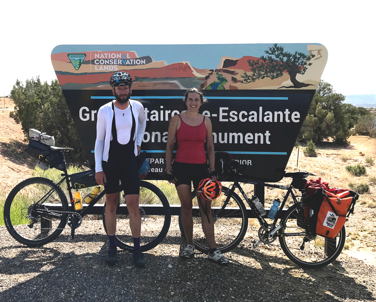
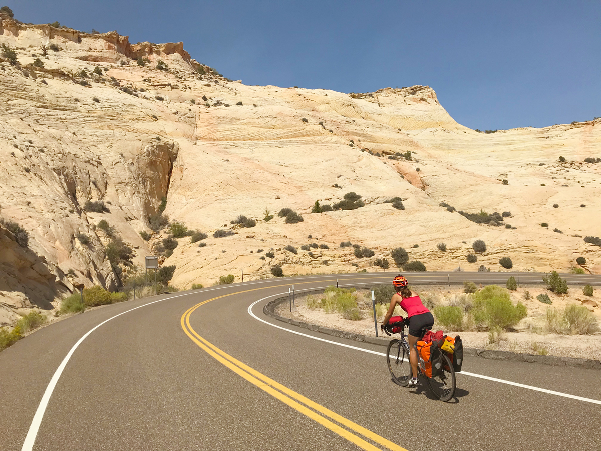
Riding south east out of Escalante, Scenic Highway 12 is quiet. We slowly climb out of the arid rangeland, under a beating sun until suddenly it’s there: The other million-dollar highway with Grand-Staircase National Monument rising to the south. We snack, smile, and take pictures. Speed read the info signs and begin the beautiful descent. It’s steep and not a place where you want to lose sight of the road. Riding fast with extra weight will fade the brakes right as you lean in and see a cattle guard with an abrupt left turn and an eternal Zoom meeting of a shoulder.
What have I gotten myself into?
A short climb and another downhill. I point to a pullout. “YEEESSSS!” I hear through the wind. We stop. Leisha points a thousand feet straight down to the trailhead we are headed towards. I climb up the red stone and look over. She takes a photo. A vulture soars overhead.
At the Escalante Natural Bridge trailhead there’s no parking, (peanut butter surfers) so we lay our bikes down on a new sandbar and change shoes and clothes. Flash floods from the previous week had reshaped the flood plain, wiping most of the trail clear.
Shoes and socks off, we wade through the alkaline water of the Escalante River. Then barefoot—pounding heels into dry sand and milk thistle. Shoes on again. Shoes off again. Socks still in hand. Mud in the toes. “I think I see something,” she says.
Hmmm.
We watch the shadows move.
“Is it worth it? How far away?” asks a spry husband with the concerned look of his wife.
“Mmmm, it’s a ways (gesturing around the next riverbend) away but it’s just a rock,” I say giving the telling meh, shrugged shoulder gesture.
We change and Leisha filters water. There he is again at the trailhead. “Did you make it?” Leisha asks. “Mmmm no, we didn’t want to cross the river again and you said it’s just a rock,” looking at me.
I notice his Heavy Pedal T-shirt.
Hmmm.
Highway 12 again: it’s gorgeous, it’s hot, it’s steep, it’s narrow and traffic is mostly going the other way. Nearing the top at an overlook of the slot canyons I hear the rustle of Lower Calf Creek Falls 1,500 feet below. Leisha pulls up; we’re both tired from the climb and the 100°f heat of the afternoon. Several cars slowly drive past, occupants staring at us like we’re lizards or aliens. I comment, laughing “I want a T-shirt that says, ‘THANKS FOR STARING.’”
Leisha catches her breath and replies, “You’re just bitter.”
Hmmm.
We reach the top of the Hogback of Highway 12. There are no guardrails and in parts —a sparse shoulder—is the only thing keeping you from sudden death. Even at our loaded down pace it’s still something to think about. Trip Advisor gives it one star.
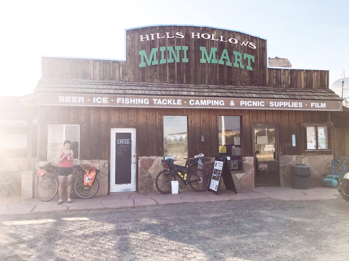
Four false summits and gravity hills later we look down upon the oasis that is Boulder, Utah. “I can see a gas station from here!” I extoll. My mouth begins to salivate. Outside the Mini Mart gathers travelers of all sorts. Ranchers, farmers, Jeep’s, motos, Subaru owners, and ourselves. It’s not a party atmosphere. Everyone looks blown, sunburned and equally salty in the face; just grateful and smiling to see an open sign. Inside is the antithesis of a gas station. The clerk gives us some directions, a story, a recommendation, then shrieks “You’re not going over the mountain, are you?”
“Not today,” Leisha says.
Outside, I try to wrestle the medium sized paper bag filled with salty chips, cheese, dried fruit, and pickled green beans onto my handle bars. I give Leisha a look. She sees my defeat.
“Just zip it up in the front of your jersey,” she says.
Hmmm.
Looking like a pregnant goat we ride east into town. I get embarrassing smiles from passing travelers. The town does have a unique bootstrap charm that could equal the backdrop of a David Lynch film. We stop in front of the Anasazi State Park Museum and check the map. The campground is an RV park. Without hesitation or question we continue on until we spot a mountain bike tire track leading off the road. It was an errant trail but there’s flat ground, a flowing stream and set camp. I pull the sweat soaked paper bag from my jersey, and we stuff our faces with some salty delight. Leisha looks at the route for tomorrow.
“Sooo, it’s 13 miles and about 4,000 feet,” she says, squinting at the screen at twilight. “So a categorized Hill Climb to start out the holiday? Nice!” I say with light sarcasm.
“I wonder if the Tour of Utah ever did this?” I rhetorically ask.
“What’s that?” she says.
Hmmm.
Labor Day breaks clear, slightly smokey, and with a headwind. Traffic on UT-12 is fairly light and courteous as we hit the city limit. We are on part of the American Discovery Trail, a network of continuous roads and trails that run from Washington D.C. to San Francisco with a split across the Midwest. Over a bluff we begin to see what’s ahead of us in the not-so-distant future. I lead in the wind for a bit, my pace is sporadic. I think Leisha is annoyed and rolls off the back. Maybe my bib shorts stink? Layers come off. Food and water go in. Around the bend I see the distance to the summit.
“I won’t say how far it is,” I say.
“I don’t know what’s more annoying,” she quips.
“She hates me,” I tell myself.
“I don’t get it!?” she yells when we meet at the next pull off. “Why do cars always seem to only pass me, randomly, in both directions, at the same time?”
“That’s chaos theory!” I yell back. We both are winded.
A cowboy on horseback is at the summit in the fields, working his dogs. We look down the road.
“This isn’t the real summit, is it?” she asks.
Without question, she’s right.
Truck and trailer traffic begin to get heavy as the road points downhill again. Going back to the grind aren’t we all. I’m well inside of the fog line when an RV gets a bit too close for comfort and I wobble in its wash and get sucked out into the roadway. Pins and needles. Fuming, I throw up my left hand, raised with question-—immediately angry—flipping the bird.
“That’s not helping either of us, or anyone else on a bike,” she says later.
Mmmm, hmmm.
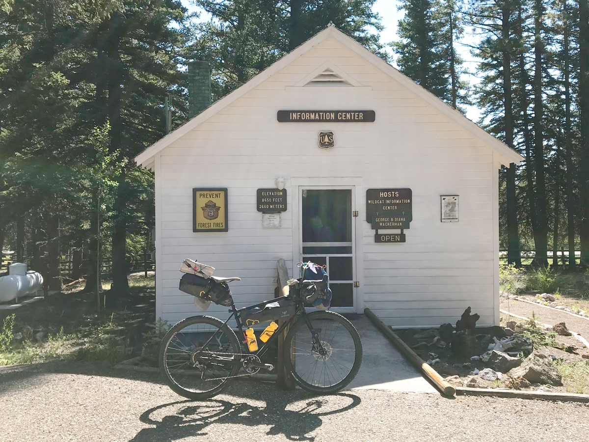
We need water now. Bad. Second breakfast had five-star views but was salty leftovers and left both tanks empty. Leisha says there was another ranger station down the road, except this one was old. When we arrive, the back door is open and Smokey the Bear is waving on the mast.
George greets Leisha behind the screen door.
“Where can we get water?” Leisha asks.
“It’s inside. Just a moment please.”
He returns: his face obscured. His wife Diana’s is as well. As is ours. They open the door.
The Wackermans have been a fixture at the Wildcat Guard Station for some time. Built by the Civil Conservation Corp in 1935, the white log cabin looks as good as new. The wood stove is 87 years old as George tells me and the place smells of hot apple pie. We fill out bottles. Diana tells a story of the last Tour of Utah that came by. “All my pictures were just a blur.” We laugh. They give us a map and show us an old one.
“Where are we in relation to us right now?” I ask.
“Just off the map, about here.”
The map is a 57-year-old relief. George’s finger pointing to the edge of the coffee table.
“About 18 miles to Torrey, 15 after that on 24 to Bicknell.” he says.
Hmmm.
We thank them and sign the guest book.
The road climbs slightly and over a left curve the forest opens to the views of the western flank of Capitol Reef National Park. The Henry Mountains to the east loom over what was once called “Wayne Wonderland,” the name given by local boosters before it was designated by F.D.R.in 1937. It didn’t open to the public until 1950 and the final road extension from Boulder to Torrey wasn’t built until 1985. The tarmac is maybe a few weeks old.
A long downhill takes us from ponderosa and white pine trees back into the tall grass, silver sagebrush and red stone cliffs along the banks of the Freemont River.
“You know what I’m thinking of?” I ask.
“A milkshake!’ Leisha replies.
It was ice cream, but “It’s close enough,” she says.
We turn west on Highway 24 in Torrey and get a whiff of hamburgers and French fries. This “thin slice of Americana,” Leisha calls is aptly named “Slackers,” and sits just off the road on the north side. The gravel lot is full. Inside, three-generations spill over tables and make small talk while a group of teenagers gawk at our attire. The corrugated aluminum walls reverberate the chatter and bustle of moms corralling playing children while the familiar whirl of a Cyclone whips up another custard. Outside we find a table under a large tree, away from a possible inquisition. The fries are salty. The shake needs a spoon to start. The conversation turns bleak as I begin to drip my now melted vanilla shake onto my already well salted shorts. As it’s been said: hesitation is devastation.
As we are about to leave an older gentleman walks up, looking at our bikes and asks, “Where ya’ coming from?” I explain our route and add, “I think we’re just past 100 miles, but this is our third day.”
His eyes grow large, he grumbles something incomprehensible as he comically turns away in a cartoonish motion and shimmies back to his table— only to wish us well as we ride past.
Traffic is now thick at times but somewhat courteous. The turnoff to Teasdale is up ahead.
“You wanna go to Teeeasdale Leisha!?” I yell over the growling headwind.
“Noooo!” I hear.
Legs are near death. Happy thoughts drift between salty food, a hot shower, soft sheets: then crash headlong into a stack of emails, cartwheel over voicemails and finally come to rest on Monday morning’s snooze button. It’s the point in time when the mind rumbles over the hiss of contemporary life—wind in the face and white noise in the ears.
We reach the turn off to Big Rocks Road again. “Wanna do it again?” I ask.
“I’d totally get fired,” she says.
Hmmm.
133mi/11,596ft | 222km/3,479m
Sean Quill is a semi-retired ski industry professional and an avid smile and wave cyclist.