By Don Scheese —
“By the middle of the morning he was on the rim of the Valle Grande, a great volcanic crater that lay high up on the western slope of the [Jemez] range. It was the right eye of the earth, held open to the sun. Of all places that he knew, this valley alone could reflect the great spatial majesty of the sky … the great feature of the valley was its size. It was almost too great for the eye to hold, strangely beautiful and full of distance.” — N. Scott Momaday, House Made of Dawn
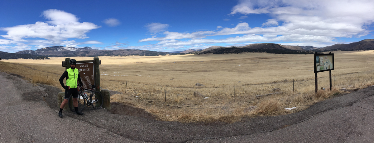
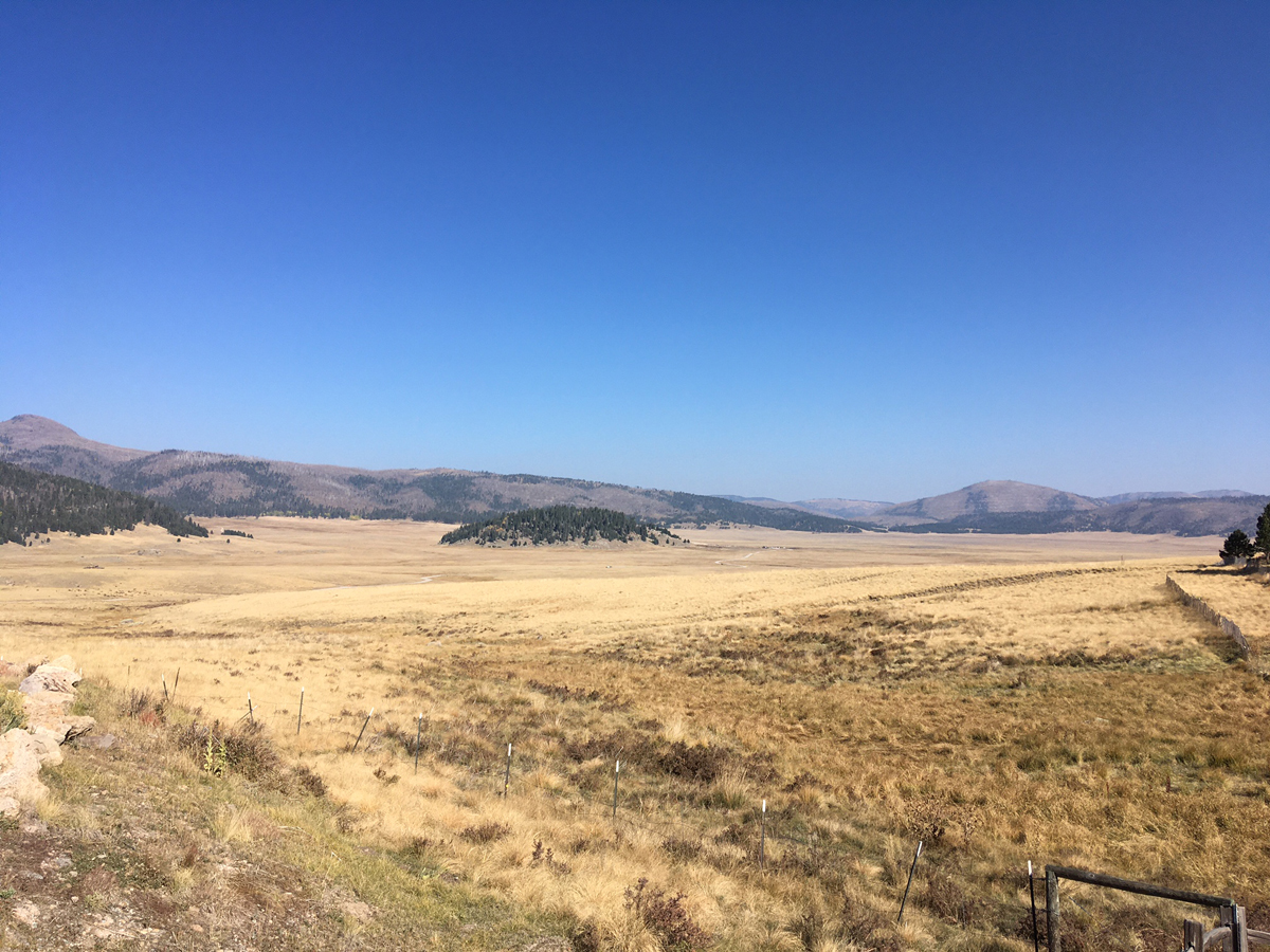
The Valles Caldera National Preserve, established in 2001, is something special. Locals simply refer to it as “The Valle,” or “The Valle Grande,” and grand it certainly is. Almost 100,000 acres in size, this volcanic caldera is New Mexico’s mini-Yellowstone, a high elevation grassland basin rimmed by dark, conifer-clad, rounded-off mountains. Elevations range from the basin at 8400’ to the Valle’s high point, Redondo Peak, at 11,254’. Whatever way you approach it from State Highway 4, which runs along the southern boundary of the preserve, the contrast between the densely forested and fire-scarred landscape from which you emerge and the open vista of The Valle is visually striking—one might even go so far as to say sublime.
It is not only the geologic history of the Valles Caldera that is so interesting, but the human history is also fascinating too. Over thousands of years people have visited, used, and at times lived there, forming a rich palimpsest of stories and events.
The caldera was created around 1.25 million years ago. As part of the Jemez Mountain volcanic complex, a “Big Bang” occurred when the volcano at the heart of the range erupted, spewing magma 15 miles high into the stratosphere, blanketing an area 30 miles in diameter in over 6 feet of ash. Eventually the caldera collapsed, and the flow of magma and ash cooled and solidified to create pinnacle-like formations made of volcanic tuff (like nearby Kasha-Katuwe Tent Rocks National Monument). Accumulating rain and melting snow created a lake inside the caldera, while resurgent domes formed as volcanic activity continued over millennia. Over time the rim of the caldera was breached on the west side, draining the lake as the running water formed creeks and canyons. With the advent of cooling global temperatures during the Ice Age some 20,000 years ago, grasslands evolved in the basin of the caldera. Colder temperatures inhibited tree growth, creating the magnificent valleys for which the Valle Grande became known.
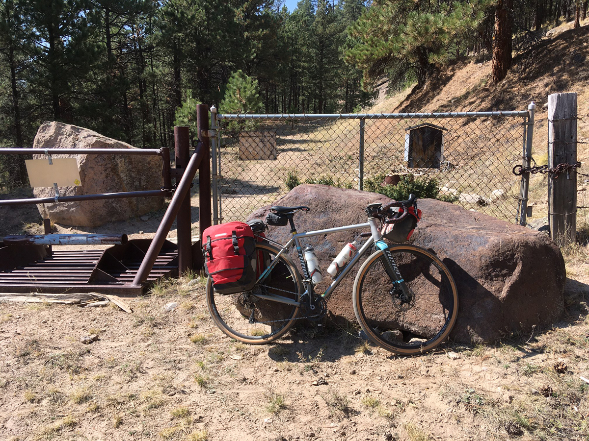
As you approach the Valle from the west on Highway 4, the forest suddenly opens up as you top out on a plateau over 8000’ high. A sign proclaiming the entrance to the national preserve appears on your left, and so begins the main gravel road that slices through the meadows and around the timberline of the Valle. It is 2 miles to the Visitor Center and entrance station, and another 16 to the northwest corner of the park on road VC 02, where I planned to exit the preserve. Since camping within the park boundaries is not allowed at this time, I intended to camp somewhere along a creek just west of the caldera. The roads are rough but passable to passenger vehicles, and monstrous RVs are not recommended (thank gawd). Let us hope the Park Service keeps it this way. Basically the lightly travelled roads of the Valle are wonderful gifts to cyclists with mountain or gravel bikes.
After loading up my steel Niner RLT with rear panniers and handlebar bag, making sure my 2 water bottles and Camelbak were topped off, I headed out from the visitor center parking lot on a gorgeous fall morning in mid-October, with temps in the 60s and a bracing northwest headwind.
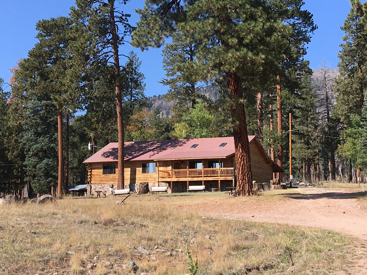
The first two miles ascend gradually to a junction, where a collection of historic buildings stands. For most of its human history the Valle was uninhabited due to its long winters and cold temperatures. It was and continues to be visited seasonally by Ancestral Puebloans and the current members of the nearby Jemez and Santa Clara Pueblos, who make pilgrimages to the tops of the highest peaks where shrines to their gods still exist. Beginning in the 1700s and lasting into the 20th century, Spanish sheepherders, the US military during the Indian Wars, and vaqueros herding cattle were also regular visitors. Only in the 20th century were ranchers willing to build cabins, and even then stays were restricted to summer and early fall. When Texas oilman Francis Dunigan purchased the property in the 1970s, he permitted the Hollywood film industry to shoot a number of Westerns in the Valle, the best of which was The Missing (1990), starring Tommy Lee Jones and Kate Blanchett. The TV series of the modern-day Western Longmire was subsequently filmed here as well.
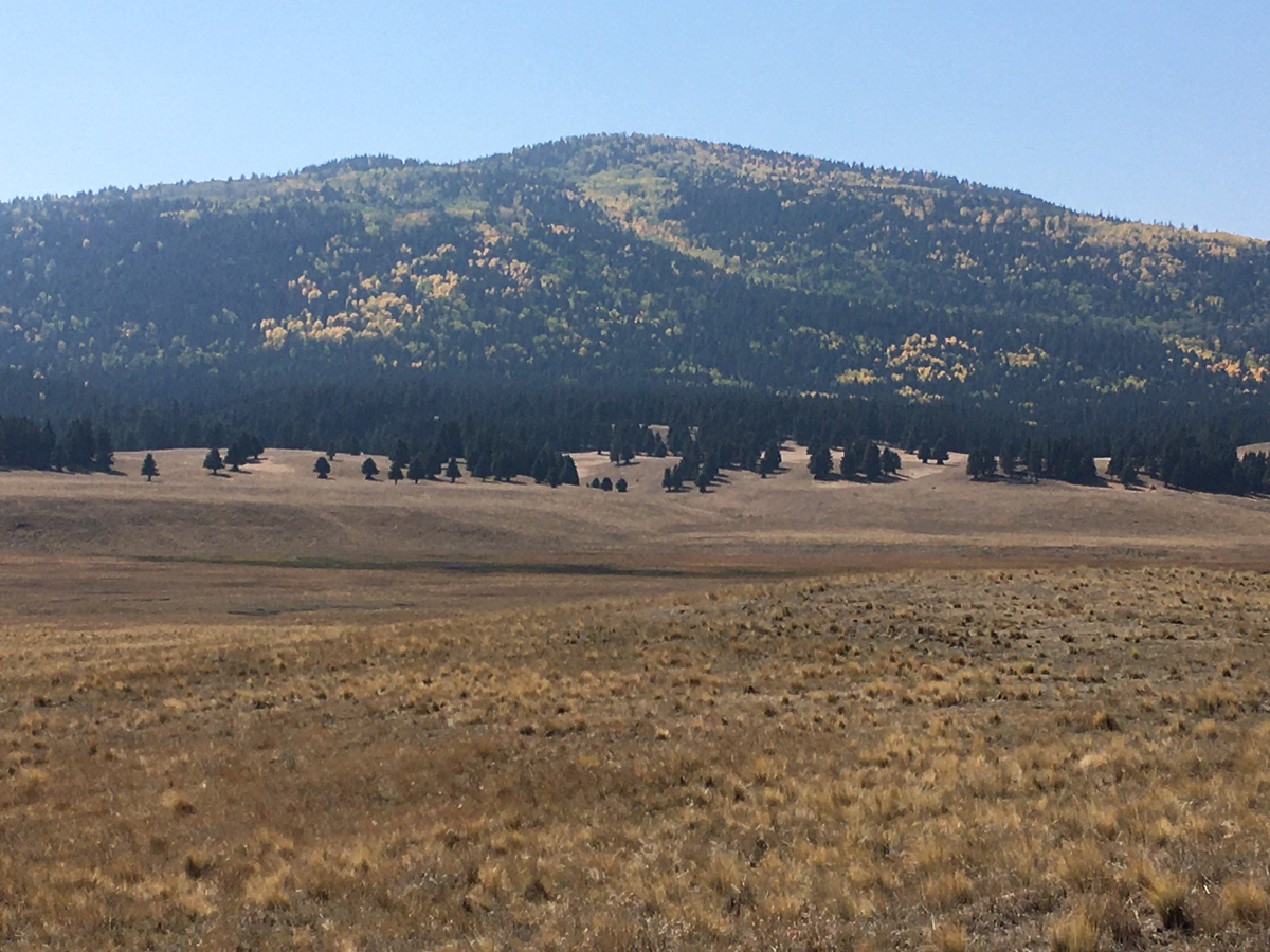
VC 02 wends its way along the edge of the timberline, through the History Grove, a magnificent gallery forest of ponderosa pine some 500 years old through which there are fine vistas looking south over the expansive grasslands towards the dark conifer-clogged rim of the caldera. One of the provisions of the Valles Caldera National Preserve when it was created held that cattle grazing on a sustainable basis would be preserved as a “historic use,” and so you may see herds of cows here and there as you follow the meandering roads. There are also some 5000 elk that thrive in and around the Valle, and a favorite pastime of tourists is to watch them graze at the forest edge early mornings and towards dusk. A member of the Cochiti Pueblo once told me he collects the elk antlers in the spring on the nearby hillsides for sale to wanna-be Westerners in Santa Fe who decorate their homes with the magnificent racks.
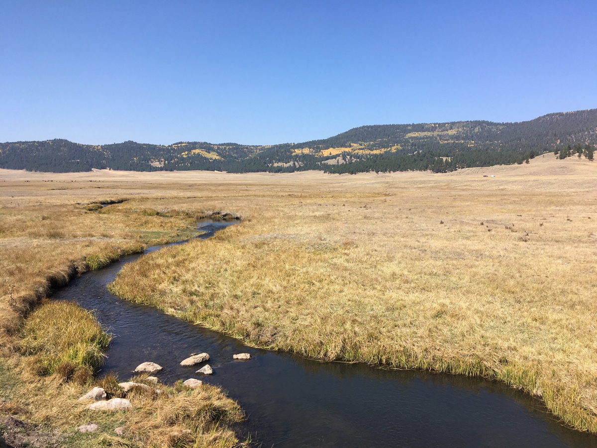
VC 02 trends northward on rolling terrain along the base of several resurgent domes that formed after the Big Bang some 1.25 million years ago: Cerro Pinon, Cerro del Medio, Cerro del Abrigo. There are some fine routes to the east that loop through the Sierra de los Valles and Valle Toledo, past Obsidian Valley (a rich source of carving tools for Ancestral Puebloans) and back to VC 02—but my route today was more direct. After a gradual climb I reached the high point of my entire 2-day journey: San Antonio Divide, 8800’, separating the waters of the East Fork of the Jemez River from those of San Antonio creek (the two drainages re-join at Battleship Rock, a stunning tufa formation to the west in San Diego Canyon).
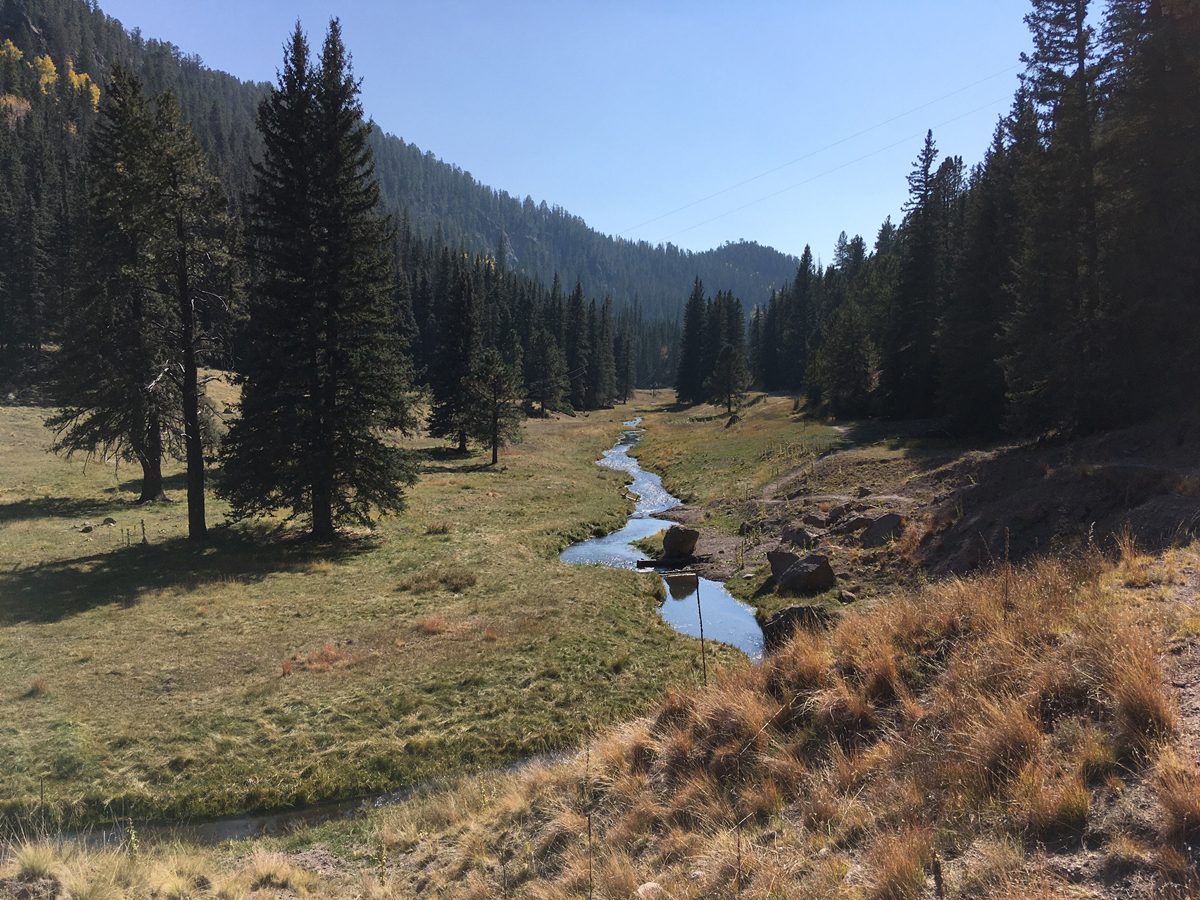
Only two or three vehicles passed me by this point, all going the opposite direction. From here it’s a 4-mile gradual descent into my favorite part of the preserve, the Valle San Antonio. Farther removed from the visitor center, it’s even less travelled by motor vehicles, and the vistas along San Antonio Creek are especially sublime. Particularly in October, when the flaming colors of the aspen stand in stark contrast to the dark green conifer-studded slopes of Cerro Seco and San Antonio Mountain. There’s another picturesque cabin along the creek, and you may well see cattle grazing off in the distance. On some of the hillsides are horizontal lines rimming the mountains on the north side, remnants of roads that are a legacy of decades of intensive commercial logging in the 20th century. I once heard a mountain biker describe the Valle as “pristine,” and had to laugh—it is hardly a landscape untouched by humans over time. But it is a rewilded landscape, and with effective management by the Park Service it should continue as such.
Occasionally a lone stunted conifer rose from the grasslands, representing the age-old battle between the two biomes. Since the last Ice Age the colder temperatures of the basin have largely prohibited tree growth, leading to the open vistas for which the Valle became famous. The isolated tree here and there called to mind ‘the tree where man was born.’ This is an allusion to a book by Peter Matheissen of that title, and the origin of the human species on the African savannah, where we became a bipedal mammal emerging from the dense forest onto the open grassland some 5 million year ago. Biologist E. O. Wilson developed his theory of the Biophilia Hypothesis from this fact, arguing that we have an innate preference for a landscape that is both open and provides cover from predators. [Editor’s Note: The idea of Biophilia, love of nature, was proposed early on by my father, Dr. Hugh Iltis. Wilson later developed the concept further in his book by the same title.] Perhaps, I thought, this is one reason, albeit of the subconscious, why the Valle is so visually attractive to visitors.
Wildfire has also played a dominant role within and around the Valle. Prior to the 20th century, ecologists have concluded based on tree-ring data and fire scars that most fires were low-intensity blazes restricted to the understory and grasses. But beginning with the total fire suppression policies of the 1900s by the federal government, fuels began to accumulate, resulting in bigger, higher-intensity crown fires, whether started by lightning or humans. Four of the 5 largest wildfires in the area’s history have all occurred since the 1970s, and the scars are visible all around the rim and surrounding forest of the caldera.
VC 02 ends at the junction with VC09 in the San Antonio valley, and from there it is 6 more miles of rollers to the park boundary and gate in the northwest corner. I geared down for a few of the short punchy grades as I approached the gate and had a good lunch after 2+ hours of gravel grinding on a loaded touring bike. It was early afternoon, a cool breeze was blowing, and there was some welcome shade under a big ponderosa as I took in the quiet and solitude, soothed by the wind whooshing through the pines.
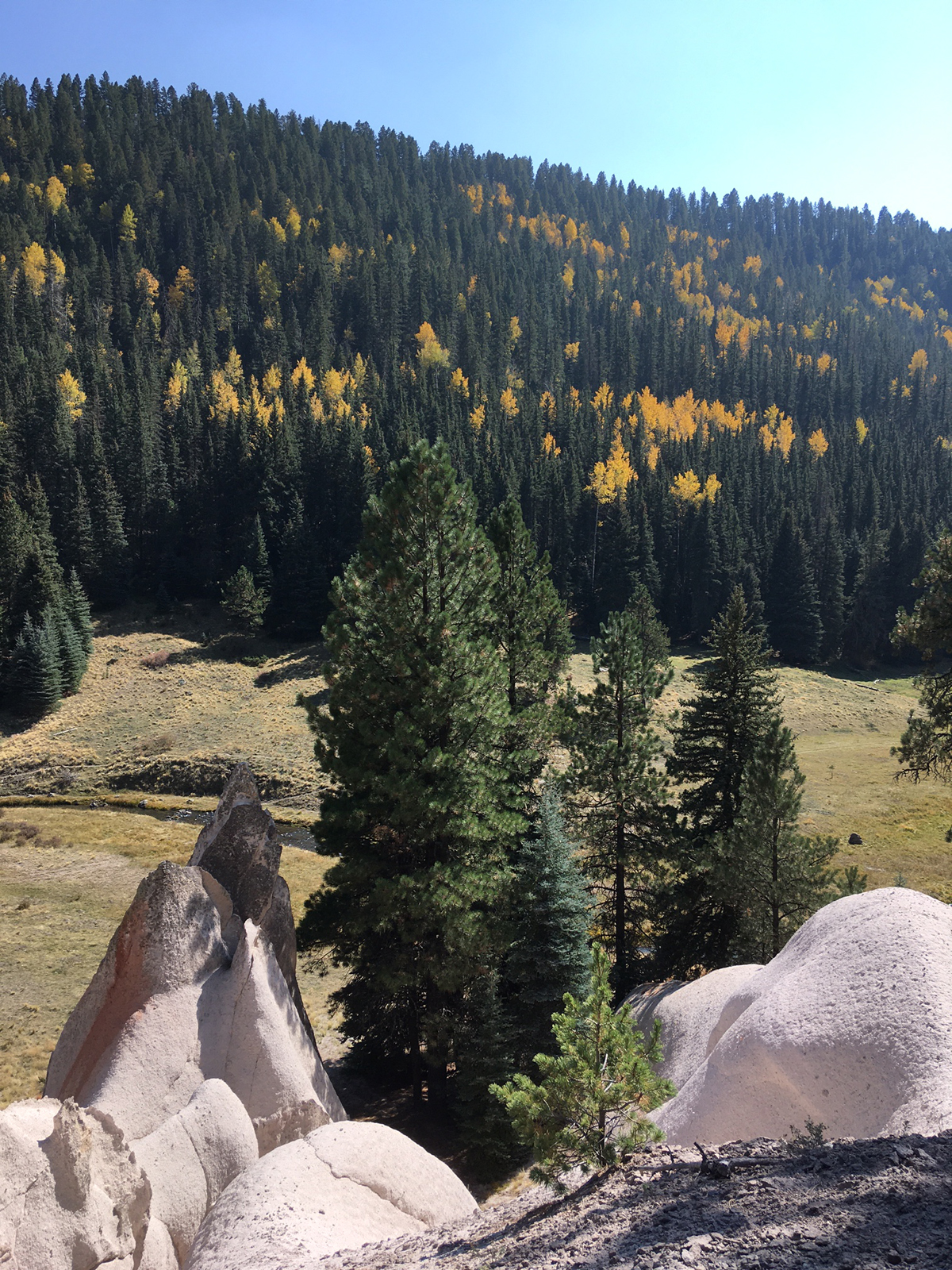
At this point I was on the lip of the caldera. The next 2 miles consist of singletrack on an old logging road down one of the most scenic canyons in all of New Mexico. A purling meandering stream; aspen trees flaming on the hillsides; and tent-rock like tufa formations punctuating the defile: I was witness to all this and more, as I descended slowly, savoring the experience. In a few spots I played it safe and dismounted where the trail took a steep plunge or the singletrack became too crumbly and unstable for my 38 mm tires. I encountered one hiker, a guy and his dog, who were sauntering up the canyon. He told me about “a primo campsite one meadow up” from the popular San Antonio hot springs. I thanked him for the tip and told him I’d definitely check it out.
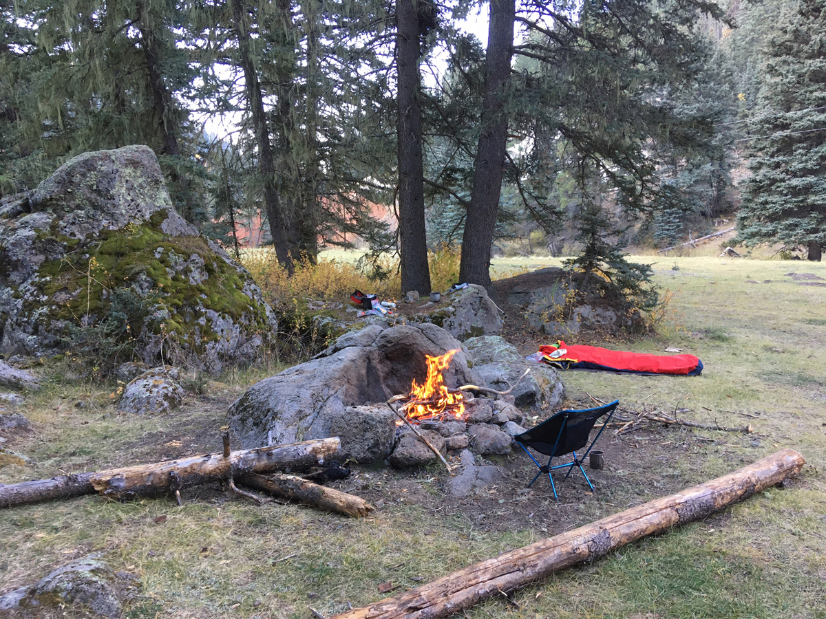
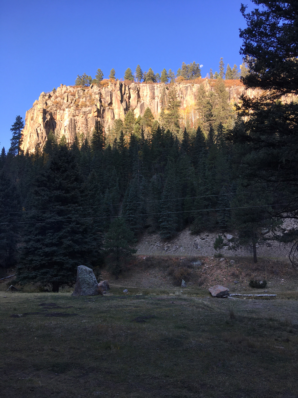
In all too short a time I recognized the spot. To reach the campsite required fording the stream, so I donned sandals and tossed my panniers and handlebar bag across the creek to lighten my load when crossing. The fresh icy cold water soothed my feet, and in no time I reached the campsite, sheltered by towering spruce. There was plenty of downed wood for an evening and morning fire, with a fire pit built up against a huge slab of granite. Above me on the opposite side of the canyon, the warmer south side, towered pink-gray tufa cliffs interspersed with ponderosa pine. After setting up camp I simply sat in my Helinox camp chair, sipped whiskey, munched some habanero jerky, listened to the purling stream, and watched the sun sink ever-so-slowly behind the cliffs.
Dinner: mac ‘n cheese with spicy Thai tuna. A nice warm blazing fire for a couple hours. Sound sleep in my down bag and bivy sac. A sky filled with stars and the Milky Way. A great horned owl hooting softly in the forest primeval. Quiet. Solitude. Wildness.
Morning: ice in my pot with water filtered from the creek. A visitor: an old Hispanic man with his pugsley dog, who told me he walks up the canyon several times a week. (I referred to him as El Viejo in my journal.) The temps slowly warmed as the sun crept over the ridge, hours later finally reaching my campsite. At that point the air quickly warmed up to the 60s, and I slowly shed layers of clothing and basked in the morning sun.
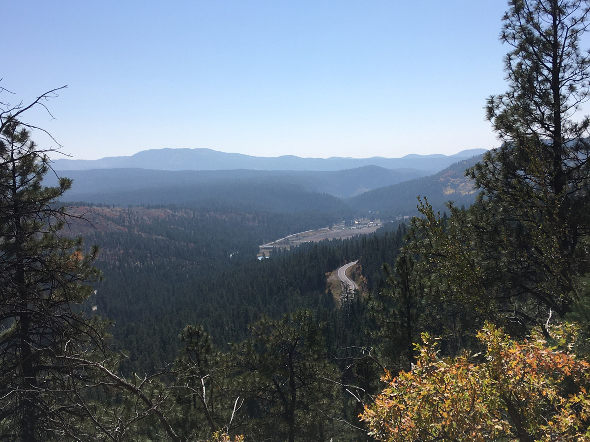
I re-crossed the stream and continued down the canyon. Forest Road 376 from the hot springs to Highway 126 is open to vehicles from June to December, and along these 5 miles I met with a couple vehicles heading to the hot springs. Just before the junction I paused to take in the overlook of La Cueva, a village at the junction of Highways 126 and 4, where there’s a general store motel, and a few summer residents.
I was about to enjoy a 2000’ plunge on paved roads all the way down to Jemez Springs, 13 miles distant. Before beginning the descent, I re-checked my brakes and rack and panniers, making sure everything was tight and in good working order.
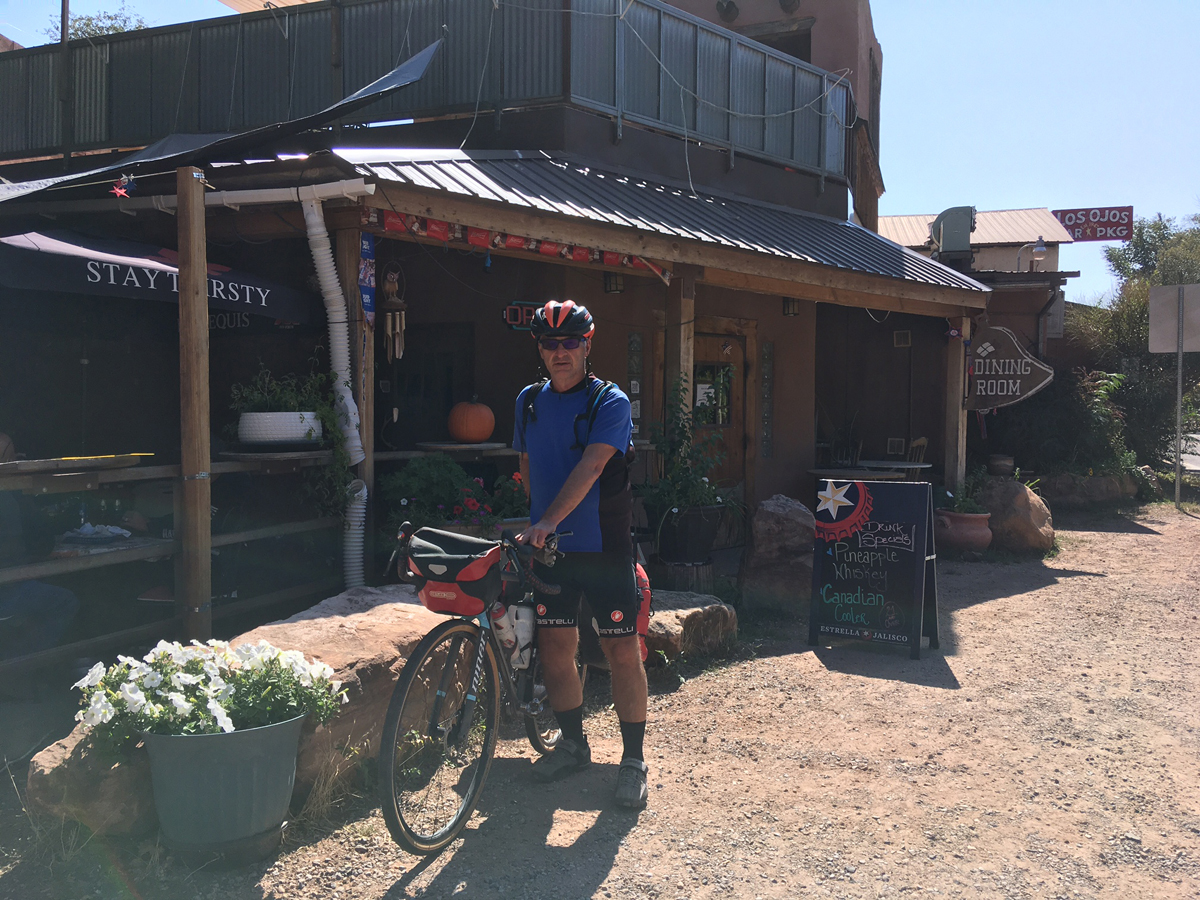
Swooping switchback twists and turns, high-speed descents on straightaways, little traffic: the Reward for the Cyclist who has labored up some 1300 feet of elevation. In no time I was passing through La Cueva. Rather than stop at the general store for some refreshment I decided to continue on down through San Diego Canyon, not wanting to interrupt my momentum (every cyclist knows that feeling). There are numerous hot springs, fishing spots, and hiking trailheads along this stretch of Highway 4, but mercifully traffic was still light and most of it was heading the other way. Of course a guy in a pickup had to pass me on the narrow-shouldered road with oncoming vehicles, but after that I whizzed past the dark prow of Battleship Rock, then the weird formation of Soda Dam, where geothermal mineral deposits have built up to form a barrier of sorts to the creek. After a brief holdup for ongoing bridge construction, I reached the funky New Mexican village of Jemez Springs, where galleries, thermal pools, and a thriving little community of independent-minded folks flourish.
Time to celebrate: a good lager and Olga’s famous chile rellenos at the historic bar of Los Ojos. I was back in the world of masks, social distancing, and the pandemic….waiting for my wife to pick me up and take me back to my car at The Valle.
Cyclists know the feeling of having come across a landscape that caused them to think, “Now this is a place that I have to come back to on my bike.” And when they do, they realize a Dream Fulfilled.
Exactly my feeling as I toasted a fine trip through the Valle Grande.
Don “Seldom Seen” Scheese lives and rides in New Mexico, always in search of new adventurous routes, especially on gravel roads.
Cool ride! Route map?