By Alex Stewart – A lot has changed in our society since my first long-distance bicycle tour in 2018, from Park City, Utah to Jasper, Alberta. More than I would expect in a four-year time window. When we choose the bicycle as our mode of travel, we open ourselves up to vulnerabilities we could’ve otherwise insulated ourselves from. As a result, we often get to have a degree of granularity in our experience unparalleled to the typical road trip. We get to see the supportiveness of the people in our society. The flip side of this coin is that we also open ourselves up to risks and can easily become the target of people’s anger and frustrations.
I dragged my feet for two weeks before deciding to go on this trip because I wasn’t sure what environment I would find myself cycling through in 2022. In a country experiencing significant tension and uncertainty, I worried about increased hostilities and if the vulnerability of (especially solo) bicycle touring would be worth it.
Partially because of this, I decided to travel close to home in a state where bicycling was more common. Despite living only a few hours from Colorado, I had never been south of Leadville — so not much further south than I-70. Like on my 2018 tour to the Canadian Rockies, I picked a destination I had long desired to visit for its beauty and challenge. This destination was the San Juan mountain range of southwestern Colorado. Along the way, I would cycle through many western Colorado towns, with dynamics both familiar and yet slightly different than the Utah resort town of Park City where I have both lived and worked.
As someone interested in affordable housing initiatives, I was curious to see what the housing and economic situations looked like in these Colorado towns where tourism has such a prominent presence in everyday life, housing, and business. I see bicycle touring as a prime opportunity to listen and observe at the immediate scale. The slow-moving nature of the machine lends itself well to that.
Not having a fixed end date to conform to, I decided to bike from my house to the state line of Colorado. The environment I traveled through to get there, southwestern Wyoming and the Flaming Gorge area of Utah, was quite different from what I would encounter later. I left Park City on a Saturday morning, passing at least a dozen cyclists on the Rail Trail heading to Wanship. I did not realize at the time that these were the last cyclists I would encounter until I reached Colorado, several hundred miles away. I exited Utah through Chalk Creek Road and hung south of Evanston, following rural Wyoming backroads and highways to traverse the northern foothills of the Uinta Mountains.
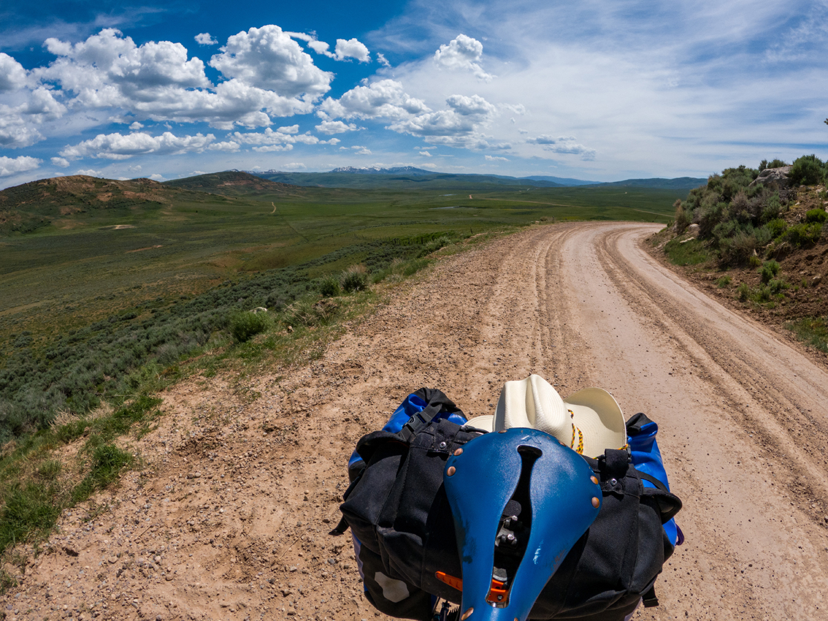
While on my way to the Bridger Valley, I encountered one of Wyoming’s notorious mounthills just east of the ghost town of Piedmont. I didn’t consider them big enough to be mountains — at least not compared to the Uinta Mountains off in the distance — but they sure weren’t small enough to be hills. This steep mounthill resulted in a slippery push-a-bike affair to make it to the summit. Thankfully, this was the only time I encountered this scenario on the trip. The main street of Mountain View, WY, had slim dining offerings, but I managed to find a meal.
A cold front was moving in the next day, so I quickly made my way down WY-414 into Manila, UT. The heat had been getting to me the past few days, so I was relieved when the ride into Flaming Gorge was cool and pleasant. UT-44 on a Tuesday morning had minimal traffic and several opportunities to stop and take in the views as I climbed my way up along the western rim of the gorge and skirted the eastern flank of the Uintas. I suggest detouring to the Red Canyon Visitor Center for a premium vantage point.
One of the most remote stretches of my trip was between Dutch John, UT, and Maybell, CO, with no services for one hundred miles. Browns Park Road enters the northwest corner of Colorado and is mostly used by rafters to access the Green River. About 3/4ths of the road is paved, with the Utah side being more scenic. Forty miles from Maybell, a driver in a Chevy Volt pulled up beside me to ask if I knew where the nearest electric vehicle charging station was. Maybell has a campground with wi-fi and showers located within its central town park. I rode US-40 from Maybell to Craig and then Hayden, with good shoulders the entire way. In Hayden, I was warmly welcomed by the staff of the Wild Goose Coffee shop, located in a quirky converted granary building on the edge of town. They made me feel right at home, even offering me some route suggestions for my trip, and I would encourage anyone passing through to pay them a visit.
I took a scenic alternate route into Steamboat Springs that guided me through rural Routt County. I followed CR-27 south from Hayden, then pivoted north on CR-33 into Steamboat. It had been raining the past few days, and the fields surrounding me glowed a vibrant emerald green, and the color flowed up and over the rolling hills beyond. Unfortunately, some of the dirt county roads had turned into a sticky, peanut butter-like consistency that forced me to stop and remove my front wheel in order to scrape out stubborn clumps of mud that had become trapped in my fender.
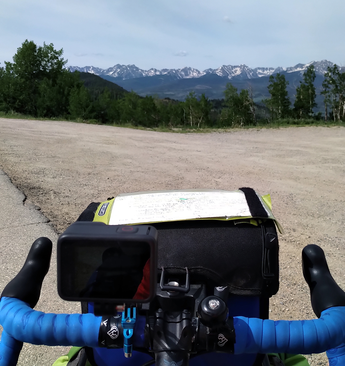
In Steamboat, Richard and Sarah hosted me for the weekend. I had contacted them through Warmshowers. Sarah happened to bump into me riding along the Yampa River bike path and gave me a personal escort back to their home. On Monday morning I intercepted Tim Tait, an acquaintance of mine who was racing the Tour Divide. We rode together briefly on the pathway out of town, and he told me about some of the Tour Divide happenings. We joked about the “dot stalkers,” people who follow the racers in person by watching the online map that updated racers’ locations. On this day and the following, I was going to officially ride a short stretch of the Great Divide route between Steamboat Springs and Silverthorne. Ute Pass south of Kremmling was one of the highlights of my trip. When I crested the summit, I got my first view of some of Colorado’s famous snow-capped fourteeners.
I took a day off in Silverthorne, staying at a swanky new hostel called The Pad. Silverthorne is a convergence point for both the Great Divide and TransAmerica long-distance cycling routes, so I encountered multiple self-supported riders during this time. Continuing on, I took a busy bike path into Frisco and then to the junction of CO-91 at Copper Mountain. There was a cold drizzling rain up at Fremont Pass. People probably wondered why I had put on a rain jacket and waterproof gloves but was still riding in bib shorts. Thankfully, warm sunshine awaited me when I arrived in Leadville. This was the furthest south I had traveled in Colorado, and I was now about to enter unknown territory.
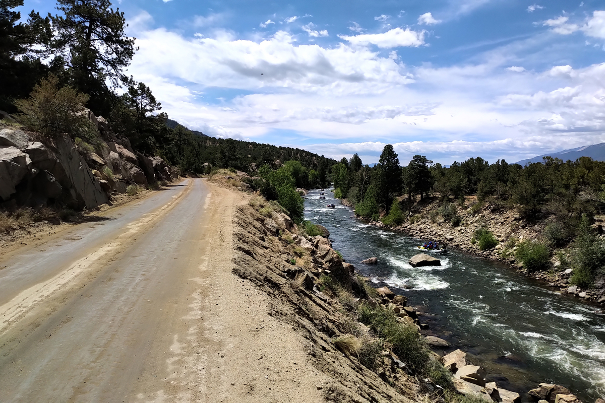
Backroad options between Leadville and Salida were ample, so US-24 could mostly be avoided. I stayed with another Warmshowers host, Ben, in Salida. He had a friend who was also passing through and staying there that evening. The next day they were off to ride some singletrack, beginning with the dirt road climb up Ute Trail west of town. They invited me to come along for that part, and I opted to join them.
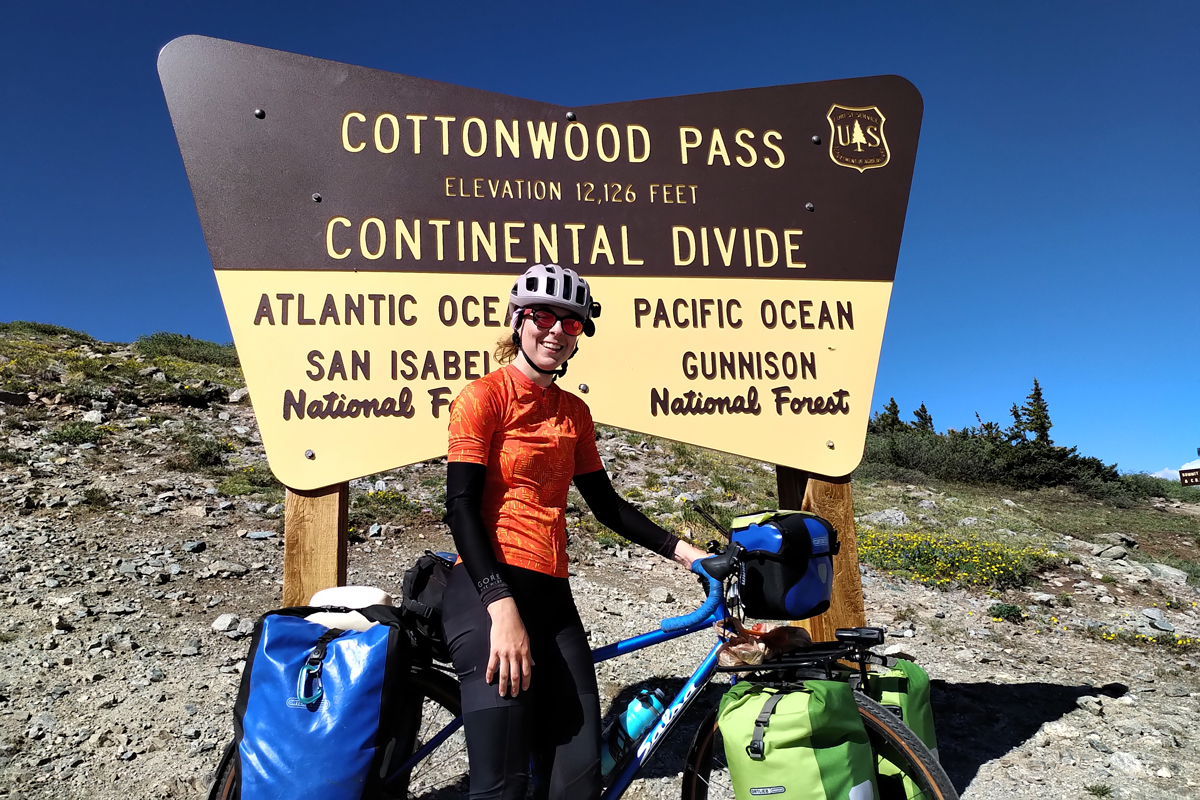
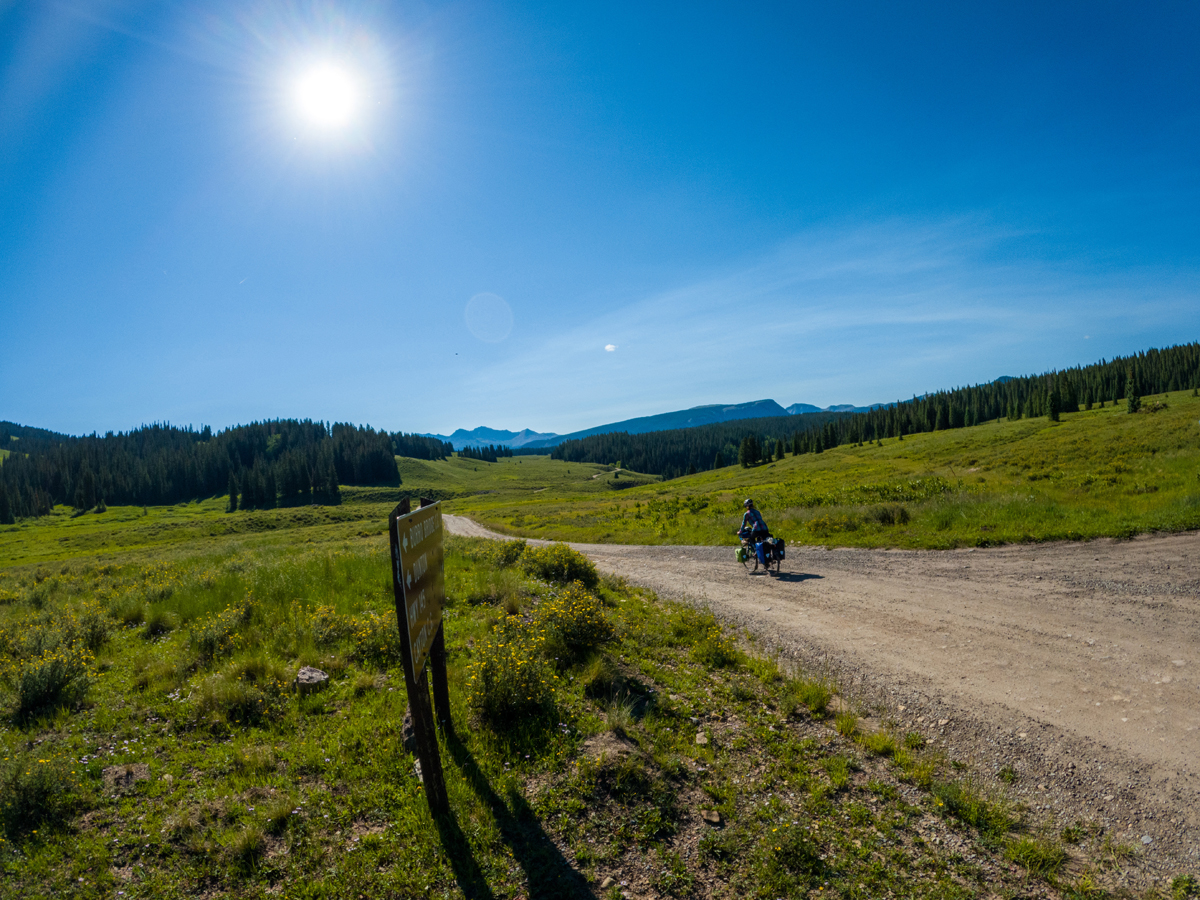
When I saw both of them come out of the house wearing jorts I became concerned. Only the fastest riders I know wear jorts. His friend was riding a singlespeed hardtail — another ominous sign that I was not in for a reasonably paced uphill ride. Once the Ute Trail started to pitch up, they peddled off together around the bend and gradually disappeared into the distance. I decided I would stick to my off-day riding pace. The next morning, I u-turned back to Buena Vista and bit off the first chunk of the Cottonwood Pass climb, camping about halfway up. Cottonwood Pass is one of the highest paved roads in North America, topping out at 12,126′. Taken as a two-part climb, I didn’t find it as challenging. In Crested Butte, I discovered the most interesting campsite of my trip. If you are willing to make the 700′ or so climb up to Crested Butte Mountain, there is a free tent camping area in a meadow with views of the surrounding mountains. Somewhat humorously, I pitched my tent in front of multi-million-dollar vacation homes, my views taking a forefront to theirs!
The route to Gunnison can be made into a loop if you are willing to climb Kebler Pass Road, then up and over Ohio Pass on a Forest Service gravel road. FS-730 tested my bike handling skills with some loose sections, but eventually I was on a quiet paved route leading into the Gunnison Valley. I custom ordered a sizeable double patty Beyond Burger at a place called Powerstop, and the cooks were surprised to see me manage to eat the whole thing. Gunnison is home to a unique bike shop/cafe known as Double Shot Cyclery — the folks lent me a quick helping hand when a poor bike parking job led to a bent rear derailleur hanger.
US-50 between Gunnison and Montrose was the most logistically tricky section of my ride. The highway is undergoing extensive construction and consulting CDOT’s website was needed to figure out when it was open. Fortunately, I had a very nice pilot car driver transport me through the stretch. I detoured to visit Black Canyon of the Gunnison National Park, riding the seven-mile-long south rim road before heading into Montrose.
My Warmshowers hosts for the Fourth of July weekend, John and Mallory, were located in Ridgway. I opted to bypass a very heavily trafficked US-550 highway in favor of the mixed-surface CR-1. It was quite the climb, and I was roasting, eventually running out of water halfway through. To my relief, some monsoonal clouds had formed and bought me some time until dehydration would become a concern. The situation worsened a few miles down the road when I went over a large bump and suddenly heard a cracking noise and a significant front tire rub. I looked down to discover my front rack had sheared on both sides at the fork mount weld points. I moved off to the side of the road, waterless and now surrounded by rumbling thunder clouds, to figure out how to fix my rack well enough to make it the few more miles into Ridgway. I ended up strapping both front bags to the top of my rear rack with some extra-long tie-down straps. I then Voile strapped the top of the rack onto my handlebars to keep it from bonking my front tire. This clunky setup managed to work.
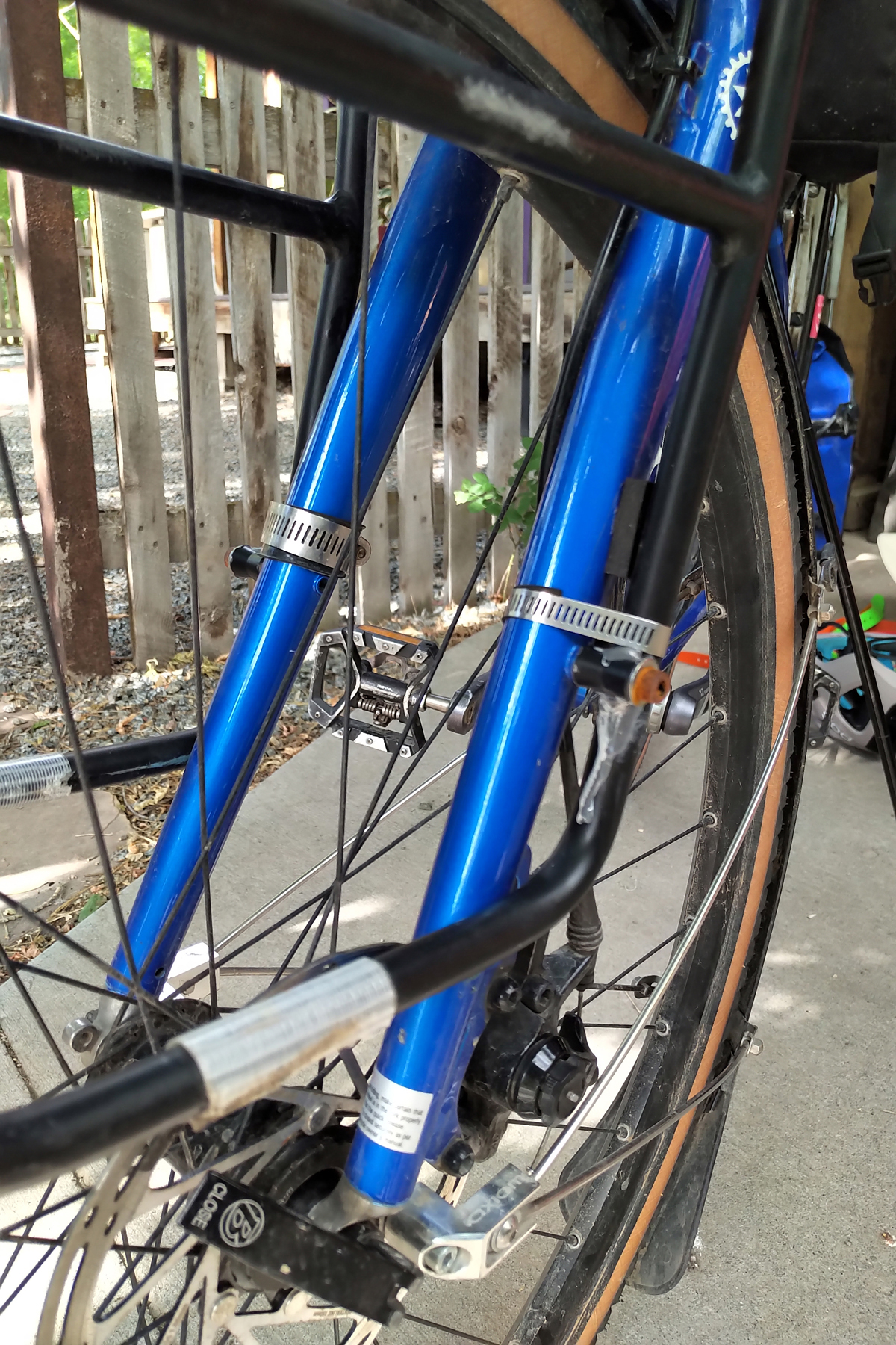
The bike shop employee in Ridgway suggested I try hose clamps as a temporary solution. Since the rack was aluminum, a simple weld job was not an option. When I got to John and Mallory’s house, John immediately started to work on trying to figure out a way to repair it. We settled on the hose clamp idea, and I placed a pre-order for a new (steel) rack with a bike shop in Durango. I figured that despite the long weekend, the rack would arrive in Durango by the time I arrived. On the night of July 4th, I camped high above Ouray at the Amphitheater Campground, watching the fireworks light up and reverberate through the steep walls of the box canyon below. I think I accidentally parked my tent right next to the charred remains of a lightning strike on the ground.
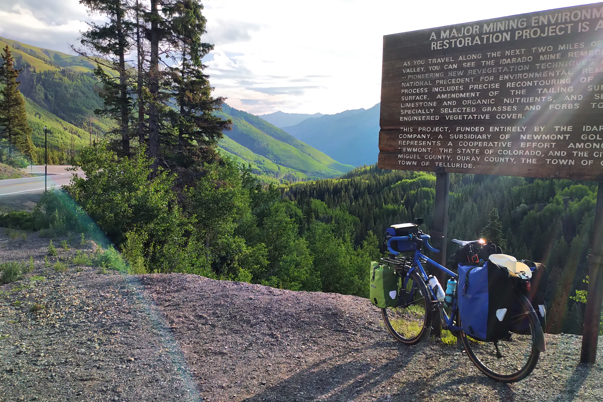
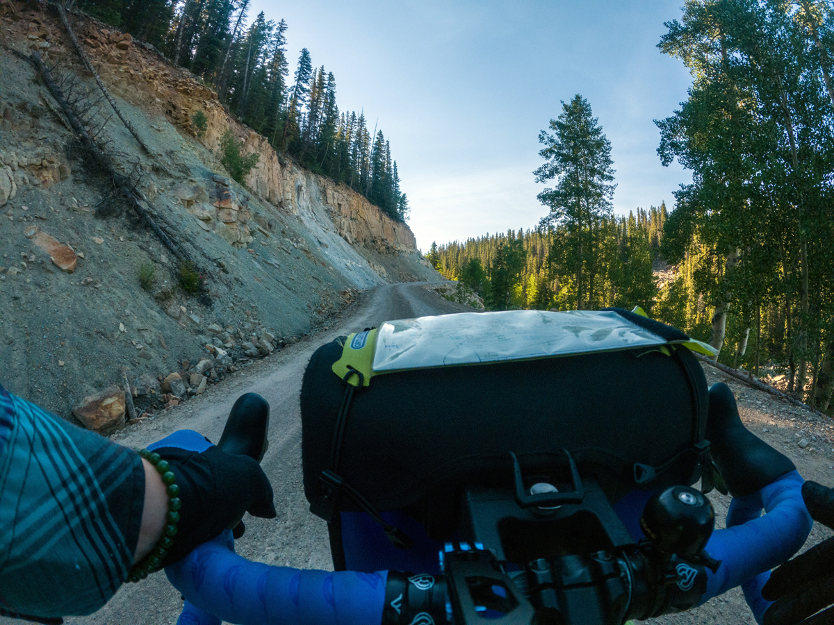
I hit the Million Dollar Highway early. In this direction, you ride the first few miles out of Ouray on the side of a sheer drop-off into the Uncompaghre Gorge. With minimal traffic and reasonably good rear sightlines, I could keep an eye on incoming and oncoming vehicles. When I saw big commercial trucks coming, I opted to find a safe pull-out in advance and wait it out until they passed, which helped make the ride less stressful. I concluded that I didn’t particularly care to ride the Million Dollar Highway after about 9am and only rode to Silverton the first day. As beautiful as the highway is, I frequently found myself hyperfocused on traffic to the point where I couldn’t enjoy it as much. A revisit to the San Juans may be in order for some bikepacking adventures. CR-250 into Durango was like a little bicycle highway. I hadn’t seen many cyclists on the last leg of my trip, but they were out in full force around Durango.
The heat returned as I exited the mountains and rode into Mancos and Mesa Verde National Park. Mesa Verde had several buildings spread throughout the ride where I could stop to cool off. After taking county roads between Cortez and Dolores, I took CO-145 towards Telluride but bypassed Rico and a good chunk of that highway in favor of taking Dunton Road. This was another road that challenged my bike handling skills as it transitioned into dirt and steep climbs, but I appreciated the more “bikepackey” feel of this route, which was quieter and closer to nature than the highway. I rode the free gondola in Telluride but didn’t stay past the evening.
I left early to ride CO-145 out of Telluride towards Placerville. Thankfully I was heading in the opposite direction of commuter traffic. I was unaware of the public bus that ran between Telluride and Norwood but would consider a public transit ride through this stretch of highway next time. I don’t think this stretch of highway is worth riding during the tourism season, despite its scenic aspects.
I decided to end my ride in Grand Junction so I could take Amtrak back to Salt Lake City. Tim had long since outpaced me on his Tour Divide ride and was back at his home in Nucla. I got pretty toasted — arguably roasted — as I rode into Nucla from Norwood. He had suggested I ride CO-141 to Grand Junction. We had dinner together and discussed.
On my last official riding day of the tour, I opted for a bold move. Rather than ride the 50 miles between Naturita and stop in Gateway, where I would spend the afternoon and evening roasting in my tent on BLM land, I decided to ride straight through to Grand Junction where I could savor some indoor air-conditioned lodging. It was 105 miles between Naturita and Grand Junction. There was some climbing, but not like in the mountains. I would have to carry 2-3 liters of water through this stretch as water access was limited beyond Gateway and the high that day was in the upper 90s. I would need to leave early to minimize my risk of heat exhaustion. I had never ridden a century on a fully loaded touring bike, so this would be out of my comfort zone.
I started my ride out of Naturita at 4am on the night of the full moon, tackling the 50 miles to Gateway before 7:30am. CO-141 is one of the most beautiful road rides I have ridden, and its scenery keeps you engaged over many miles. The ride towards Gateway reminds me of riding along the Colorado River out of Moab, but with a fraction of the traffic volume. As you climb towards the Unaweep Divide summit, the red rock canyon walls transition to a grey hue. As you approach Whitewater, the landscape starts to change yet again. I found the temperature remained tolerable through this stretch, but the final descent into Whitewater felt like I was dropping down into an oven. I hit my low point maybe five miles out of Grand Junction. The heat finally got to me, and I had to stop. Eventually, I composed myself enough to dizzyingly limp into Grand Junction, where a Sinclair gas station (not a mirage) lay on the horizon with shakes and ice-cold beverages awaiting me. My recovery was surprisingly quick after that.
The next day I did a quick cooldown ride to Fruita and back. I waited for my Amtrak train back to Salt Lake City the day after. Unsurprisingly, it was delayed six hours and didn’t depart Grand Junction until after 10pm. I ended up taking a red-eye train to Salt Lake Central, arriving with the dawn around 6am. When the bike was rolled off the baggage car, I noticed my front tire was soft. Upon later investigation I found my rim strip had shifted slightly, which may have caused a very minor pinch and slow leak. This would be my only flat on the entire trip. Thankfully, my friend offered to pick me and my bike up from the train station so I wouldn’t have to ride back to Park City. That concluded my 37 bicycle-filled days of exploration.
Reflections
At some point early on in my trip, I decided to adopt a mindset that would help me accept some of the inevitable negative or stressful encounters. First, I decided to be positive towards others as a default unless they gave me some reason not to be. I found the mood-boosting effects of exercise and the relaxed wandering pace of my travels helped me maintain this. Second, I decided at the start of each day that I was going to preliminarily accept having one negative encounter per day. I usually met my quota, unfortunately, but almost never exceeded it. And the overtly positive and supportive encounters always exceeded the number of negative incidents.
When it comes to the increased cost of housing, some people like to rationalize it as “it’s happening everywhere.” I feel that this perspective doesn’t acknowledge local and regional variations, and western Colorado towns with tourism-heavy economies are experiencing the crunch in particular ways. As I cycled, I witnessed the extensive commuter traffic coming from towns like Craig, Gunnison, and Montrose. At one point, I believe I even stumbled on an area of primitive Forest Service land that employees of a nearby, very affluent resort town were camping on. This town (I’m keeping it anonymous because of the subjective nature of my observation) is possibly experiencing the worst workforce housing crisis of the nation’s ski resort towns, and the clogged two-lane highway leading into it might convince some workers to camp closer to their jobs, especially with high gas prices. This makeshift camping area was heavily occupied but was kept clean and tidy. I can’t confirm what I saw, but I think it would be fascinating to explore if there is any validity to this suspicion.
Two of my Warmshowers hosts, Richard and John, are both involved in local government. The issue of affordable housing sits at the forefront of their communities of Steamboat Springs and Ridgway, respectively. Workforce housing, in particular, has been one of the most pressing subcategories of affordable housing needed in these towns. My other Warmshowers host, Ben of Salida, lived in an ADU (Accessory Dwelling Unit) and worked in construction; as someone who helped produce housing units, he was also closely connected to the issue. Perhaps it was just a coincidence that these folks were my Warmshowers hosts, but I find the people who are friendly enough to welcome strangers into their homes at no cost as guests are often engaged in this issue. At this time, the housing situation varies from a crunch to a crisis, and ways to alleviate it are still ongoing; affordable housing projects and programs often have to fight to even come into existence.
Bicycling can be a lot more than a way to get around or a form of exercise. It can be a practice in self-empowerment, mindfulness, and observation. The very activity of cycling cultivates a perceptive and receptive mindset, and from it we may discover and connect with aspects of our world and its residents otherwise muffled by our day-to-day societal routines.
Planning Resources Used
- CDOT’s Colorado Bicycling Map (online): shows traffic volume for state highways and which have wider shoulders
- Colorado state road map (physical): found at a rest stop, free
- Benchmark Maps Road & Recreation Atlas: Colorado (physical): useful for finding dirt road alternate routes
- Cycling Colorado Facebook group (online): I reached out with my tentative route plans and was able to get feedback and suggestions
- Strava heatmap (online): shows popular cycling routes
- Long distance cycling routes: TransAmerica Trail and Great Divide Trail (Adventure Cycling)
- Caltopo.com (online): for mapping my .gpx route file
- Gaia GPS (mobile app): my phone’s .gxp reference. It can also store downloaded maps for offline use
Some Equipment Used
- Specialized Pathfinder Pro 700x38c tires
- Shimano PD-T8000 SPD/flat dual-sided pedal
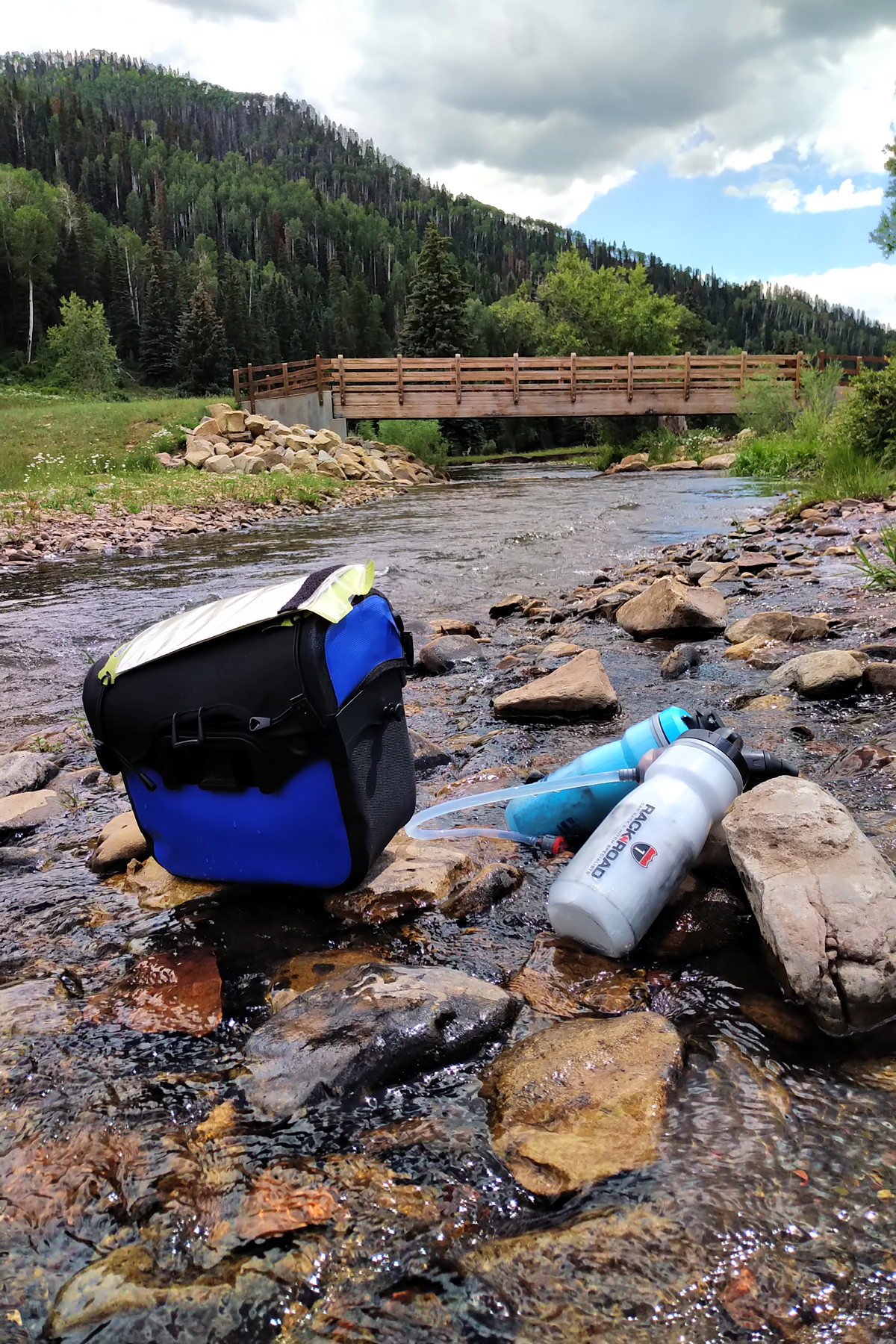
- 4-6 liters of water storage capacity
- Big Agnes Copper Spur UL 1 tent
- 30F down quilt (lower could be better)
- Ursack Major bear-resistant bag with scent-resistant liner bags
- Interagency Annual Pass, for National Parks and Forest Service access
- Bike weight: approx. 50-65 pounds
Daily Mileage Log:
- Day 1: Park City, UT – Uinta County, WY (south of Evanston) – BLM camping, 67.4 mi., +3,600’
- Day 2: Uinta County, WY, inc. Piedmont, Robertson, Mountain View, WY-414 into the badlands region – BLM camping, 49.9 mi., +1,920’
- Day 3: Uinta County, WY – Manila, UT via Lonetree, McKinnon, 37.5 mi., +1,420’
- Day 4: Manila, UT – Flaming Gorge, 41.6 mi., +3,990’
- Day 5: Flaming Gorge – Browns Park Road, entered Colorado, 56.6 mi., +3,994’
- Day 6: Browns Park Wildlife Refuge – Maybell, CO, 54.5 mi., +2,607’
- Day 7: Maybell – Craig, 31.5mi., +1,257’
- Day 8: Craig – Steamboat Springs via Hayden, CR-27 and CR-33, 67.7 mi., +4,058’
- Day 9: Day off in Steamboat Springs
- Day 10: Steamboat Springs – CO-134 / Rock Creek C.G. via Great Divide Route, 49.8 mi., +3,800’
- Day 11: CO-134 / Gore Pass – Horseshoe C.G. / CR-3 via Kremmling, GBMBR, 50 mi., +3,400’
- Day 12: CR-3 / Ute Pass – Silverthorne via GDMBR, CO-9, 25.4 mi., +1,800’
- Day 13: Day off in Silverthorne
- Day 14: Silverthorne – Leadville via bike path, Frisco, CO-91, 42.1 mi., +3,090’
- Day 15: Leadville – Salida via CR-10, CR-298/398, US-24, CR-371, Buena Vista, CR-321, CR-270, CR-260, CO-291, 66 mi., +1,775’
- Day 16: Day off in Salida, Ute Trail ride, 25 mi., +2,760’
- Day 17: Salida – CO-306 / Collegiate Peaks C.G. via CR-160, US-285, CR-260, CR-301, Buena Vista, CR-343/355, 44.2 mi., +3,613’
- Day 18: CO-306 – Crested Butte via Cottonwood Pass, Taylor Park, CR-813, CO-135, 62.7 mi., +4,733’
- Day 19: Crested Butte – Gunnison via Kebler Pass Rd, FR-731, CO-135, 41.7 mi., +1,530’
- Day 20: Gunnison – Curacanti Ntl. Rec. Area via US-50, 20.3 mi., +540’
- Day 21: Curacanti Ntl. Rec. Area – Black Canyon of the Gunnison Ntl. Park via US-50, 40.5 mi., +4,318’
- Day 22: Black Canyon of the Gunnison N.P. – Ridgway via Montrose, US-550 frontage road, CR-1, 62.7 mi., +3,982’
- Day 23: Day off in Ridgway
- Day 24: Ridgway – Ouray via CR-23, CR-17, 15.1 mi., +1,690’ (July 4th)
- Day 25: Ouray – Silverton via US-550, 23.9 mi., +3,140’
- Day 26: Silverton – Durango via US-550, 51.8 mi., +3,350’
- Day 27: Day off in Durango
- Day 28: Day off in Durango, replaced front rack
- Day 29: Durango – Mesa Verde N.P. via CR-210, CR-125, CO-140, US-160, Mancos, J/H Road, Mesa Top Ruins Rd. to Morfield C.G., 45.3 mi., +4,000’
- Day 30: Mesa Verde N.P. out-and-back – Cortez CDOT rest area, 51 mi., +4,320’
- Day 31: Cortez – Burro Bridge via US-160, CR-29/30, Dolores, CO-145, Dunton Rd. (CR-38), 52.8 mi., +4,250’
- Day 32: Burro Bridge – Telluride via CR-38, CO-145, Ophir out-and-back detour, 34.4 mi., +3,363’
- Day 33: Telluride(USFS camp) – Naturita via CO-145, Placerville, Norwood, Nucla detour, 61.2 mi., +1,900’
- Day 34: Naturita – Grand Junction via CO-141, Gateway, Whitewater, Coffman Rd., US-50, bike path into downtown, 105.3 mi., +4,482’
- Day 35: Grand Junction – Fruita out-and-back via bike path and local roads, 32.5 mi., +635’
- Day 36: Day off in Grand Junction. Red-eye Amtrak train to Utah
- Day 37: Amtrak train arrives at Salt Lake Central, driven to Park City. End trip.
Wow…what an epic adventure. Alex…did you ever have to do the dreaded “walk a bike” due to steep grades? What gearing did you have?
Hi Richard, nice to hear from you again after I bailed on the Randonneurs rides this season to pursue my touring 🙂
I really only had 1 hardcore hike-a-bike incident, and that was on the Day 2 Wyoming mounthill encounter. I left this detail out of the article, but while I was pushing my bike up a rancher drove by in the opposite direction and he stopped, rolled down the window, and said “well that doesn’t look like much fun.” I explained that it gets more fun, just not at this moment. We chatted for a bit before heading our separate ways.
Most of my hike-a-bike was just pushing the bike into the woods to camp. Sometimes a short push up a 4×4 road to get there. But my previous experience with mountain biking and gravel biking allowed me to handle some of the more technical gravel sections without having to do too much pushing. The touring bike is definitely more squirrely on the gravel than the other bikes I have. I suspect its due to the higher center of gravity with the panniers and running inner tubes in the tires requiring a higher PSI.