By Tom Diegel — The California Coast is legendary for bike touring. It makes up a long, critical section of the Pacific Coast route that extends from Alaska to South America. In the fall of 2021, my wife Ashley and I had an opportunity for a longish road trip through California that focused on doing a few bikepack/bike tours by the ocean. California is understandably famous for its cycling: the huge size of the state, the wide array of environments from rain forest to desert to vast farmlands to one of the the biggest mountain ranges in the lower 48, very mild weather, and it’s home to a lot of adventurous and speedy cyclists up and down the state. We wanted to do sections of the Pacific Coast route, but we weren’t going to be able to do long point to point tours, so we worked on finding some fun loops that would take us along the coast and then up and over the mountains to return on the inland side. We anticipated figuring out some nice alternatives, but what we didn’t expect is a rogue “atmospheric river” that would change our course.
California has been in a long-term, well-advertised drought, but long-term droughts don’t care about short-term, moisture-laden storms raging out of the South Pacific, and the two days prior to the start of our ride the northern California coast and Bay Area got drenched with over a foot of rain. As the storm moved east and the skies cleared and crews started cleaning up, we pondered our tour start in the Silicon Valley area at the base of the Santa Cruz mountains.
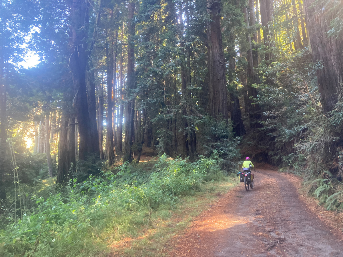
Our relatives had lost a huge tree when the ground holding its roots got unusually liquified, so we knew we had to strategize how to get over unfamiliar mountains that were drenched and lost a lot of trees that create the beautiful corridors of hundreds of miles of great, windy, and quiet roads snaking through endless groves of big redwood trees between the South Bay and the coast. But with one exception of downed trees and power lines that had a convenient gravel bypass, our roads were only littered with redwood needles and branches, and we had a long, glorious descent down to the Coast Route, and typical southerly winds welcomed us to roll easily along a scenic coastal plain into the great beach town of Santa Cruz.
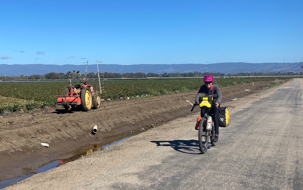
Santa Cruz is a quintessential surf town, and in the aftermath of the storm the surf was still raging; the seafront path was full of the typical people riding, skating, strolling, as well as the surfers walking barefoot back to the point after their epic, mile long rides on perfect waves. Soon the route took us out of the busy town and gave way to thousands of acres of commercial agriculture. We thought the riding through this area might be a bit grim, but likely due to the popularity of the coast cycling route and the fact that California is simply an amazing state in its embrace of The People’s recreation, there was a signed route on roads that were mostly used by tractors. It was also fun to see the amazing agriculture of the Salinas Valley; October was harvest time for strawberries, artichokes, Brussels sprouts, cauliflower, broccoli, raspberries, blueberries….and amazingly, much of that farmland looks like prime real estate development land near the coast; seems like California very much appreciates its agriculture as well.
Back at the coast, the route rolls for 18 miles on deserted separated bike path to the next notable town of Monterey, which is famous for its aquarium, which is pretty amazing and absolutely worthy of a few-hour stop, especially if you live in the intermountain West and don’t get a chance to partake in the ocean too much.
When riding out of Monterey, it was natural for us to take advantage of a pretty famous and relatively car-free coastal road: 17-Mile Drive. As we toodled around the one-lane road along the coast that was still bursting with storm surf, we saw that it is far busier with cyclists who ride for free, while for better or worse there’s an expensive toll for cars holding way-too-rich folks heading for the two iconic golf courses of Pebble Beach and Cypress Point (both of which Ashley has played but that’s another story; almost another life). 17-Mile Drive feeds into the “charming” (code for too-rich) city of Carmel, where we got back on Highway 1 and started heading south in earnest.
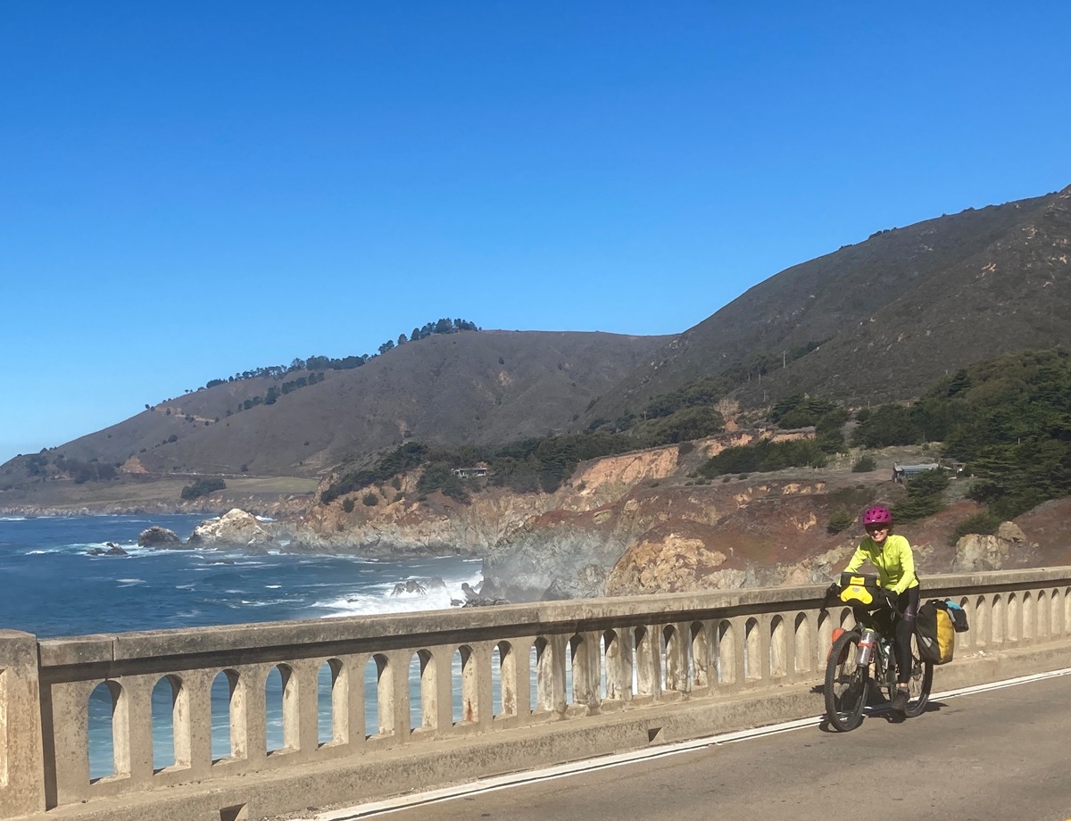
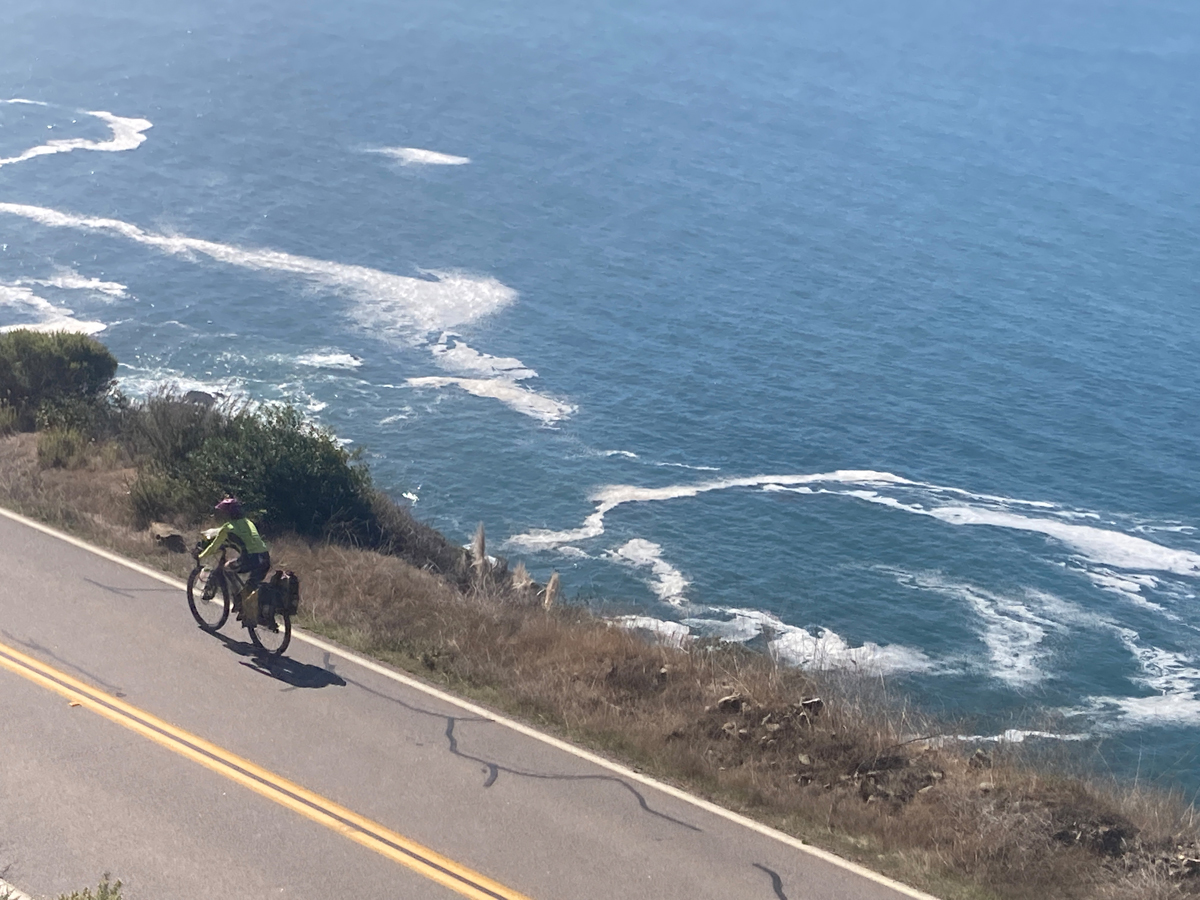
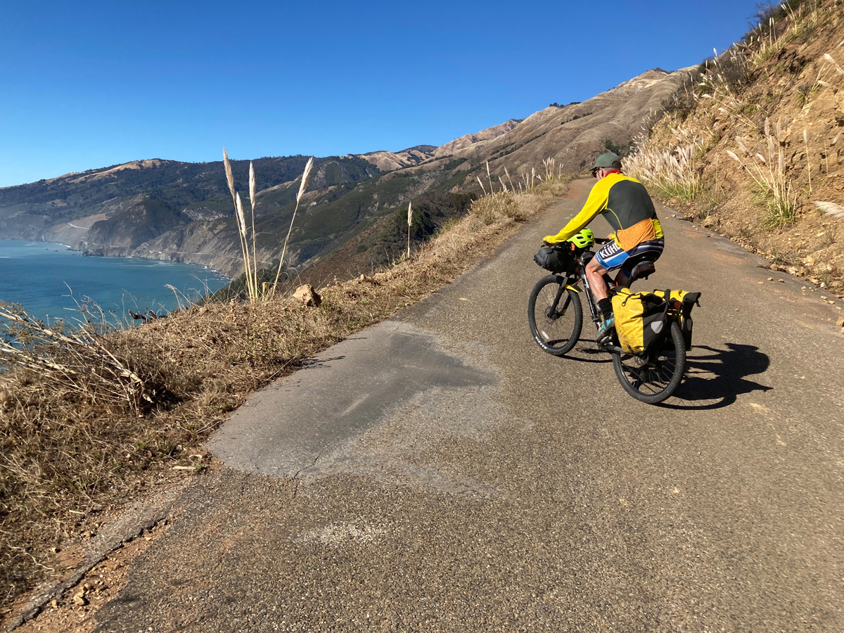
Highway 1 to/through Big Sur and beyond is an iconic road; it was built over a period of 40 years and stretches from the Bay Area to Las Angeles, with the Big Sur section being the first to be finished in the 30’s, which is quite impressive considering it crosses the most rugged terrain of the California coast, with steep mountainsides tumbling straight onto rocky shores and side canyons slicing through that require impressive bridges across wide and deep chasms, which is interspersed with long corridors of cool, shady redwood trees. It’s fame as a cycling route is well-earned; the two lane highway rolls and twists along the torturous coastline, and even though there’s not too much traffic, a guy at a Carmel bike shop gave us a hot tip to do a 12 mile gravel detour that took us into the mountains above the famous Bixby Bridge through more redwoods on the shadowed sides and mahogany and sage on the sunny sides.
Not far south of Carmel we had seen a digital electric sign saying “Highway Closed” at some place that wasn’t familiar to us; we blithely rode past without giving it much thought; road closures rarely affect cyclists, right? We didn’t really understand the history of big rain events creating big landslides down across the road. But as we rolled into the “community” of Big Sur (a store, a state park, and a campground) we heard some folks talking about the closure. Again, they were motorists, and we didn’t worry about it much, but then we saw a guy on an enduro motorcycle, and I asked him about it.
“Oh yeah, it’s FULLY closed. There was a huge landslide, and there’s a huge boulder perched very precariously above the road, and they are trying to figure out how to move it without getting crushed. There’s no way around or through the closure, and they got guards there 24/7.”
Hmm…that sounded problematic.
He went on: “I live a mile south of the closure, and I’m riding 5 hours around to get home, and they think it’ll take at least 5 days to deal with it.” The closure was near Gorda, about 45 miles south, and we had planned on camping in the Big Sur campground, so we had some time to ponder our options.
California takes its cycling seriously, so we were excited to roll into the campground and find a designated bike site for $5. We shared it with a few other cyclists who were on long Pacific Coast road tours, and there was much talk about what to do about the closure. Our original plan was to ride south of Gorda and take a small road over the mountains into the valley on the other side and work our way back north.
A quick look at a map showed us that there was another, smaller Forest Service road that did the same thing about halfway between Big Sur and Gorda, and the problem seemed to be solved, even for the road-intensive tourers, but apparently the prospect of a 2400 foot climb on a small forest road that would probably add a half day was pretty daunting, and of course the Big Rain increased the probability that a small, closed mountain road would have its share of washouts as well.
Our fellow cyclists continued to perseverate on “what are we going to do?” the entire rest of the night and the next morning as we prepared to ride, which grew a bit tiresome. As we rolled into the Big Sur Forest Ranger station for the latest info, we saw a Kiwi couple stuffing their bikes into the camper of pickup; they were opting to hitch a ride for the long back-up-and-around detour. We shrugged and just pedaled on to find our new forest road.
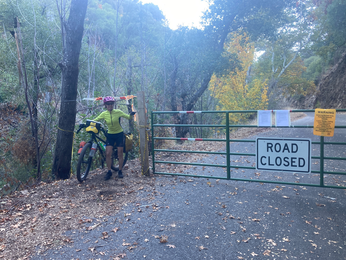
After a couple of hours of riding we got the little road, which had a locked gate across it where it left the Highway 1. No traffic now! As advertised, it was a nice long climb up to pass through surprisingly-burly mountains that went through the heart of the 2020 Dolan fire, which burned 128,000 acres over 3 months, and it was easy to see why it burned so much because of the steepness of the terrain and relative inaccessibility from either the coastal or inland sides. We did ponder the fact that the Big Rain may have had a bigger effect on the burned-out terrain, but while there was plenty of debris strewn onto the road and a couple of minor washouts that would have stopped a car, there were no awkwardly-placed boulders or huge redwoods to impede our progress.
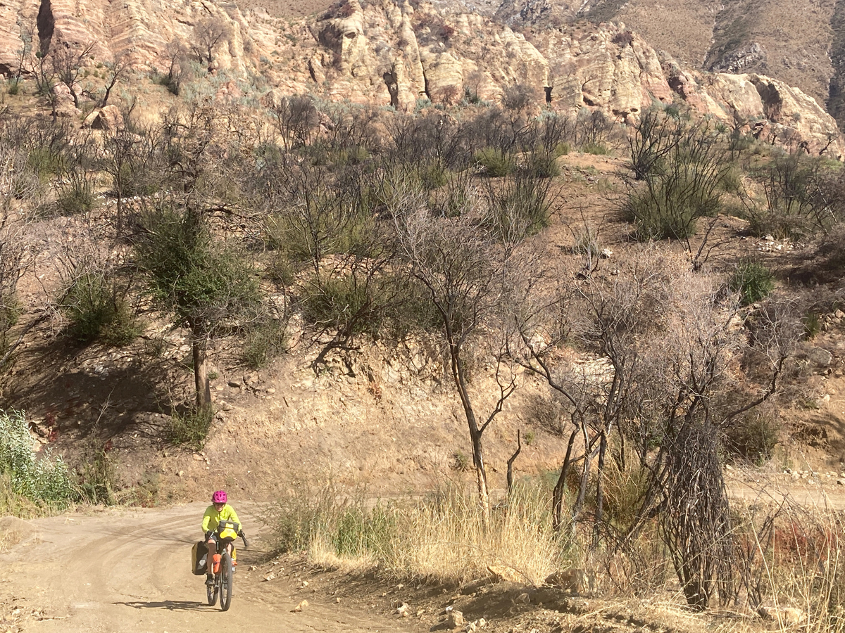
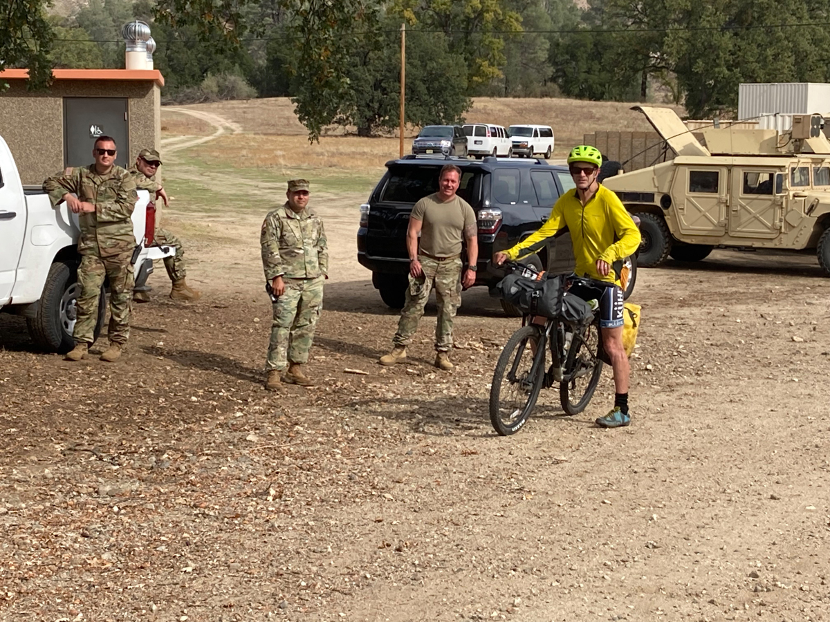
Down a glorious descent into oak grasslands and around the second locked gate we eventually dropped into Fort Liggett. We were warned by signs every few hundred yards to stay on the road to avoid unexploded ordnance, which was an easy order to follow, and we were happy to pass by an actual working army camp where we were – as always – able to beg some water from some bemused soldiers. We exited the apparently ordnance-laden area on a nice paved road with literally no cars, and eventually the road ended at yet another locked gate, beyond which lay a great double track heading up into the coastal mountains again, with an ultimate plunge into the dramatic limestone gorge of Arroyo Seco Creek, which was un-campable, but we stumbled into a nice campground with water.
It appeared that we were still well-shy of any purchasable food and hadn’t quite planned for that situation, so I I asked the campground host where the nearest place was where we could get some snack food for the next day and it was pretty far out of the way, but she said “you know, the firemen working that fire last year had these energy bars and we have a few left; you want those?” Sure, why not? She came back a little later with a grocery bag full of an off-brand protein bar and plopped them down; as much as I wondered how hungry young firefighters couldn’t/wouldn’t finish those off, I agreed to take all 6 pounds-worth. Some weeks later we finally and ceremoniously gagged down the last one….
From there we continued to gradually we worked our way northward back into civilization on mostly quiet, serpentine, and roll-y roads, and ultimately ended up at the Laguna Seca car raceway, home to the famed Sea Otter Classic cycling festival that had happened just a couple of weeks prior. In the midst of lots of the surrounding suburbia I knew there was a campground at the raceway, but just as I was about to throw down the extraordinary expense for a site the host said “Oh, by the way, our water is toxic.”
Huh? what about the drinking fountains and such at the big raceway? All toxic. I don’t know how a cycling festival had happened without potable water. But, okay, we’ll figure out something else.
Amazingly, just past Laguna Seca is yet another army base – Fort Ord – but this one has been abandoned and now is just open land riddled with trails. We rode through it and found a nice campsite, I ducked out of the “fort” into a very average neighborhood and begged some water, and then sidled back in for a nice night of camping.
We rolled back through the Salinas valley on the other side of the valley, amazed at the seemingly effortless transition of clearly-wealthy California suburbs and working-class towns that seemed plucked straight out of Mexico, complete with a far livelier vibe than the relatively sterile suburbs with their plethora of fenced/gated, too-big homes and too many Teslas.
We rode through Santa Cruz heading for what sounded like some more amazing deep redwood forest camping, but as the refreshing mist gradually evolved to an impressively strong rain and we got closer to the latest California strip mall town of Scott’s Valley, “camping” gave way to a Best Western and a hot bowl of real Ramen, and the folks cleaning the room the next day earned their tip from all the muddy drippage from our bikes and clothes that we left behind. Fortunately, this latest rain was just a normal rain, and no problems loomed.
While the Santa Cruz mountains aren’t big at a couple thousand feet high, they are surprisingly long, and after climbing up to the ridge from Scott’s Valley we had well over 30 miles of undulating, twisty Skyline Drive that took us to the final descent back down to our start in the Silicon Valley.
The California Coast is best known for its incredible through-riding on the iconic Highway 1, but if you’re willing to climb into the adjacent coastal mountains and have a bit of adventure, there are some great ways to actually loop the coast. Just be conscientious about big rainstorms that might alter your plans!
I’d be very appreciative if you could share your route. I’ve ridden portions of the area but from your description it sounds like you pieced together a few things that I may have missed. Thanks!