By Lou Melini — Riding the Going-to-the-Sun road in Glacier National Park has been on the “bucket” list of tours for Julie and I ever since I acquired a Monte Dolack print of a bicyclist riding the the road in 1987. It is described as one the most scenic road in America by several websites.
The road officially received its name, “The Going-to-the-Sun Road,” during the 1933 dedication at Logan Pass. The road borrowed its name from nearby Going-to-the-Sun Mountain. Local legend, and a 1933 press release issued by the Department of the Interior, told the story of the deity, Sour Spirit, who came down from the sun to teach Blackfeet braves the rudiments of the hunt. On his way back to the sun, Sour Spirit had his image reproduced on the top of the mountain for inspiration to the Blackfeet. An alternate story suggests a white explorer in the 1880s concocted the name and the legend.
Despite years of discussion, I had a concern that the trip may not happen. Julie and I had planned on leaving Salt Lake on June 19th, riding Glacier on June 22nd, the day after Going-to-the-Sun was to open for the season. However there was a slight complication. This is the discussion at Thanksgiving dinner in 2012.
Daughter-in-law: “Julie, Lou; I’m going to have a baby. The due date is June 16th.
Julie: “Oh Wow! I can’t wait! Congratulations! I am so excited! I’m going to be a grandmother! I will be able to help in whatever way!”
Lou: “Uh honey, we leave on June 19th for our bike trip. Oh, congratulation!”
The little “Lewie” was born on June 10th. He was 3-weeks-old when we left on July 4th for Missoula Montana, the home of the Adventure Cycling Association (ACA).
Another reason for starting in Missoula is that I had a place to leave my car. In July of 1969, I walked across the parking lot at Rider College (now University) that is located just south of Princeton, New Jersey. Coming towards me was another freshman entering the dorm for several days of freshman orientation. Bob Luceno and I shook hands and introduced ourselves. Forty-four years later we re-united I was able to take advantage of our friendship.
Julie and I have now done 6 long trips. We sometimes get asked which was our best trip. Our honest answer is all of them as each one has unique features. However, we both think that if you want a bike tour with endless days of beautiful scenery then do the Great Parks North Tour mapped by the ACA. Huge granite slabs reaching high in the sky with thick green pine forests below. Water is everywhere in the form of huge picturesque lakes, raging rivers, and too numerous to count waterfalls. Water is also seen frozen in massive glaciers tucked into the mountains, though reportedly disappearing rather quickly in geological time.
Trip Summary:
Montana:
We used the Adventure Cycling Association (ACA) maps exclusively for this trip save for a very short detour. For that we used the BC Rockies map that we picked up at a visitor information center. Our bike weights (weight of bike and everything on it) were high with mine at 95# and Julie at 85# to start the trip. We left Missoula anxious to get to Glacier National Park. We rode 160 miles the first 2 days to Columbia Falls along Montana route 200 (good road) and route 83 (not so good road). We passed the large scenic Salmon, Swan and Seeley Lakes and in Bigfork, the north end of Flathead Lake, We also passed numerous deer and 4 Rocky Mountain sheep that were very close to the road. I had reasons to start in Missoula. My advice would be to start in a town north of Flathead Lake to avoid route 83 with its long stretches of no shoulder and high-speed traffic.
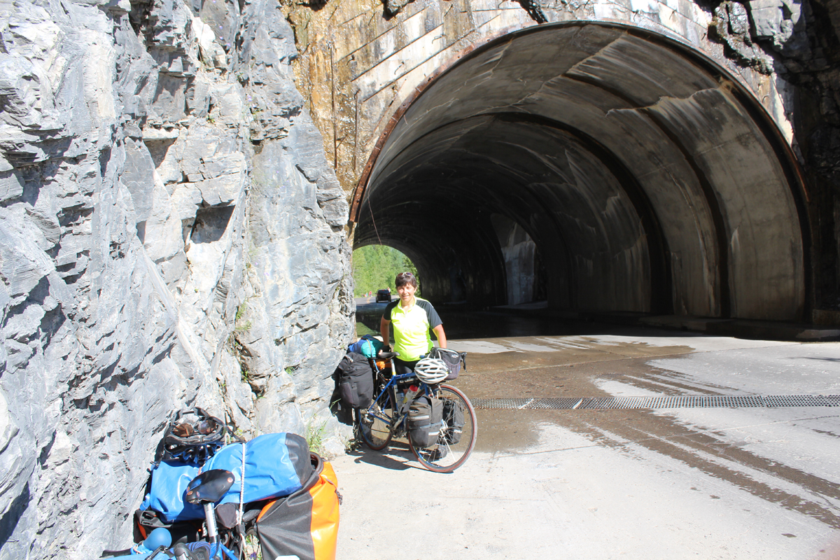
After Bigfork, the ACA maps take you onto some low traffic back roads. We entered Glacier in mid-morning of day 3, free courtesy of my National Park Senior Pass. We took a short break and quickly rode to Lake McDonald lodge. The road on the west side of Glacier is closed to bicycles from 11 AM to 4 PM between Apgar campground near the entrance of the park and Avalanche campground another 5 miles from McDonald. So we killed time at Lake McDonald sitting on the back porch of the lodge viewing the lake, reading and eating an early dinner.
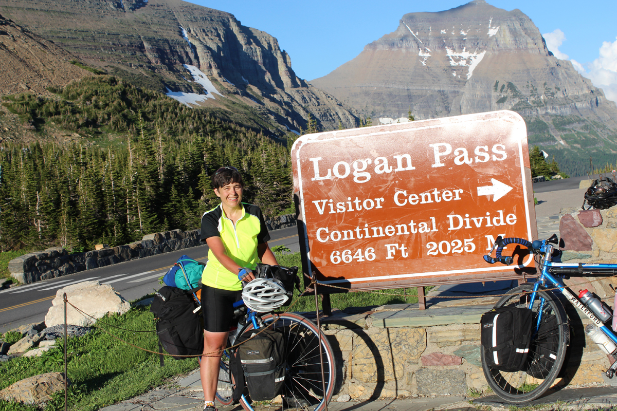
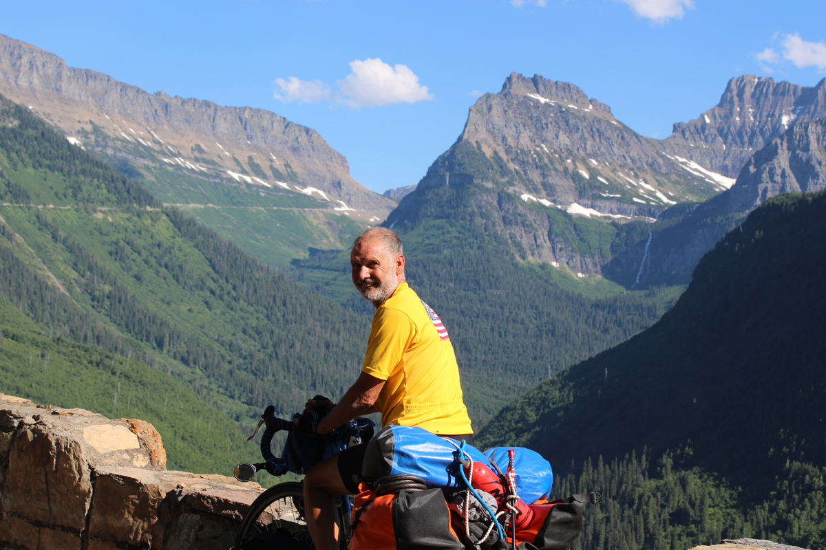
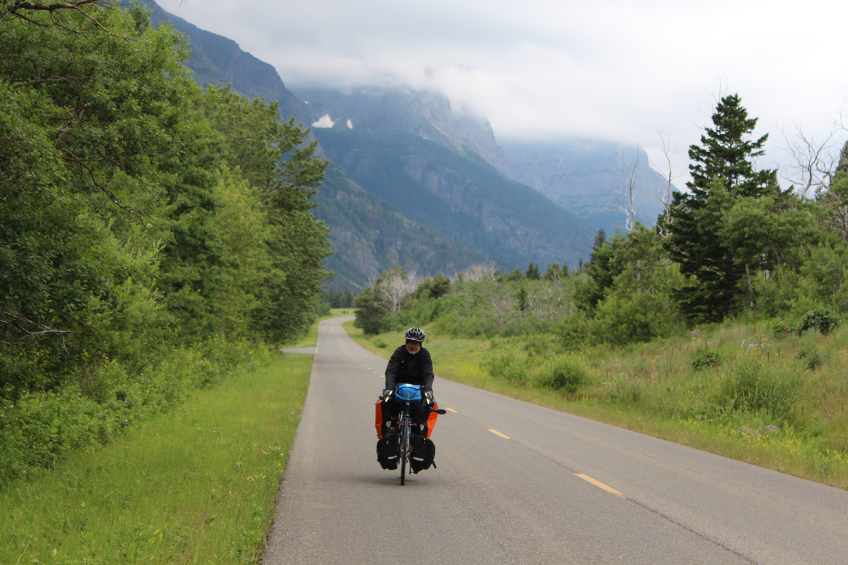
The uphill portion of Glacier to Logan Pass from the west entrance is also closed to bicycles during that same time period. We left Lake McDonald area at one minute before 4 and quickly did the 5 miles to the start of the climb to Logan Pass. The road for the final 16 miles has a profile very similar to riding to Snowbird ski resort. Julie did great cresting the summit at 8 PM. We even took time to take a picture of the wild goats near the top. The ride up to Logan Pass is stunning with numerous waterfalls cascading off the mountain scenery. We found the spot that matched our Monte Dolack poster and took a picture of that as well. Traffic was heavy and the road is very narrow, but there were enough pullouts that we didn’t affect flow too much. Most people seemed to cheer us on. It was hot and each of us went through our 3 bottles. I was able to buy a $1 bottle of Powerade from a tourist that pulled off the road. We did need to put on warm clothes for the 12-mile ride down to St. Mary’s campground due to the time of night. We knew there was a Hiker/Biker area so getting in just before 9 PM was not a problem. Unfortunately the line for the showers was 8 deep and the showers close at 10 so we gave our tokens to a family of 8 camped near us that really needed and appreciated the tokens. If I go through Glacier again I will most likely do it from the east side to avoid the time restrictions.
Alberta, Canada:
We left the campground at St. Mary’s and proceeded into Canada on day 4. Just past the border we met a Montreal family doing a 3-year cycle trip with their 7- year-old daughter. Later in the afternoon we were caught in a massive downpour with hail. The thunder sounded like it was coming from above our heads and the wind was difficult. With 2 miles of uphill and another 6 to a private campground we pushed on with our rain-suits. It was laundry day anyhow so we passed the time doing laundry. The weather cleared the next morning.
Day 5 put us in Blairmore, one of several “towns” that make up the municipality of Crowsnest. Our ride to Blairmore was hot, mostly with headwinds. We resupplied our food in Pincher Creek, a town of 3600 and large enough for a decent sized grocery. We also stopped at a local bakery for bread, chatting with some of the locals and their guests from the Netherlands. We had lunch at a Provincial historical site where we took a short tour of the local coal mining history and the landslide that buried part of the town and 100 people. Overall it was a good day. Our campground was nice, shady with a sleep-inducing stream 10 feet from our tent. On the other side of the stream were railroad tracks. About 6 trains rumbled through during the night negating the effects of the stream. In the evening I did my bike checking duties that I was behind on. I found a spoke that had nearly pulled through Julie’s rim. She had been riding all day with the rim out of true and rubbing the brake. With 1100 miles to go we planned on getting a new wheel in Fernie, the lunch spot on day 6.
British Columbia:
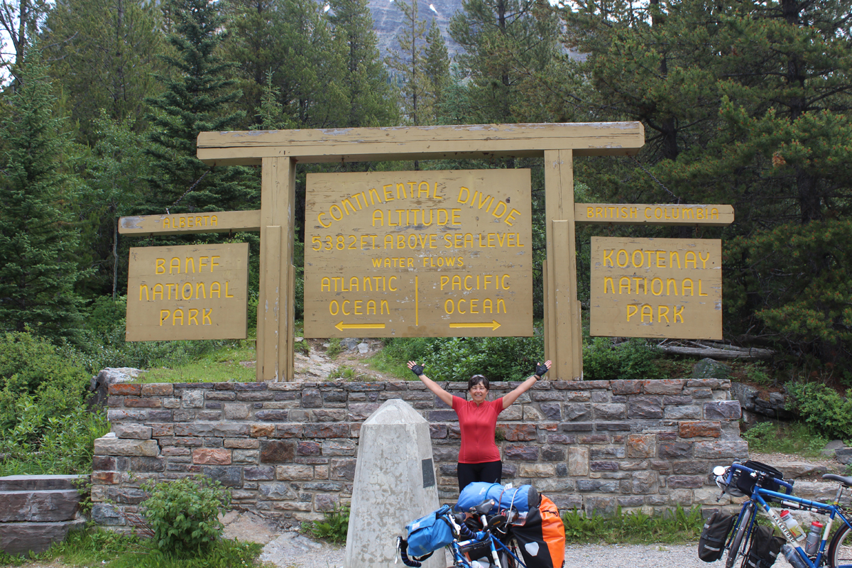
We had crossed the continental divide riding over Crowsnest Pass, one of several crossings. Helmets are now mandatory in the Province of British Columbia. Our ride went quick today with a long break in Sparwood. While in Sparwood we chatted with the first of several Great Divide riders on the road due to the flooding. The broken wheel that I trued held well. Fernie, like many of the towns we passed through have been re-invented in tourism after the coal and lumber industries declined. We knew there were 3 bike shops in Fernie. Fortunately there is a 4th. We went to all 4 before finding a wheel with a 130 mm spaced 700C wheel and that was taken off the only road bike in stock. After obtaining our wheel, we shopped for food, had lunch and took off in the heat to Baynes Lake Provincial Park. Camp fees for the night were $30 cash, no credit cards at this provincial park. Visa is accepted in Canada at all of the other campgrounds. Do leave your Discover card at home as it was not accepted at anywhere we went in Canada.
Kootenay National Park:
Favorable south winds pushed us quickly northward to Radium Hot Springs for lunch on day 8 at the visitor/information center. We were on the border of Kootenay National Park. We read that passes were necessary to be in the Park. The day passes cost $9.80 or $67 for an annual pass ($10 less for being a senior). We elected the annual pass, as we would be in the parks for more than a week. We were only asked once to show our pass.
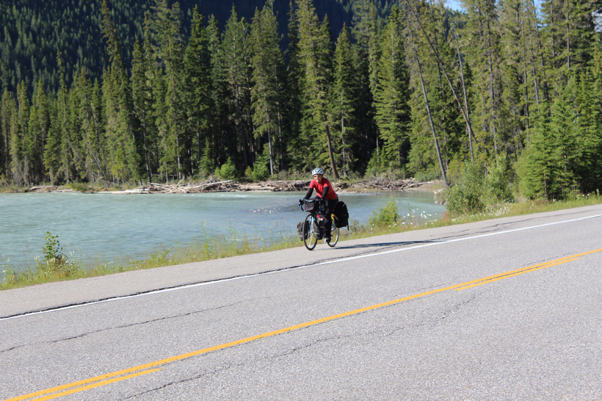
We had been riding quickly until we entered the park. The first mile was at 11% and was 2-lane, broken pavement with no shoulder. I elected to jump on an adjacent sidewalk. The next 8 were at 6-8%. Ten miles before Radium Hot Springs we had a similar one-mile climb out of Invermere but there was an adjacent, steep, but narrow bike path that Julie needed to walk. Invermere is also the last of the “normal” grocery stores before entering the national parks. Kootenay National Park is the start of a lot of “Wow, what beautiful scenery” that continued into Banff and Jasper National Parks.
Back to Alberta to enter Banff National Park:
Day 9 and we returned to the Province of Alberta entering Banff National Park. Our goal was the legendary Lake Louise, plus the not as famous but equally beautiful Lake Moraine. These 2 lakes are worthy of at least a one-day layover for hiking along the trails. So we did the tourist thing and spent one “rest day” at Lake Louise, riding nearly 30 miles walking for 9-miles along Lake Louise. Not the rest day I imagined. The Lake Louise campground does not have a hiker/biker area and always had a “full” sign. We did not have a problem obtaining a site. Shopping at the market at Lake Louise will give you sticker shock. The pear and pecorino cheese ravioli sounded good and was reasonably priced considering that a can of Campbell’s Chunky soup went for $5.
The weather changed on the 2nd night at Lake Louise. It rained most of the night so that in the morning we moved under the convenient shelters found in Canadian Parks. These shelters have tables, benches and wood burning stoves. We had breakfast, dried our tent and packed to head north.
I had a case of the sniffles the day we left following Julie’s case of the sniffles. However when I get any illness, despite being mild, I end up with rather severe muscle aches. For the next 2 days riding north I had problems getting on and off the bike. In addition I had muscle stiffness in my neck making it difficult to turn my head.
It remained damp with a few minor showers and cooler for the next 2 days ride northward. At one lunch break at a campground someone had started a fire in the shelter stove, a nice luxury as we encountered a brief heavy rain as we approached the campground.
Jasper National Park:
On our second to last night heading north we camped next to 4 other cyclists that just happened to meet up. They had started with 3 separate “groups” heading in various directions. The weather was still changing as we woke up to a morning chill of 22° according to Julie’s stem mounted thermometer. There was frost.
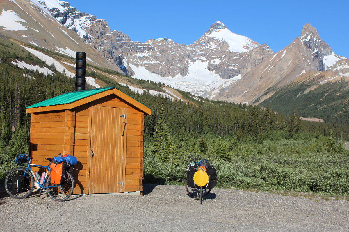
Our last night traveling north was at the Columbia Icefield campground on day 12. It was my decision to turn around here and not go the next 60 miles into Jasper city, though this may have turned out to be a good decision in retrospect. However, The scenery, with massive glaciers, waterfalls and jagged mountain peaks more than made up for my discomfort that lasted for less than 2 days. The weather was also improving. This last day of traveling north was a short day of 25 miles, with 15 of it uphill, the last 6 at close to 8%. The night at the Columbia Icefield campground was great. I woke up around midnight with a full moon illuminating a glacier capped mountain peak. A fantastic sight! I almost woke up Julie to ask her how to best take a night photo. I am not a “stop and take pictures” kind of person, but the view was that good.
Return trip through Canada:
The return trip back to Radium Hot Springs was uneventful as we rode over the same passes except from the opposite side. In total we did 9 passes with Logan Pass in Glacier the worst though Bow Pass made our 84-mile day back to Lake Louise “interesting”! Fortunately most of our climbs were aided by thermal updrafts in the late morning and afternoons.
The weather was again getting warmer though we had a heavy rainstorm on the afternoon we returned to Lake Louise. I was definitely feeling better than the previous 2 days. Again the campground sign said full. A park ranger waved me to the front of the line away from the cars. I asked for a shady campsite near the showers and bear containers, bingo the perfect campsite. Camping at Lake Louise was a bit odd as it is surrounded by electrical fence due to bear issues. We shared our rather generous campsite with a young couple hitchhiking across Canada.
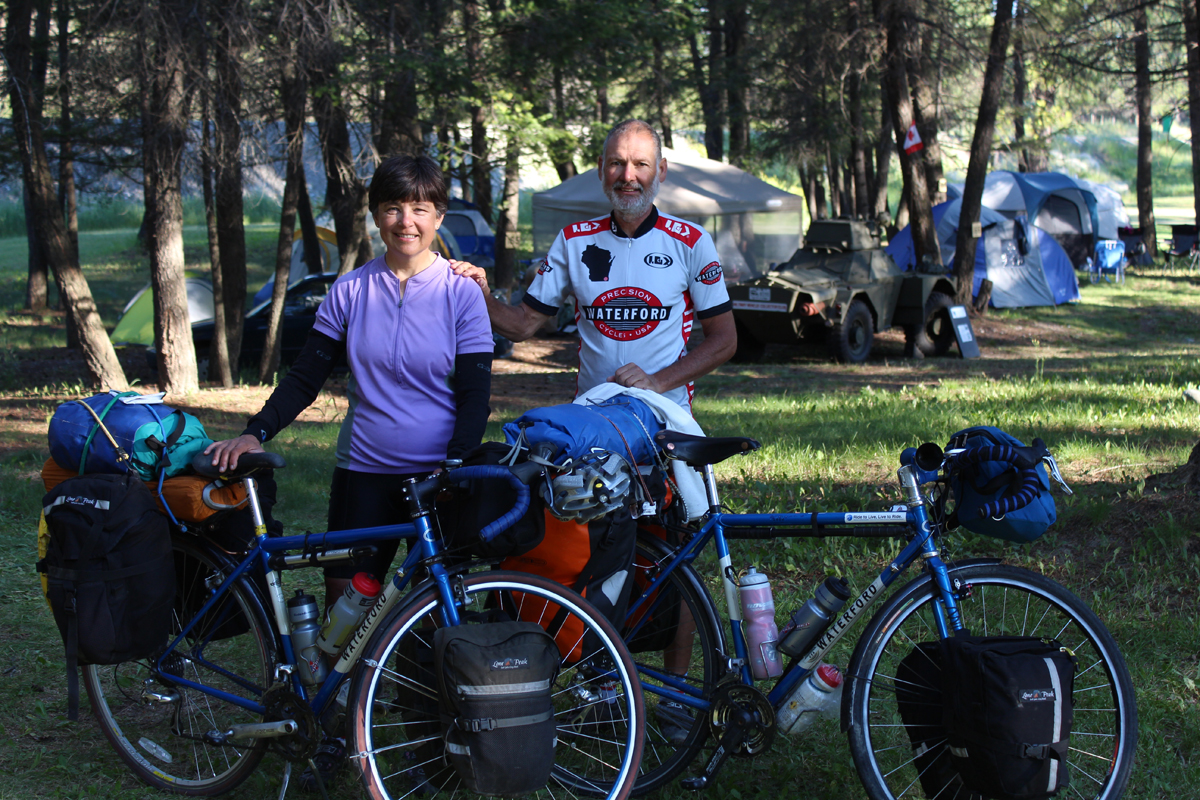
One of the interesting aspects of bike touring is meeting the same person(s) in different places. As we traveled south we did a short detour in our trip that put us in Fort Steele for one night. Maggie one of the cyclists that we met 5 days earlier came a couple of minutes behind us. Earlier when I went shopping I couldn’t find a package of hamburger less than a pound. Fortunately for Maggie, we were all able to share a campsite and the hamburger. Maggie is quite the traveler having solo hiked the Pacific Crest Trail a few years ago.
Entering the U.S.:
Entering the U.S. was easier than we thought. We were asked the standard questions. We told the border patrolman we had oatmeal, peanut butter and a turkey sandwich for lunch. He smiled and waved us through. The line to get back into Canada on this Sunday night was over a mile long at 5 PM. We camped at the city park in Eureka, Montana meeting a father/son duo that planned to cycle through Glacier. The city park had a shower, but both Julie and I used my sandals to stand in the shower. The toilet was backed-up and non-functional. Fortunately the gas station across the street was open 24 hours. The toilet got fixed just as we were leaving. We did leave the $10 suggested donation for using the park.
We were at this time ahead of schedule so I was planning to possibly go off route and travel west from Whitefish to Libby Montana for 2 or 3 days. Julie was having some issues with her front derailleur not shifting into her smallest ring. Then, while riding up a short but very steep (12%?) grade her chain suddenly shifted into the big ring but she managed to power over it. This happened a second time with an equally steep hill and again “big-ring Julie” powered over it. It turned out that the top pivot pin had fallen out so I replaced it with some thin rope and secured the front derailleur from moving. She could only use the middle ring. There was only one more short, steep climb for the remaining 40 miles to Whitefish, Montana. As we got closer to Whitefish, the traffic increased and the quality of the road severely decreased especially the final 10 miles. The heat was also getting to us. In Whitefish we decided to not replace the derailleur and simply ride the remaining 180 miles back to Missoula in her middle ring. We knew there were no climbs requiring her small ring but not having her big ring meant a top speed under 20 mph. In Whitefish, we shared the campsite with a girl from West Virginia that had just finished riding the Great Divide trail from south to north. She did most of the trip alone as her boyfriend left her after entering Colorado. Inspirational that she finished the ride.
We had an uneventful 3-day ride “home” from Whitefish for a total of 21 days. I did get my first flat tire equaling Julie’s one flat tire. My tire was notably worn. It had a total of 1400 touring miles on it. This was the 3rd time we needed the spare tire that we carry in our 6 tours. We also experienced being turned away at a private campground due to it being full on a Tuesday night. There was a Forest Service campground about 1 mile away, making it our 6th non-shower night. (Half-price with my senior pass)
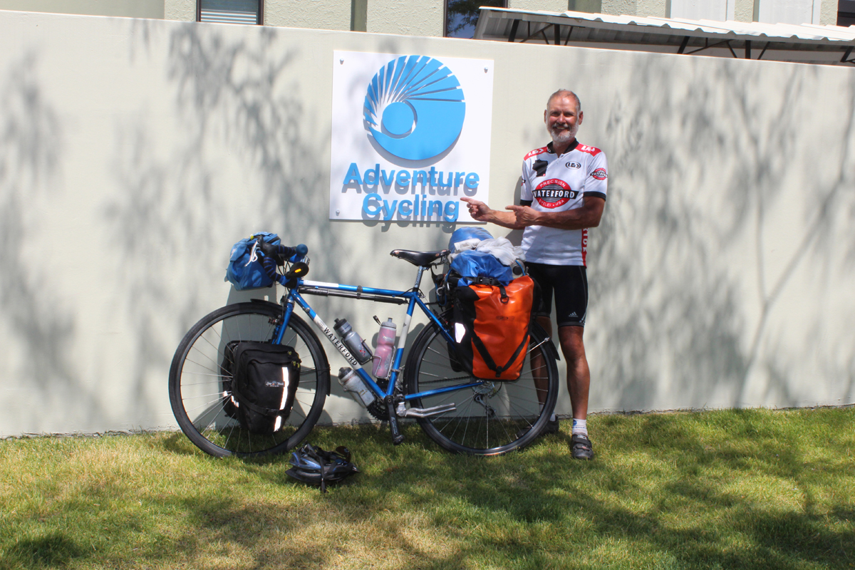
We cruised into Missoula on our last day, Thursday the 25th. We went to the Adventure Cycling Association Headquarters for the free ice cream, a picture for placement on their wall of visitors and an interview and pictures with Greg Siple, one of the founders of the ACA. We then returned to Bob’s house and our car. We left the next morning for Salt Lake. When we came home that Friday evening there was an email for me from Lorenzo, a Basque cyclist that stayed in our home for a few days in April of 2012. He is in his 16th year traveling by bike. He was passing through Missoula riding the Great Divide trail. He went to the ACA headquarters on Friday and saw our pictures from the day before. We missed him by one day. Small world!
Miscellaneous Trip Nuts and Bolts:
Julie is really into trip statistics. So for the finally tally 1340 miles in 119 hours and 17 minutes of riding time. The high mileage day was 84 (twice) and the low mileage was 27 and 25 on “rest” days. The daily miles-per-hour ranged from a low of 8.2 (our last day traveling north) to 12.9 (5 times above 12.5 mph). We spent $510 on food (though I packed quite a bit to start the trip) and $429 on campgrounds. With miscellaneous expenses such as the Parks passes ($125) and Julie’s wheel ($145) we spent $1277, nearly one dollar per mile or $60/day – our most expensive trip in North America. Even little Lewie, our grandson, received a small cardboard infant bear book that Julie carried from Lake McDonald in Glacier for 17 days.