By John Roberson — The following is a description of a recent, seven-day bicycle tour of southwest Montana. It was a self-supported tour on beautifully paved and graded highways and byways, with most nights spent sleeping out under clear Montana skies. Overall riding conditions were excellent, and people I met couldn’t have been nicer. I ate well, and I slept well every night. I had all of the gear I needed, but I never had to pitch a shelter, wear a rain jacket, or filter water from a creek. And I had no flat tires. My bicycle – a 25 year-old Rockhopper – performed magnificently. It was a little hot at times, and I wished a couple of times for a lower gear, but all in all, it was a very fine ride!
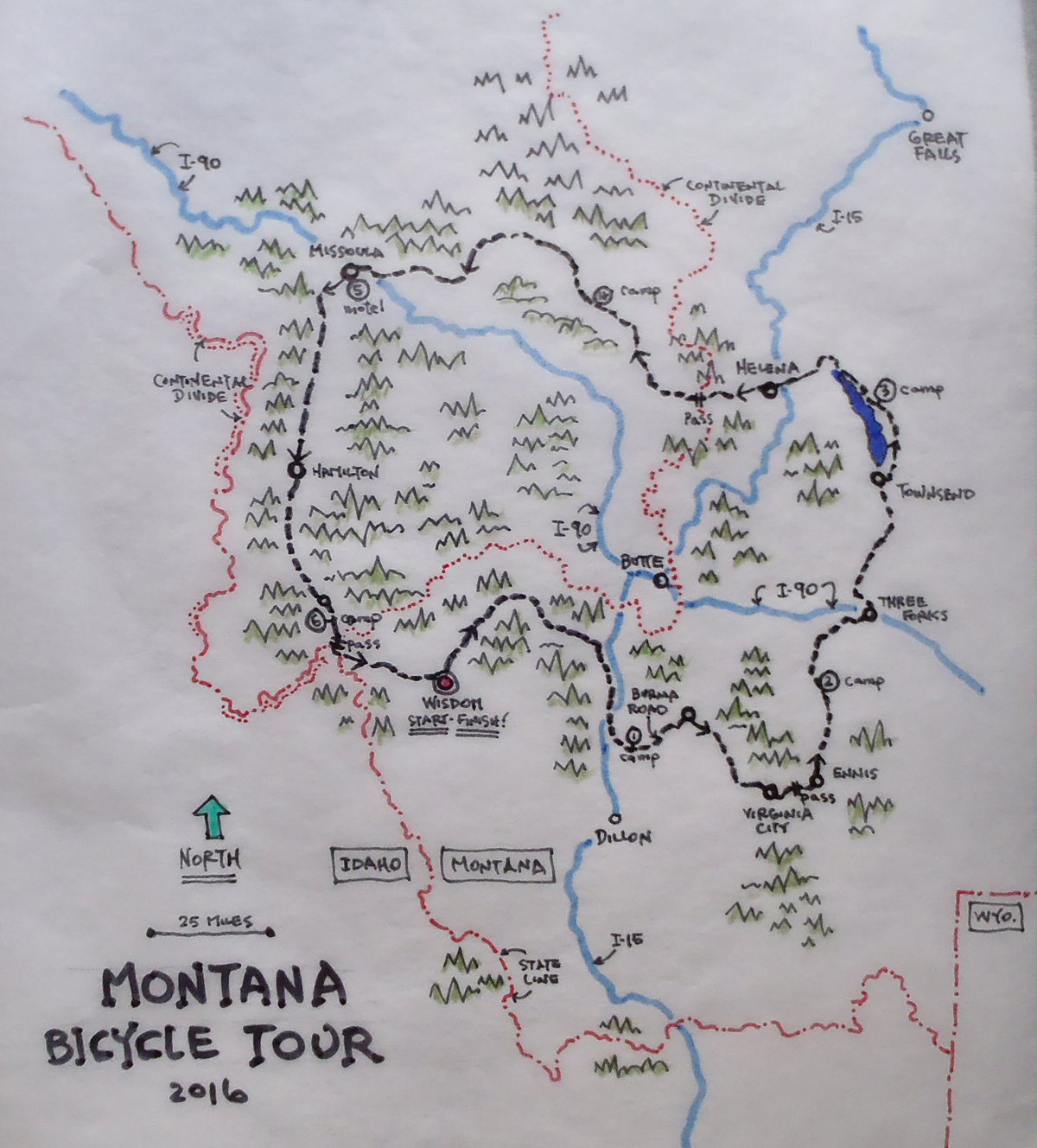
Day One – Wisdom to the Burma Road
I awoke one morning in late July to the sounds of birds moving about in the grassy field next to my brother-in-law’s cabin, and a few of the town hounds barking down the street, greeting what appeared to be another beautiful, Montana day. I was in the tiny town of Wisdom, Montana, where I’d spent a very restful night on Brother Bill’s front porch after having driven up from Salt Lake the day before. I was hoping to beat the heat and spend the upcoming week riding the hills and valleys of southwest Montana. I hoped to stretch my legs out and see lots of new sights. I planned to stay on the paved back roads and byways when I could, and I intended to camp out at night. As usual, my bicycle would be carrying everything I thought I might need.
I made my very first stop of the morning just a couple of blocks from Bill’s cabin, at a cafe in downtown Wisdom, and it was there that I met my first fellow bicycle tourist. His name was Roger, and he was in the middle of a coast-to-coast ride following one of the Adventure Cycling Association’s well-known bicycle routes (the non-profit ACA is based in Missoula and is a well-known and enthusiastic supporter of bicycle touring in all its forms!). I told Roger that in years past I’d seen many other touring cyclists passing through town, there at the cafe and camped out at the Lion’s Club picnic grounds west of town. Over hotcakes and coffee we shared all sorts of touring stories, about bears and crazy drivers, about the joys of retirement, and where to find water in dry lands. It was a nice way to begin a trip, and although he was headed west and I was headed north, we both agreed that prospects for a great day of riding were good.
After breakfast I rolled out of Wisdom and spent that first morning on Highway 43, following the Big Hole River as it wound its way north. The highway was quiet and nicely paved and shouldered, and I had the advantage of a bit of tailwind as I put in the first miles of my tour. I passed open meadows and patches of pine forest, and the occasional ranch house or fishing lodge off in the distance. Like other rivers I would ride beside in the days ahead, the Big Hole river was a constant companion that first day, sometimes flowing in close to the road where I could hear the chatter of birds and the gurgle and hum of moving water, and at other times defined only by a line of trees or occasional flash of sunshine on water, out in the middle of the valley. It was all very beautiful.
I spent a leisurely couple of hours riding north, then east and southeast as the river flowed north of the Pioneer Range. I chatted with a group of cyclists at the Wise River store, where I’d stopped for a cold drink. They were a disparate bunch. A couple of riders were, like Roger, carrying full panniers and gear and heading for the Pacific coast. Another pair of bike-packers were travelling super light and had just dropped off the high ridges in order to resupply at the store. They were anxious to get back up into the high country. Everyone seemed to be having a great day!
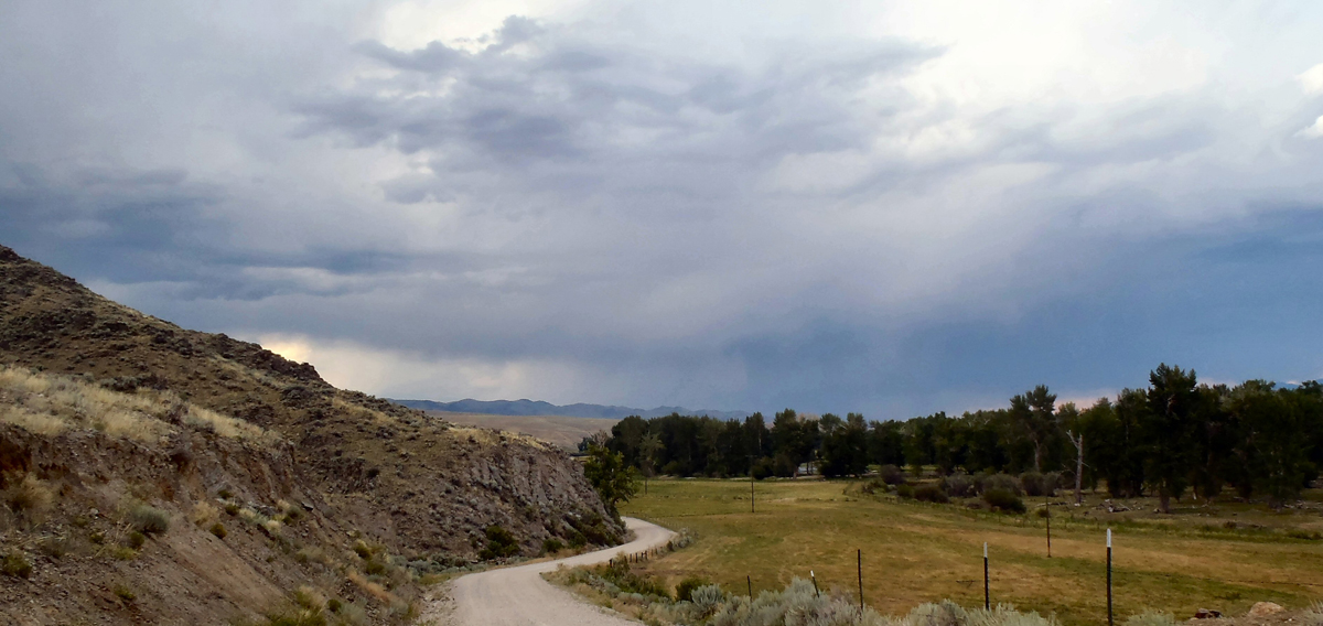
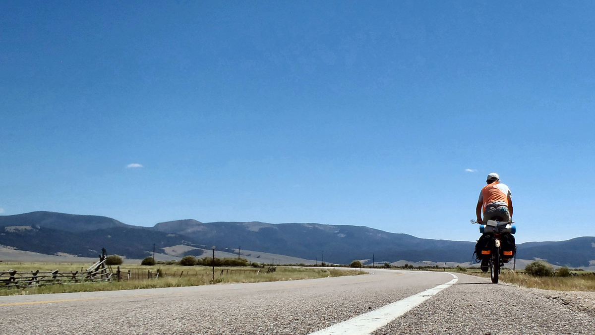
Highway 43 eventually intersected with Interstate 15, so I turned south, along with the river, and followed the old highway/frontage road for another easy 15 miles or so. At one point I left the frontage road and the busy I-15 corridor and turned east onto a well-graded and quiet ranch access route called the Burma Road. I had lush, river-side ranches off to my right as I cruised through the early evening light, dry hills and coulees to my left, and grand views of the Ruby Range off in the distance to the southeast. It was a delightfully mellow way to finish off a great first day. As the sun dropped below the Pioneer Mountains to the west I found a primitive access road leading up into the hills and followed it to a cozy perch on a hill where I camped for the night.
Day Two – Burma Road to Harrison (almost)
I slept well that first night and was back on the road before the sun had risen too far into the morning sky. The day was shaping up nicely. Montana mornings in July are clear and cool and perfect for riding, and I wanted to put a few easy miles into my day before the sun got to be too fierce. Within an hour of leaving my hilltop camp I had left the Burma Road behind and ridden north on paved Montana Route 41 to the town of Twin Bridges. Twin Bridges is one of many Montana towns where serious fisherfolk come to try the state’s legendary trout streams. It’s at Twin Bridges that the Big Hole, Beaverhead and Ruby rivers come together to form the Jefferson River, which in turn joins the Madison and Gallatin Rivers further downstream to form the might Missouri River.
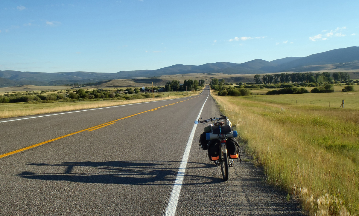
After a short break in Twin Bridges I turned east onto Montana highway 287 and began to get back some of the elevation I’d lost during the previous day. I was riding southeast, more or less, climbing gently up the broad valley of the Ruby River and through the small towns of Sheriden and Alder.
Cross-country bicyclists were common along this beautiful stretch of highway, but my contacts with them were limited to hand waves and smiles and an occasional “Good morning!”. Some of the riders seemed less focused on the marvelous scenery to be enjoyed than on the task of getting down the road.
The highway continued east and south and became steeper as it left the valley and began its climb into the foothills separating the Ruby Mountains to the south from the Tobacco Root Mountains to the north. Despite having to slow my pace with the steeper grades of the highway, before the morning ended I had climbed into the celebrated, and very busy, town of Virginia City, Montana.
Virginia City is part of a National Historic District that celebrates the glories of an early period of Montana history (the 1860s) when gold was discovered in nearby Alder Creek. At the time, everyone and his brother rushed in to claim a fortune. The town was such a success that for a time it was the territorial capital of Montana, claiming both the first newspaper and public school in the territory. Many of the town’s original buildings remain, though some have been repurposed in order to serve all the out-of-town visitors that fill the sidewalks on either side of the main street during the travel season. They were out in force on this day. I took in the scene as I enjoyed a cool drink from a convenient “saloon”, then finished the last of what had become a rather arduous climb to the pass. After a refreshing downhill run off the summit to the east, I entered into the lush Madison River Valley and the small town of Ennis, Montana.
Ennis would prove to be another in a series of peaceful, river valley towns that I would pass through on this trip. Generally, these small towns service the basic needs of the local ranchers and farmers, as well as the passionate fisher-folk who come for the trout, and all the various wanderers who flock to these beautiful river valleys with the same adventurous spirit that led Lewis and Clark to these valleys more than 200 years earlier.
I rolled through Ennis on U.S. 287 and maintained my northerly heading as I continued riding throughout the late afternoon and evening hours. I poked my way up and over a minor pass and watched late afternoon storm clouds build over the Tobacco Root Mountains to the north. I dodged a rattler sunning itself on the highway shoulder, then enjoyed a few easy downhill miles to a highway crossroads at Norris, Montana. I had hoped to find some cooling fluids in Norris, but the only gas station was closed for repair, and the community’s single tavern was shut up tight. My hopes for an end-of-the-day cold drink had to be put off.
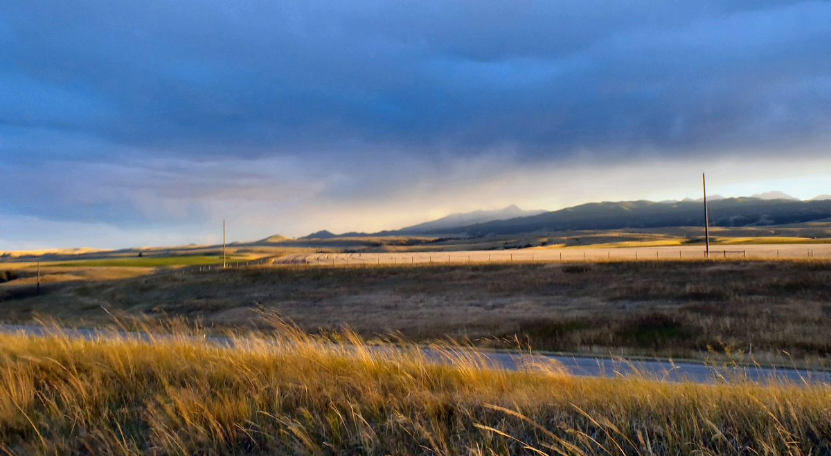
While I paused in Norris I had a nice chat with a touring bicyclist from Belgium who was heading south to Ennis with a light load and an empty food bag. He said he had counted on resupplying in Norris and at that point was down to nothing. He sounded slightly desperate. I had plenty, so after giving him enough chow to get him through the night, and wishing one another a bon voyage, we parted ways. He rode south and I rode north into the fading sunset light. A few miles north of Norris I found a comfortable camp site at the top of a roadcut along the highway and settled in. A gusty wind blew for a while as I set out my camp and watched the end of the day. Over the mountains, the afternoon storm clouds were breaking up as the day cooled down, and a rich palette of glorious sunset colors filled in the spaces between and below the clouds that remained. For a while it was simply amazing; just another, magnificent Montana sunset, I guess!
Day Three – Harrison to Canyon Ferry Lake
I had a wonderful ride on my third day of touring, from my roadside camp south of Harrison, Montana, and a good 65 miles, as the crow flies, to my evening camp. The sky was especially clear during the morning hours, and the winds were very helpful throughout the day. Clouds built up over the hills during the hot afternoon hours – a regular occurrence during these late July days – and I watched a few rain squalls move across the terrain, both in front and behind me. I dodged the rain, but I relished the shade the clouds sometimes provided and the fresh, wet smells of the newly-moistened countryside.
I had a tasty, sit-down, second breakfast in Harrison where I listened to the local old boys nurse their coffees and gossip with the waitress, then I zoomed up Highway 287 to (and through) Twin Forks, Montana. This is where the Jefferson, Madison and Gallatin rivers come together to form the mighty Missouri. Lewis and Clark passed through here in 1805 and gave the rivers their names, and for their guide, Sacajawea, it was a homecoming, of sorts: she had been kidnapped from the same area a few years before joining up with Lewis and Clark downriver.
The traffic north on Highway 287 – an excellent, higher-volume highway that connects Three Forks and Helena – was pretty heavy, but the day was beautiful, and the riding conditions were first rate. Tailwinds helped me blend in with the flow of traffic, and the shoulders were nice and wide. All in all, it was a pleasant stretch of roadway.
I took a nice, mid-afternoon break in Townsend, a wonderfully well-appointed and shady town, then left busy 287 for a quiet, zig-zaggy backroad that runs through open countryside along the east side of Canyon Ferry Lake/Reservoir (Montana’s third-largest lake and, according to a Townsend local, a favorite iceboat racing spot during those chilly Montana winters).
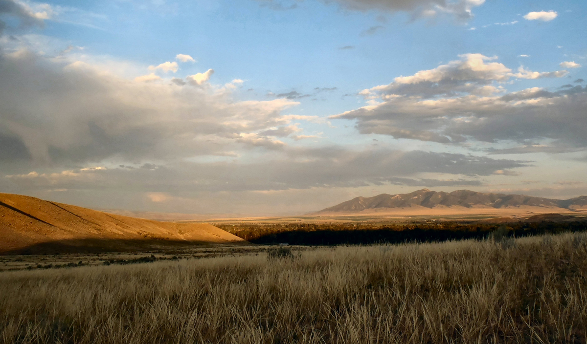
I spent the waning hours of the afternoon cruising easily up the east side of the lake. The traffic was light and the vistas were of the classic, Big Sky variety: expansive, not-too-distant mountain ranges, towering cumulus clouds trailing curtains of rain, deep blue skies, and rich sunset colors. I found a nice place to set out my third camp, on a small rise a quarter mile from the roadway, then fought the breezes from the last of the late afternoon squalls as they broke up over the lake. I enjoyed another glorious sunset, followed by a tasty meal and a star-filled night sky.
Day Four – Canyon Ferry Lake to Highway 141, Near Finn
I really gave my creaky old bones a workout on the fourth day of my tour, riding from my camp on the shores of Canyon Ferry Lake to a skimpy roadside camp at the end of the day. In between I climbed a couple of passes and dodged through the workday traffic of downtown Helena.
I began the sunny morning with a lot of rather nice, up-and-down riding, at the north end of Canyon Ferry Lake. I rode past summer homes and marinas near the reservoir’s dam, which was built back in the early 50’s, and pretty much had the quiet road to myself. As it was, I enjoyed a very quiet, back-door route into the general hubbub of Helena, the capital city of Montana.
I rolled through Helena around mid-morning. I needed a short break, and there was plenty to see, so I replenished my fluids and supplies and took my time cruising through town. As the capital city of Montana, and at one time one of the richest cities in America because of its extensive gold diggings and determined miners, Helena is still a vibrant place, filled with both beautiful Victorian buildings and the commercial trappings of any American freeway community, as well as the remarkably friendly people who seem to populate every Montana town.
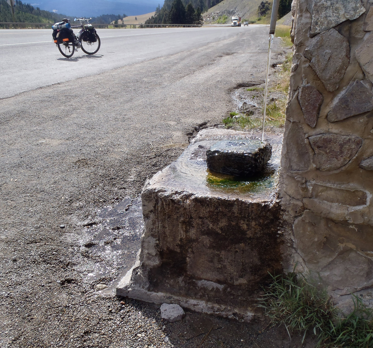
From Helena, I rode west on U.S. Highway 12, a major road connecting Helena to Missoula. I spent a good portion of the middle of my day climbing to MacDonald Pass and the Continental Divide. It was a bit of a grind, to say the least, and I took it slowly, using the route’s excellent shoulders and passing lane, and stopping frequently to cool off in the shade by the side of the road. By mid-afternoon I cleared the pass and found a charming roadside fountain just past the summit. I stopped there to fill my bottles (delicious water!) then coasted for a few miles down the other side of the pass to the town of Elliston, Montana. I took a break in front of an Elliston store and watched the traffic and a couple of trains roll past. Refreshed, I carried on down the busy road into the late-afternoon sunlight, following both the rail line and Route 12 nearly to the town of Avon, where I left the busy highway for what I hoped to be a much quieter backroad, Route 141.
Route 141 was a peaceful two-lane highway that led me up and over a gentle pass and into a modest valley separated by the Garnet Mountains to the west and the wide-ranging hills of a portion of Helena National Forest to the east. My long day was winding down and I found myself truly relaxing for the first time since leaving Helena earlier in the day. The riding was sublime. The early evening light was soothing to my eyes, quiet fields and meadows stretched off towards the hills on either side of the road, and the few slow-moving vehicles that passed me seemed to be enjoying the beauty of the evening as much as I was.
Journal Entry:
“Another highway right-of-way camp. The sun has set and I’m out of sight above the pavement, away from any sign of ranch house or barn. My camp is stretched out at the top of a steep highway cut, on a bit of fairly level, but lumpy, ground, and up against the rusty right-of-way fence. It’s not a bad spot, actually. The views are stunning, and the highway is sure to be quiet tonight. The breezes are just light enough to keep the bugs at bay, but not so brisk as to make running the stove a pain. The nighthawks are swooping and buzzing in the air above me. Water is heating in the kettle as I write, and there’s another delicious Mary Jane’s freeze-dried meal set up to take that hot water. A great way to finish the day.”
Day Five – Highway 141 to Missoula
I awoke early the next morning to classic, summer-in-the-Montana-countryside noises: a couple of Sandhill cranes croaking together down by the creek, an airplane motor way off in the distance, and a few cows in a meadow waiting for someone to notice them. Conditions were as good as it gets as I headed off that morning. The highway was empty, the sky was clear blue, and the air was calm and made fragrant by a delightfully rich mix of animal and plant smells. It was truly, ideal riding.
I spent and hour or two on that quiet highway, following the creek as it made its gentle way down-valley to a point where it joined the much grander Blackfoot River. In the late morning hours I was finally forced to leave the peace and quiet of Route 141 and joined a noticeably busier highway, Route 200.
I spent the rest of my day on 200 as it made its way downriver to the west, and on to the city of Missoula. At times during the long afternoon the highway ran alongside the Blackfoot River, and at other times it left the main river valley to follow one of the main river’s, tributary creeks. As I followed the river’s flow I remembered that I was on the west side of the Continental Divide. I considered the fact that most of the cool, clear water I was seeing in the river and creeks would eventually end up in the Pacific Ocean, by way of the mighty Columbia River.
There were plenty of places to cool my heels along the way, and I took the time to relax whenever I encountered a particularly nice rest spot or convenience store. As the afternoon progressed I rode past the communities of Ovando, Greenough and the turn-off to Seeley Lake (a beautiful route north, to Kalispell and the Flathead Lake area). As both the afternoon and I wore down, I became aware of a gradual increase in traffic, and knew I was getting close to the city of Missoula and the end of my day.
I worked my way through the towns of Bonner and Milltown, east of Missoula, where the Blackfork River becomes the Clark Fork of the Columbia River (the largest river, by volume, in Montana!). As I came to the city’s outskirts I realized that I had entered suddenly into the most urban environment I’d seen since leaving Salt Lake. Traffic was everywhere as people finished their work days and headed home. The day was winding down, for me, too, and I realized that a good camp spot might be tough to find, so I decided to grab a room in a cheap motel on the east end of town.
Day Six – Missoula to Sula
Journal Entry:
“It’s dawn at the Thunderbird Motel in Missoula, a spur-of-the-moment destination chosen at the end of the day yesterday. It was wonderful to be able to clean up and cool off after the buzz and heat of yesterday’s afternoon/evening run down the Blackfoot River into Missoula. The grades and shoulders along the way were decent enough, but the traffic was pretty heavy from mid-day on; working people and travelers, mostly, looking to get off the roads as eagerly as I was.”
Montana’s second largest city was quiet and cool as I set out early to ride through Missoula’s comfortable, neighborhood streets. I had a so-so breakfast at a cafe called Ruby’s, then continued to work my way south and west of town, on Routes 12 and 93.
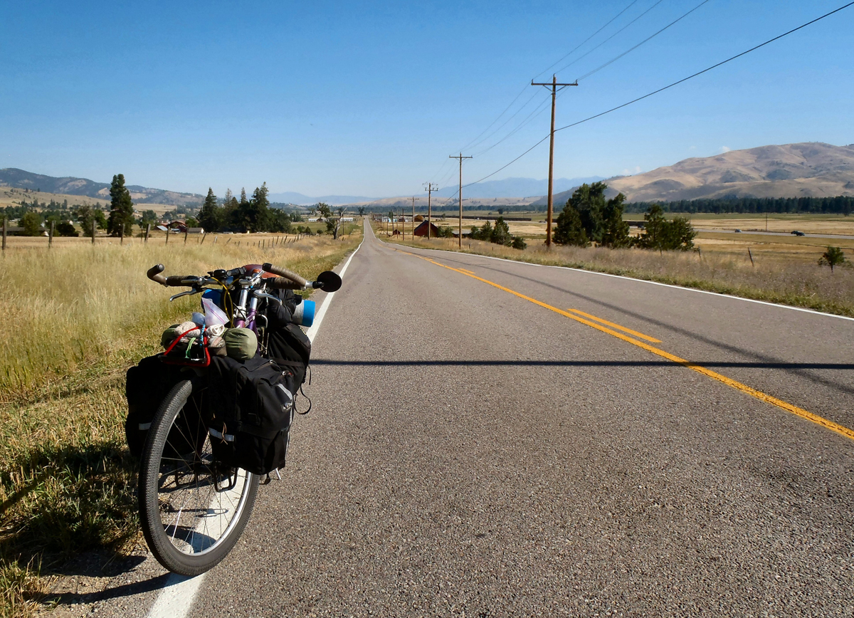
At the west end of the valley I was delighted to come across a dedicated bicycle and pedestrian pathway. It was a wonderful thing to discover! As the morning and afternoon progressed, I stayed on the pathway, which seemed to connect the outskirts of Missoula to the towns south of the city, and along the Bitterroot River Valley. The path runs parallel to U.S. 93, a very busy highway that also services the communities up and down the long, Bitterroot Valley. I followed the path through Lolo and Florence and Victor, and on up the large town of Hamilton, Montana. Along the way there were places where I left the pathway to check out a piece of old highway, and I often returned to ride 93 itself as it passed through a town’s business district. It was a wonderful way to ride up the Bitterroot River Valley, and the afternoon passed quickly. Both the pathway and the daylight hours of my riding day had pretty much petered out by the time I reached Darby, Montana, where the highway began its real climb out of the river valley and up towards Lost Trail Pass.
I left most of the local, valley traffic behind me and began to climb back up into higher country.
I finished my day a mile or so up the road from the Sula store, in another campsite just above the roadway and on the edge of a small stand of conifers. It was really a very restful spot: the road noises were minimal to non-existent, the ground was level and soft, and the sky was a beautiful mix of both deep blue sky and sunset-colored clouds. I slept like a log!
Day Seven – Sula to Wisdom
Journal Entry:
“The sun’s about to appear in a notch in the far hills. The birds twitter. The cows mooo. The sounds of the river rise to my hillside perch. It’s been an especially fine campsite that included a delicious evening meal, eight solid hours of sleep (despite a short-lived, midnight cacophony of yips and howls from a nearby troupe of coyotes!), and that wonderful visit from the owls at dusk, coming in close enough and bold enough, as they did, to make me just a tad nervous. A magical experience”
I left my Sula campsite with the sun still low to the east and continued my climb up U.S. 93 to the south. I had slept well, and I felt refreshed, so I took my time climbing to Lost Trail Pass. The morning was delightfully cool, and the air seemed unusually still and quiet. I could hear both the sounds of the forest and approaching traffic from a long way off. The day’s travelers hadn’t yet hit the roads in big numbers, so I was able relax and enjoy my surroundings. My low gears worked well, and 93’s shoulders and passing lanes allowed me the opportunity to tack back and forth through the lanes and shoulders, in order to ease the climb.
I cleared the pass around noon and paused to rest there. I was up pretty high, so I figured I’d the let sun warm things up a bit more before I dropped off the pass beyond, back onto the east side of the Continental Divide, and back again into the Big Hole River Valley where I’d begun my tour a week before.
While I waited there at the summit I had a conversation with a very pleasant, older fellow (an easy-going Montanan who had helped me free a small mammal from the depths of a MDOT rubbish bin!). Neither one of seemed to be in any particular hurry. We shared an admiration for Montana highways and byways and for the sights to be seen along the way, and we bemoaned the forces of progress that seemed to be filling in more and more of the world’s pretty places. We expressed a mutual admiration for the writer and native-son, Ivan Doig, and we shared what we knew about the Big Hole National Battlefield site, just down the road. We talked about how tough Chief Joseph and his band of Nez Perce had been when they made their desperate run for Canada back in 1877. In the end, they didn’t make it, and the battlefield site marks one of the band’s worst encounters with U.S. forces. It’s both a beautiful and very sobering place to visit.
The old Montanan and I parted ways there at the summit and I began a long, last descent back into the valley below. The weather was still nearly perfect, and much of the traffic that had finally built up as I approached the summit earlier in the day had continued to follow U.S. 93 as the road dropped into Idaho and on to Salmon, and points south. I was back on peaceful Route 43 again and headed back into Big Hole River country. It was a delightfully easy downhill cruise, and before I knew it, I was back in Wisdom, at the end of another excellent tour.