By Lukas Brinkerhoff
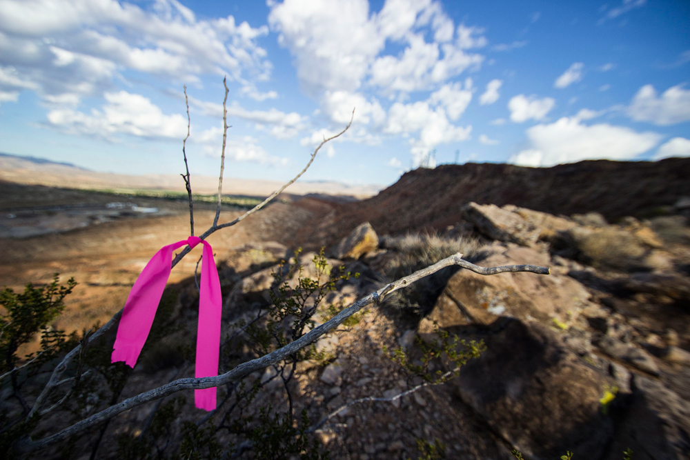
The pink ribbon is tied tightly around the upper branches of the chaparral bush. The ends were left long so we could see it from a ways off. Now that we have a better idea of where the trail is going to be, it is clear that this particular bush is about 15 feet above where we need things to happen. The great thing about ribbon is it is pretty secure once it is placed. The horrible thing about ribbon is that it is pretty secure once it is placed. And even worse is when the knot has been pulled tight.
My fingers tug at the ribbon, one side and then the other. If I wasn’t so excited about the line we had “found” I would probably be yanking at it with much more gusto, but as it sits, I’m feeling pretty stoked just to be walking around in the desert placing pink ribbons. After a few more minutes of frustration, I finally just break the branch that it’s tied around and pull the ribbon off the end. Once off the branch, it’s plenty easy to untie. I then proceed down to the new alignment and place the ribbon where it needs to be.
Building trails legally and sustainably is a long, sometimes bureaucratically painful, process. As frustrating as pulling ribbons off of poky desert bushes can be, it’s actually my favorite part.
In my experience, trails begin as dreams. The dream is usually about being able to ride on a mesa, to a certain rim for a view off the other side or to drop down that face just to see if it’s possible. As dreams go, the original vision is seen from the clouds, a rough draft if you will. The dream is one of the only truly easy parts of building trails. It’s also the one that I think every mountain biker can relate to. Who hasn’t seen the light dance off of a desert mesa and not wondered what it would be like to ride the rim? Or maybe it’s just me.
The dream must then be turned into a rough draft, a proposal and then the bureaucratic part starts. Every plot of land in the US is managed by someone. It can be a private individual, a municipality or, in the case of much of Utah, be federally controlled. If you hope that your trail won’t be destroyed after you build it, it’s a good practice to get the land manager’s permission before you even put a boot on the ground.
In the case of federally controlled land, this means finding the recreation manager and convincing them that allowing recreation on the plot is a good idea and that it won’t hurt any resources. If you can get them to agree, then you get to wait for an Environmental Assessment to be completed to show that your dream won’t damage anything. This is followed by a public comment period to allow other users or concerned parties the opportunity to give their input.
Get through all of that (the above version was condensed for your reading pleasure and to not lose you) and then the fun begins.
Have you ever planned a hike using Google Earth? If you have, you know that, while being a useful tool, there are lots of things that can’t be accounted for within that software. You won’t know exactly what is there till you walk through it. This is akin to what creating an actual alignment is. The dream you had a few paragraphs back was put into a proposal meaning it was put into Google Earth and a rough map was drawn where you want the trail to be. Creating the alignment is bumping around on the actual earth and determining where the trail will be.
This is when the pink ribbons come into play.
Photos by Lukas Brinkerhoff
Creating the alignment is a lot like sanding. You start out with your map which is your rough draft. Heading out in the direction you drew, you begin to mark features and determine what parts of the earth in front of you would be the most fun to ride. You mark spots you think are important or you would like to route the trail around. You follow the line out and then turn around and follow it back. You switch to a finer grit sandpaper and begin to flag between the features, you mark the turns to ensure that the proper radius is maintained to allow for a fun flow. You think about how uphill and downhill riders will need to interact and try to design the trail in a way that can reduce conflicts. You scout the drainages, up and down to find the best spot to cross to mitigate water damage when the floods happen. And they will happen.
And poof! A trail is born.
Ok, not really. This is the part when the hard work begins. Once the trail alignment is marked, the land manager will require a few more assessments to ensure that everything is kosher. Then the diggers can descend on the alignment and do their magic. Grade reversals are put in, the drainages get armored, benches cut and slowly that line of pink ribbons turns into a dotted line, then a route and finally a trail.
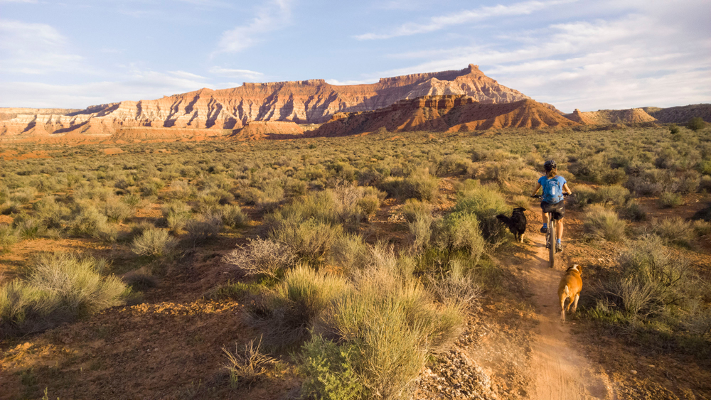
There’s a lot about mountain biking that is magical, but nothing compares to the sensation of riding virgin singletrack whilst simultaneously knowing every turn, dip, bank and line. It’s a feeling that every rider should aspire to know.
If you live in Southern Utah and are itching to have that experience, go to www.dmbta.org to join the cause. Anywhere else in the state, join your local IMBA chapter at www.imba.com.
Lukas Brinkerhoff blogs about mountain biking and life at mooseknuckleralliance.org.