By Jack Stauss — Early on a Wednesday morning, I watched lightning flash outside my tent, stirring me from an already fitful night of sleep. Blurry-eyed and sore-backed, I pulled myself to sitting and unzipped the fly. While I sat for a second, letting the dim world come into focus, I thought of how in a couple hours I would be riding an indeterminable number of miles in a landscape I had never been in. It was dawn and I was ready for a cup of coffee. I packed up my Green River roadside camp and headed into town.
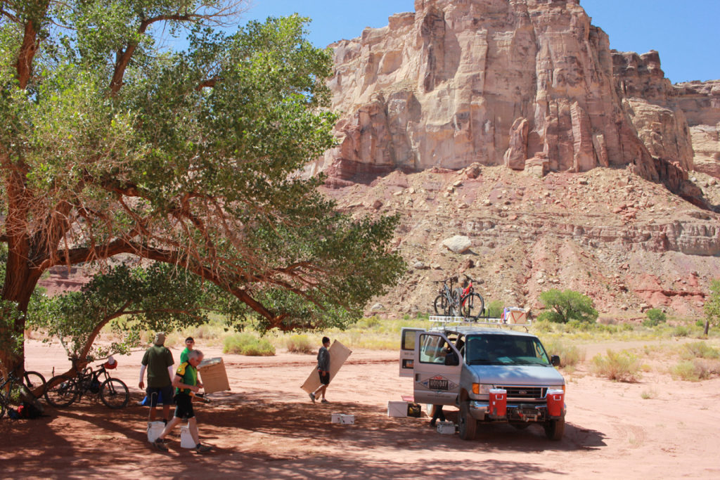
After stopping for some gas station brew, I arrived at the Holiday River Expeditions headquarters. I had done the river part of the outfit’s business, and I was eager to try their San Rafael bike trip. Their trips were always top-notch and the guides took a pro attitude across the board: providing adventure, interpreting history of the region, explaining plants and ecosystems, and pointing out the constellations while sitting around a campfire. Most importantly, they were going to support with their five-star mobile kitchen, cooking us gourmet meals after hard days of riding.
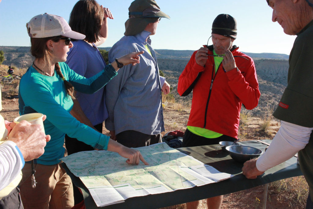
Sitting at a green picnic table outside the building, I slurped down the rest of my coffee. A sleepy young guide pushed through the swinging door and said “Hello.” Jack, one of our two guides, took a test ride on my hardtail and loaded it on the van. Soon the rest of the guests had arrived, and we all gathered around as our trip leader Susan unfolded a map on the table.
“We’re going south!” she said. She pointed to an exit off of I-70 about 40 miles west of Green River. From there, she traced her finger along backroads to the bottom of the Swell, all the way to the Temple Mountain Wash Panel. Over three days, this was going to be a huge survey of the region. I was psyched. This trip was not only going to open up a huge blank spot on the map for me, because we were riding, the bike would let me really experience the land.
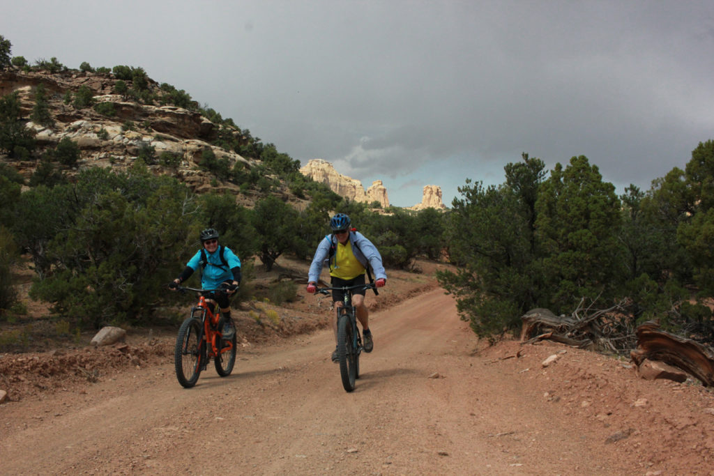
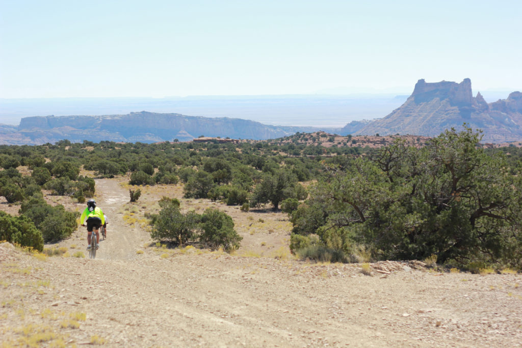
After a quick drive on the highway and out into the desert, we topped off water, pumped up bike tires, and lubed chains. Our driver bid us farewell and we let the rubber hit the gravel. I started pedaling with a guy named Nick from the Boulder area who was there with a couple friends. He had never really done a trip like this, but spent a lot of time road riding and traveling the world. It seemed he was in his element. Along with us were his two buddies Eugene and Eric, and a couple from Albuquerque: Leslie and Matt.
We took a detour back to the north of I-70, to see a pictograph panel, so the groan of civilization droned on as we rode through a giant metal culvert under the freeway. The path was worn from easy access by Jeeps and four-wheelers, so the track was like a sandbox. My skinny tires slid around, sometimes stopping altogether in the soup. Our guide Jack’s fatter rubber ripped through the dust. We all weathered the sandstorm as best we could, and soon we were stopping at a massive rock art panel.
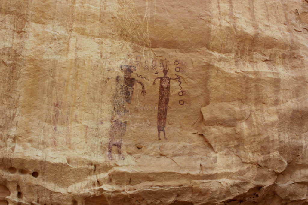
Susan explained to us that it was left by the Barrier Canyon Culture, some of it painted 4,000 years ago. This civilization was different from that around sites commonly seen in Moab and along the rivers of the Colorado Plateau. While little is known about the ancient people, the Barrier Culture and their unique style is just another reminder that this is a place much older than our civilization, and worthy of our utmost respect.
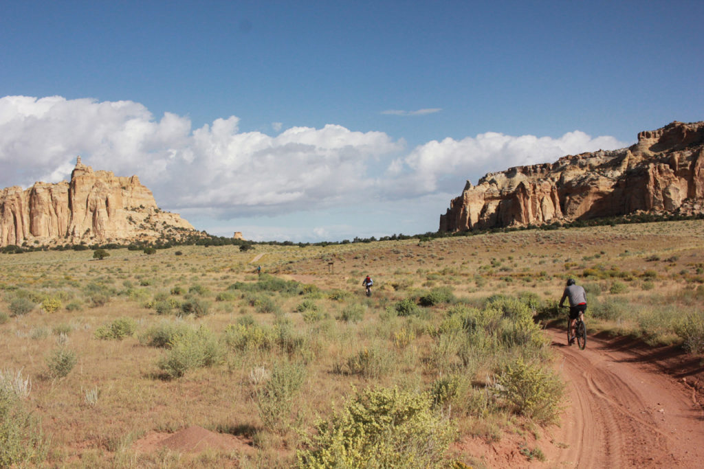
We ripped along gravel roads, thankful to have left the sand and highway behind. The country opened up in front of us, with rolling sage grasslands, shrubby blackbrush, and the occasional pinon juniper. We cranked along, passing each other, chatting, and feeling the wind rush around our bikes and bodies. Dark clouds swirled above and threatened rain. At lunch, we all wondered if it would produce, but the desert stayed dry.
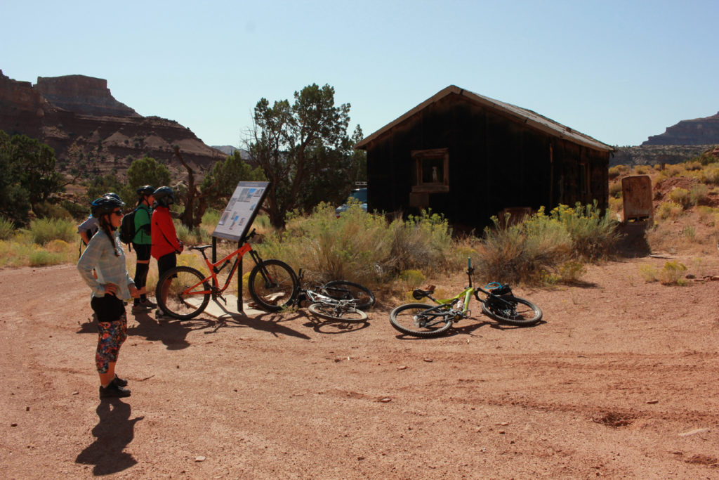
Our long lunch break gave us time to explore Swasey Cabin, some old ranching infrastructure, and some interesting geological formations. Swasey Cabin is built from lodgepole pine timber linked together as a dusty reminder of how the original Euro-American settlers spent their time. It was built from the want to live among the unforgiving landscape. The settlers used the resources as best they could. They collected water and ice from a seep, and stored food in a cave that doubled as a freezer.
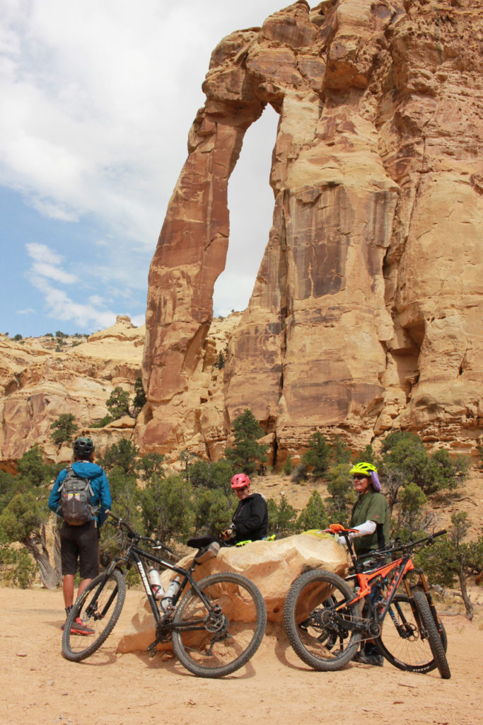
Behind Swasey Cabin was Eagle Canyon. Susan took the pulse of a sleepy post-lunch crew.
“Who wants to bike down to Eagle Arch?” she asked. We all rallied and mounted up. The ride down to the Arch was the first technical riding of the trip. We romped through loose sand, slickrock terraces, drops, and fun balance-y broken ground. It was exhilarating rolling over the obstacles, challenging myself to commit to scary drops or a fast, loose corner, blasting dirt off the double track.
The Arch rose out of the drainage and swept up high until it connected with the cliff it had been pulling away from. Ravens drifted above with the grey clouds. We snapped a few photos, stretched out, and climbed back on our bikes to repeat the steep ascent. Only a couple raindrops pattered on our shoulders.
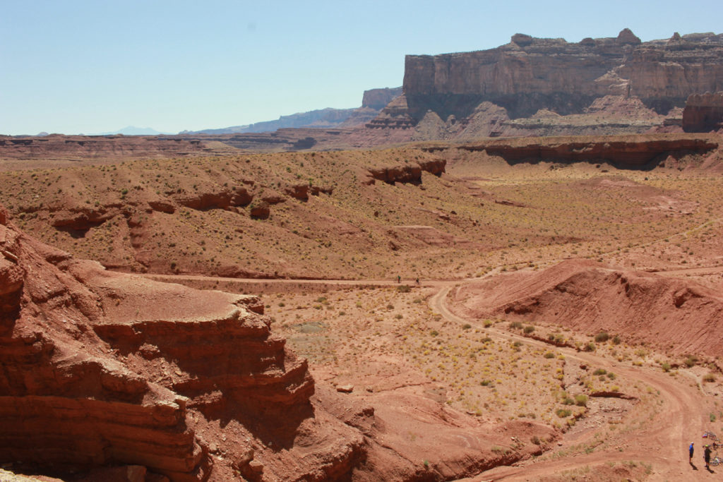
After Swaseys, we cruised more gravel that criss-crossed the plateau. The route to our campsite was more or less the main gravel road through the Swell, so the sandy slog from the morning was a distant memory.
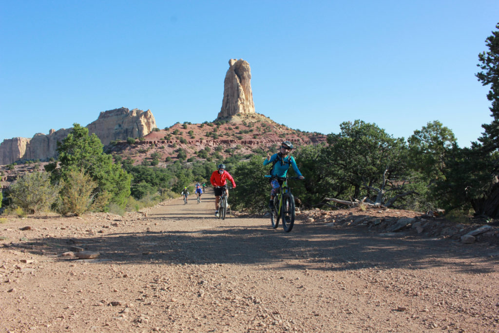
We climbed a hill which dropped into a long and enjoyable descent, flowing through winding corners, past tall sandstone walls and whizzed by juniper forests. To get to camp, we whooped through a rollercoaster of hills onto the Family Butte mesa, which features a series of desert towers. The climb was mellow, and I chatted with Eugene, the oldest member of our group. He told hilarious stories from his time traveling the world and the West.
Soon we were atop the mesa and Susan started looking for the turnoff to a camp she had hoped we’d get. She peered to her right and veered off, the rest of us waiting at the junction. A minute later she came back with a wide grin, “Oh yeah! This is the place!”
It was an astonishing view off a massive cliff, down onto another giant valley, across which stood a huge sandstone wall. Beyond that were blue-grey mountains stretching into the distance. The clouds that had not produced any rain swirled on the horizon, the setting sun shining through them, illuminating the canyon colors.
As we stood there, someone pointed out that we had not seen a single person since we left Swasey Cabin. It seemed that we had the whole desert to ourselves. We had dinner and drinks and watched the colors change with the light. As the sun dipped behind the horizon, the wind picked up, but we stayed out for a while and watched the stars rise before heading off to bed.
Susan pointed at the constellations: Vega and the Summer Triangle, the Big Dipper pointing to the North Star and Cassiopeia, and Sagittarius and Scorpius. With stories of the stars swirling through my mind and my legs tired from the day, I climbed into my sleeping bag and fell asleep within minutes.
The next morning, coffee and pancakes got us up for our scenic start of the day. I loaded up on calories and packed up all my gear. We were excited, as the wind had died down and the temperature was perfect for desert riding. To start the day, we had another epic descent down gravel roads for several winding miles from Family Butte to Red Canyon, the canyon we had camped above.
Our first stop of the day was at the Lucky Strike Mine from the 1950s. At the mouth of a wide wingate canyon, dilapidated old buildings stood defiant to many seasons. Looking around the hillsides, entrances to shafts and tailings lurked in the terraced landscape.
After wandering around the camp, we gathered to talk about the history. We were here to recreate and experience the place, but the miners came down to dig out uranium. They spent a decade weathering the elements and hoping to make it rich from a place they must have been at odds with.
The discussion of mining took us into a broader discussion of the Colorado Plateau. Susan drew a picture in the sand of the region and helped us get oriented to where we were in relation to the Grand Canyon, Moab, and the mountain ranges that hem in the plateau.
She told us of the geological story of how the region came to be, pushed up from forces of the earth, layers upon layers of sand and sea for millions of years, uplifting again, then eroding away. And in the center of all of it was the Colorado and Green Rivers and their tributaries all of which played a major role in the shaping of the canyons.
We pedaled through some more sand and loose cobbles away from the mine. Finally, one more descent on the day to the Muddy Creek. This was a fast fun ride downhill, ripping past steep walls and drop-offs. We pedaled off the main road and found another massive mining relic.
Lunch was on the banks of the Muddy Creek, where I splashed cool water on my face and neck. We ate zesty wraps and lounged in the shade of cottonwoods with the massive Hondu Arch on the horizon.
After lunch, life quickly went from casual to a steady grind. We had to climb out of Red Canyon, and it took all afternoon. Fortunately, the road was firm and all of us were going about the same pace. The pitch of the road never got steep enough to warrant pushing, but I definitely had to put my head down and tell myself to keep turning the pedals.
A couple hours later, we popped back out high on the mesa in the middle of the Swell. Sage meadows led us along rolling hills, and eventually through five miles of four-wheel drive double-track to our last campsite.
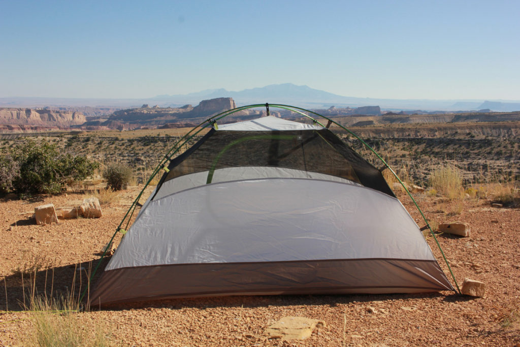
Much like the first night, this site had an astonishing vista. Instead of being on top of a wide valley, we were perched above a twisting slot canyon to the east. Beyond that, the jagged edged silhouette of the La Sal Mountains stood in contrast to the wide expanse. To the south, we had a direct view of the Henry Mountains, and further along still I could see Bears Ears and Cedar Mesa. Eric mentioned how amazing it was where a couple pieces of rubber could take you.
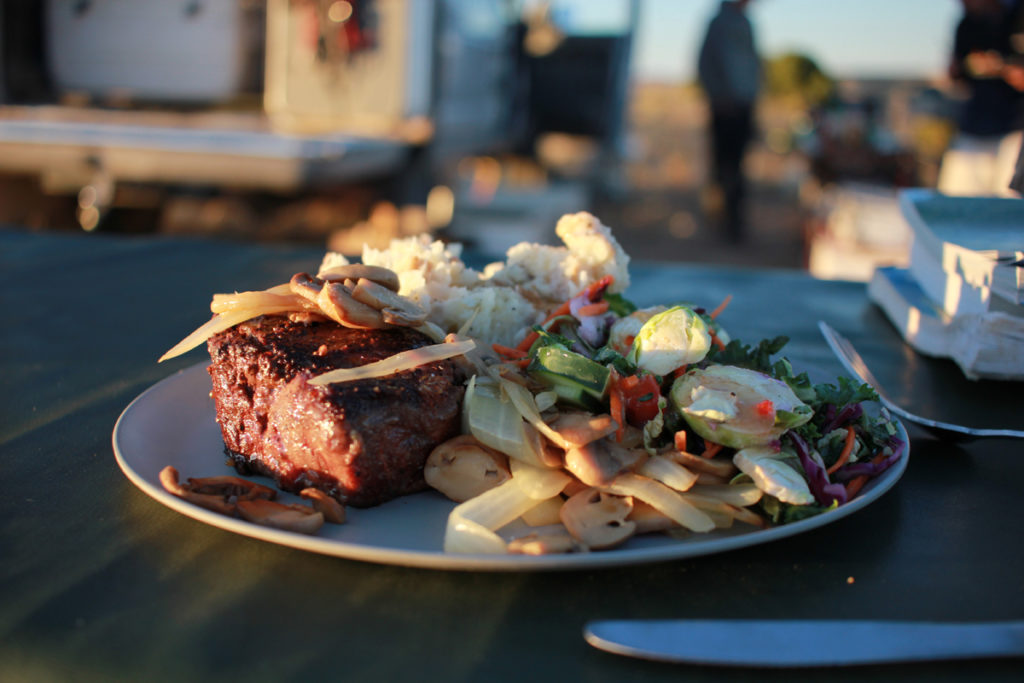
The last meal Holiday whips up for their guests is always perfectly grilled steak and mashed potatoes. After the day of hard riding it certainly felt like we earned it. With no wind and an amazing sunset, we feasted next to a fire. We told stories and laughed, watching another color-show over the canyon country and enjoying the company of friends. Again, we all remarked on how fortunate we were to have had the roads and trails completely to ourselves.
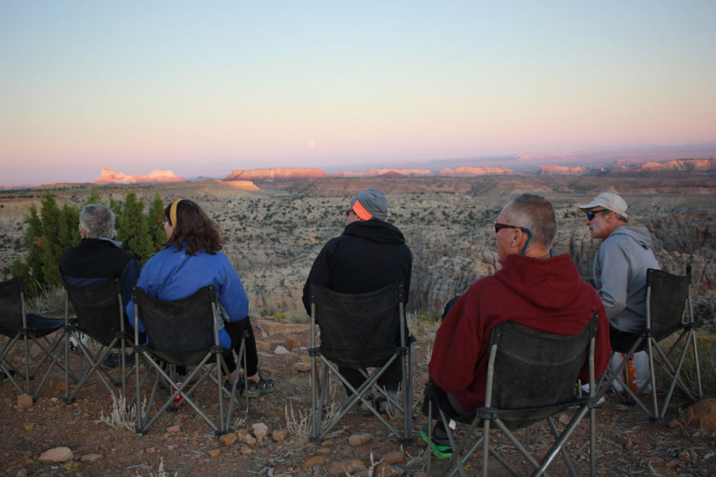
When it was finally dark, we did a deeper dive into the stars looking at more constellations and telling myths about what it all meant. Susan had a deep passion for the place, and she shared it with all of us.
In the morning we all regretted the fact that we would have to return to civilization and “real” life. Over the previous few days of riding through the region, we had become old friends, and the landscape was as much a part of that as the connection to one another.
We lamented packing up, but soon we were back on our bikes and in the grove of the gravel. I took my time getting through the last hills, snacking and looking at wildflowers. On the saddle of the last rise we looked out down to Temple Mountain and at the Henry’s in the distance. Soon we’d be back at pavement and onward to our lives and work, but before that we had one last long fun descent to rip together. We clicked into high gear and let it ride off the plateau all the way down into the twisting canyons beyond.
Nuts and Bolts
Trip Location
– Southern San Rafael Swell. From I-70 to Temple Mountain Road (pick up near highway 24).
Trip Route (more or less)
– This trip primarily followed Emery County Roads 1024 and 1012, with some detours to sites of interest. We exited out Temple Mountain Road. The whole trip was done from north to south.
Days (and mileage)
– We bike three full days, each day we rode between 20 and 25 miles
Water Availability
– There is no available water until you reach Muddy Creek. For us, this was at lunch on the second day. Muddy Creek has seasonal fluctuations.
If you go with Holiday tips (contact Holiday)
– To do this with Holiday River Expeditions contact them via their website: www.BikeRaft.com
If you go on your own tips
– It would be possible to run this on your own. National Geographic has a good topo with roads marked. It is highly suggested to do this with a support vehicle as you are many miles from help, service, and water is unpredictable at best.
Jack Stauss is an East Coast transplant who moved to the West in 2008 for college and skiing. Over the years he has fallen in love with the desert and mountains and spends every season either biking, hiking, ski touring, or rock climbing. He now works as a freelance writer and as an outreach director for a local environmental non-profit. He lives in Salt Lake City with his dog and girlfriend, who can out-bike him any day of the week.