By Wayne Cottrell
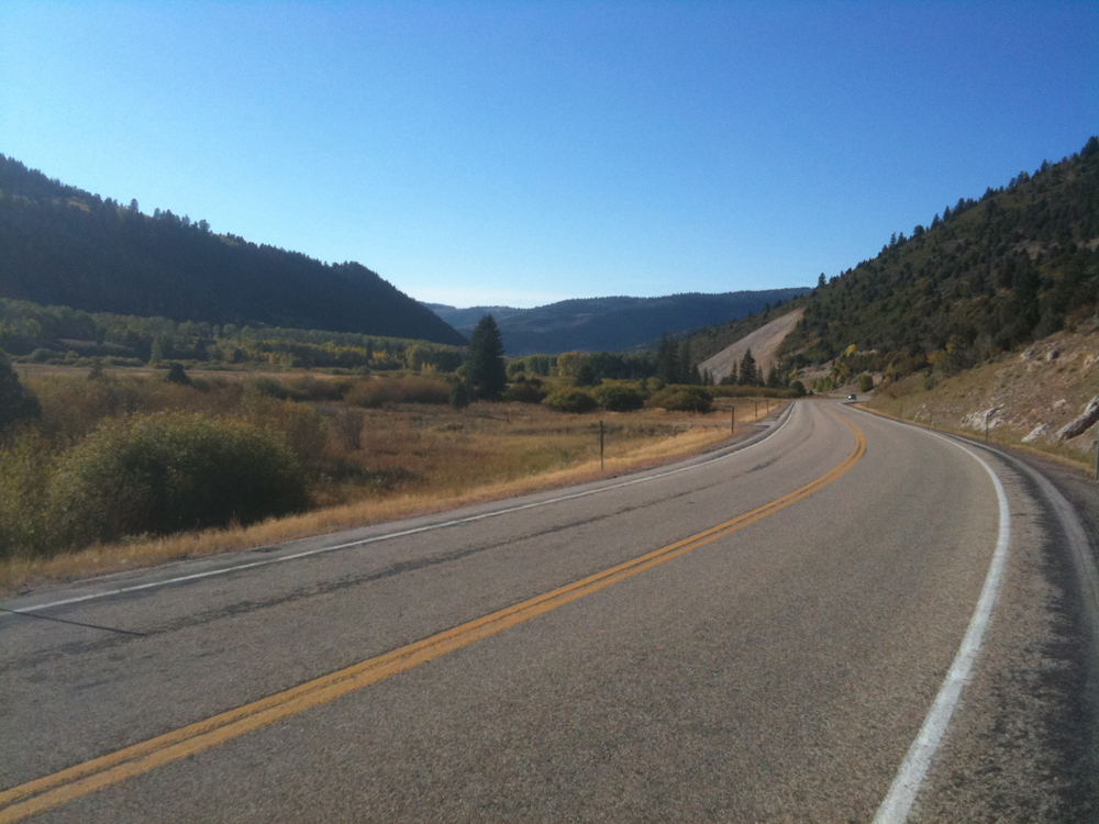
A great summer ride – in part because the road is open only during late spring, summer, and early fall – is the Wolf Creek Challenge. Using State Route (SR) 35, the Wolf Creek Challenge takes the rider up and over what may be the third-highest pass in Utah, at 9,493 feet. (Higher passes are at Bald Mountain, in the Uintas, and in the Tushar Mountains). Wolf Creek Pass is in the Uintas, as well, to the southwest of the highest peaks. Be prepared for a long, steady climb, as well as a long descent, and a significant temperature differential. Also, be sure to check road conditions before venturing out. The pass is normally closed from November or December until late May or early June (it is actually open to snowmobilers). This year, SR 35 opened much earlier than usual.
This version of the Wolf Creek Challenge, with a turnaround at Blue Lake, is 51.8 miles in length, with 3,950 feet of climbing. (Optional longer rides include turning around in Hanna, for about 77 miles out-and-back, or Tabiona, for about 88 miles and-out-back, each with over 6,500 feet of climbing). Start the ride in Kamas, at City Park, located on 400 South just east of SR 32 (40.636597oN 111.280708oW). Kamas had a population of 1,921 in 2013, reflecting a growth in population of 50% since 2000. The city is the starting point of the annual High Uintas Classic (currently on hiatus), an 80-mile road race that takes riders up and over Bald Mountain Pass, on SR 150, and on into Evanston, Wyoming. Kamas has also been either the finish line or along the route of stages of the annual Tour of Utah. Head south on SR 32, immediately leaving Kamas. The starting elevation is 6,495 feet. The highway climbs imperceptibly into the town of Francis; with a population of 1,140 in 2013, this town had grown by over 60% since 2000. Right in the center of town, turn left onto SR 35 and head east. To your right, just before making the turn, is the Byron T. Mitchell House, which is on the National Register of Historic Places. After another 4 miles of riding, during which SR 35 curves southward, and then southeastward, enter the community of Woodland. This settlement, at an elevation of 6,700 feet, is the last for miles and miles, as SR 35 begins to climb into the mountains, with Provo River’s South Fork (not Wolf Creek) keeping you company. Daily traffic volumes barely reach 500 as you leave the Woodland environs. The highway winds its way upward, gradually at first, and then more steeply. This area was once dense with trees, but intensive logging, starting during the second half of the 19th century, has “deforested” the region. Hardy homesteaders adapted well to the loss of lumber income by switching to farming and ranching. You will pass by a number of campgrounds, trailheads, forest roads, and summer homes as you ride along the highway. From Mill Hollow Road (Forest Road 054, at mile 16.7) to Forest Road 057 (mile 18.2), the highway’s grade averages 6.2%. The grade increases to 7% for the next segment, finally cresting at 9,493 feet, at mile 21.4. You may see patches of snow at the highest elevations. Wolf Creek Peak (9,949 feet) will be off to your right.
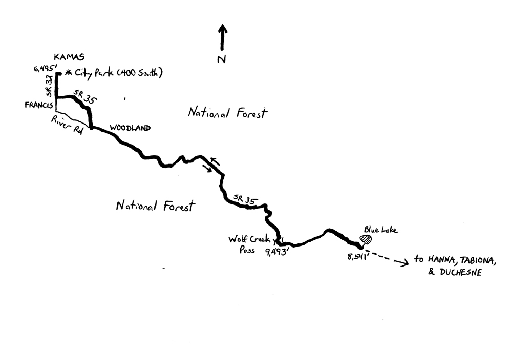 As SR 35 begins to descend, the highway finally picks up Wolf Creek, which runs parallel to the road over the next stretch. Continue to descend for 4.5 miles, losing just under 1,000 feet of elevation, to the small turnoff for Blue Lake, which will be on your left. This is the turnaround point, at an altitude of 8,541 feet. Be sure to take a look at Blue Lake, which is a small, pristine mountain lake in a beautiful setting. The next town, Hanna, is about 13 miles away, as noted above. Once you are heading back, northwestward on SR 35, the return ride begins with just under 1,000 feet of climbing at an average grade of 4.0%. From here, you will be tracing a portion of Stage 4 of the 2015 Tour of Utah, during which the riders climb Wolf Creek Pass from the direction in which you are now heading. Once you summit Wolf Creek Pass, it is a net downhill through the towns of Woodland and Francis, and back into the city of Kamas.
For more rides, see Road Biking Utah (Falcon Guides), written by avid cyclist Wayne Cottrell. Road Biking Utah features descriptions of 40 road bike rides in Utah. The ride lengths range from 14 to 106 miles, and the book’s coverage is statewide: from Wendover to Vernal, and from Bear Lake to St. George to Bluff. Each ride description features information about the suggested start-finish location, length, mileposts, terrain, traffic conditions and, most importantly, sights. The text is rich in detail about each route, including history, folklore, flora, fauna and, of course, scenery.
Wayne Cottrell is a former Utah resident who conducted extensive research while living here – and even after moving – to develop the content for the book.