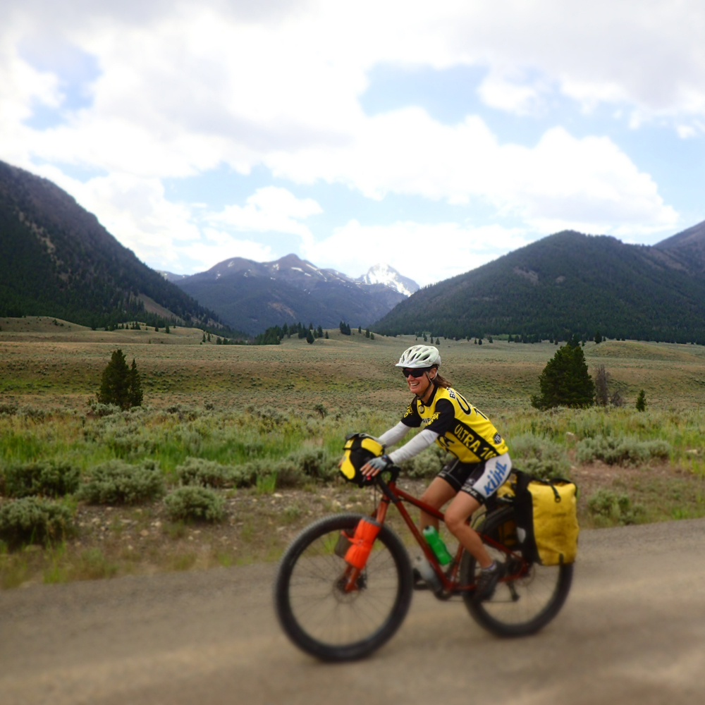
By Tom Diegel – In the heat/heart of the summer even avid Utah bike tourers sometimes can find it difficult to do bike tours in our fair state; sure there are nice high roads like Mirror Lake Highway and Skyline Drive on the Manti Plateau, but the bicycle’s ability to cover long distances will invariably result in plenty of low-elevation roads where brain-searage from the heat is quite real. Utah’s central location gives it good proximity to warmer climes in the colder months and cooler places in the summer, so it’s relatively easy to get to weather and terrain that’s great for bike tours. And as one of the cooler spots in the intermountain West with practically unlimited quiet back roads, the Sun Valley/Stanley area of Idaho is perfect for hot-season riding.
A few years ago Idaho Republican congressman Mike Simpson sponsored a bill to create the Boulder-White Clouds wilderness. It created a lot of controversy in Idaho’s recreation community, since many of the trails in the new wilderness areas were originally established by intrepid motorcyclists and have since cherished favorites of the sizeable Sun Valley mountain bike crowd. The creation of the wilderness had the unfortunate effect of pitting historically-aligned conservation-minded recreationists against one other (some argued that was part of Simpson’s strategy, since wilderness creation is not typically a GOP activity) but ultimately it passed the House unanimously and President Obama signed the bill designating wilderness, thereby instantly shutting bicyclists out of large sections of Ketchum and Stanley’s local mountains.
For better or worse, the wilderness area is parceled into three pieces (The White Cloud, the Hemingway-Boulders, and the Jim McClure and Jerry Peak Wilderness Areas), and as with several of the Idaho wilderness areas, some key corridors exist that enable linked mountain crossings. One of those corridors creates a passage from the East Fork of the Salmon to the main Salmon drainage and allowed us make a great 3-4 day loop out of Ketchum.
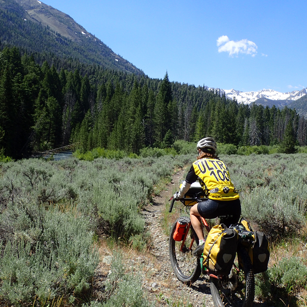
We started rolling past the toney Sun Valley resort and soon enough were on the graveled Trail Creek road that climbs 2300 feet up to the pass that sits between the impressive Pioneer Mountains to the south and the equally-grand Boulder Mountains to the north, as well as forming the divide between the Big Wood and Big Lost rivers. A long cruise on fast dirt/gravel roads found us paralleling the Big Lost, and while yes, it’s cooler up there than in Utah, it’s still warm enough that a dip in the chilly river was a refreshing way to recharge after the long climb! Soon enough our knobby tires were humming on pavement, and it wasn’t long before we saw the first key to our loop: Walker Way, which is a double track that runs along the eastern foot of the Boulder Mountains before ultimately climbing 1400 feet to another 8000 foot pass and ending with another long cruiser descent down to the East Fork of the Salmon.
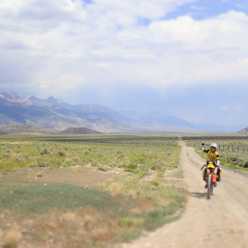
The East Fork of the Salmon is under-appreciated; while it has plenty of water and is really beautiful, a combination of limited whitewater and a lot of private land have kept it off the radar of fishermen and rafters, and most folks barely know it exists. But it’s the gateway to the classic Little Boulder/Big Boulder mountain bike loop (just barely outside the new wilderness boundary) and the upper reaches of the drainage that conceal craggy peaks, high mountain lakes, and yes, a rideable slot to get up and over to the main Salmon drainage on the backside of Galena summit (the main highway pass between Ketchum and Stanley).
Given that we had allocated 4 days for what we figured was a 3-day trip and the fact that the East Fork of the Salmon was a little awkward to get to, we decided to do a “layover” day hike up into some of those craggy peaks and crystalline lakes. We stashed our gear at the bottom of the Big Boulder road, rode the few miles up to the trailhead intending on riding up the trail a couple of miles to where the mountain bike route splits off to link up to with the Little Boulder. However, the huge Idaho snowpack and subsequent melt from this year had pushed Big Boulder Creek over its banks and destroyed the trail, so we started our hike earlier than anticipated (near a ranch that was a private inholding, whose owner chose to paint the word “TRUMP” in huge letters on his roof??!!) and indeed had a great hike to the first of the brilliant Boulder Lakes.
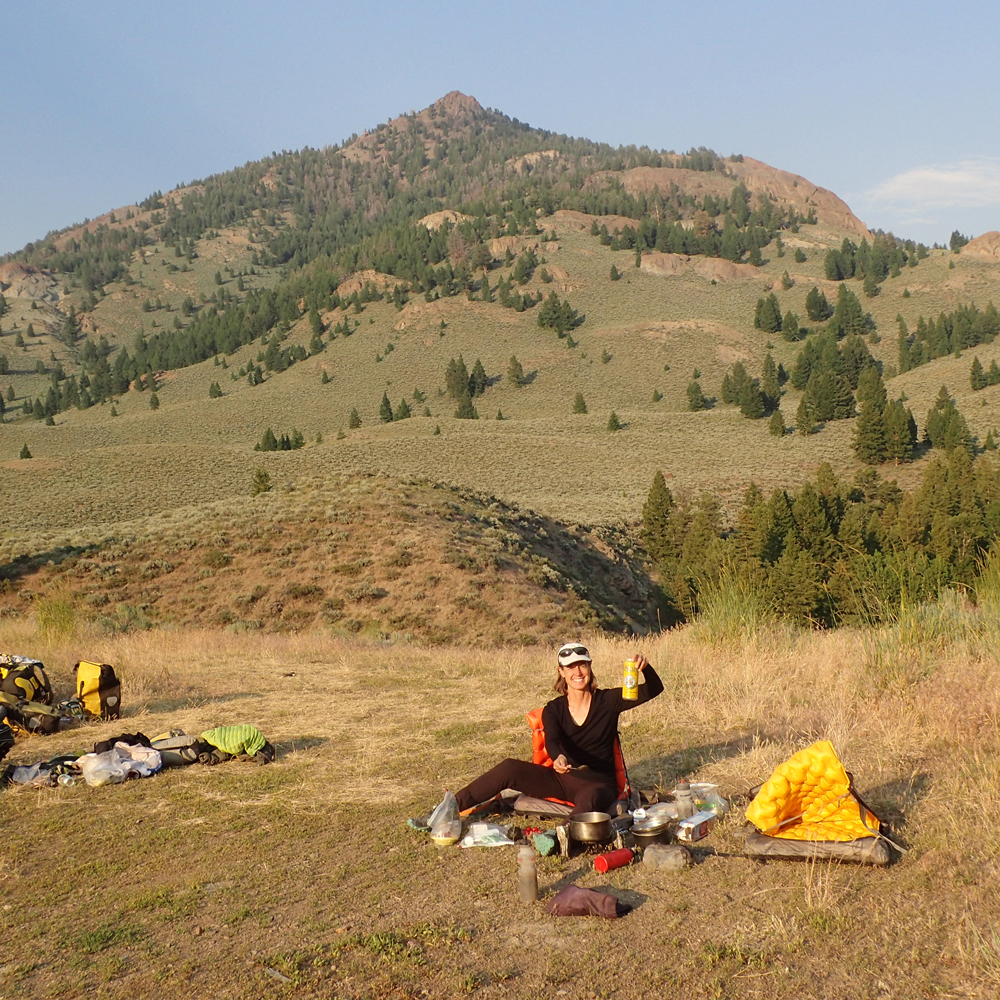
Back down at the bikes we continued to trundle our way up the traffic-free East Fork Salmon road towards the long-abandoned Bowery Ranger station, where not one but two great hot springs awaited us. The only thing better than soaking in a hot springs is soaking in a hot springs with a beer in hand. Given we were traveling light, we decided it was time to invoke our oft-practiced Begging for Beer strategy. Our first stop at a free BLM site had us chatting with some nice folks and netted a couple cherry sodas but no beers. A mile later, the sight of a Toyota Tundra with a rocket box parked next to a Sprinter held more promise. Not only were we right, but they were old river dog friends from California in between kayak trips on the Middle Fork and Main Salmon rivers, so our beers were happily shared with friends before we rode the last few miles to camp and enjoy the hot springs as the sun set over the looming Boulder Mountains.
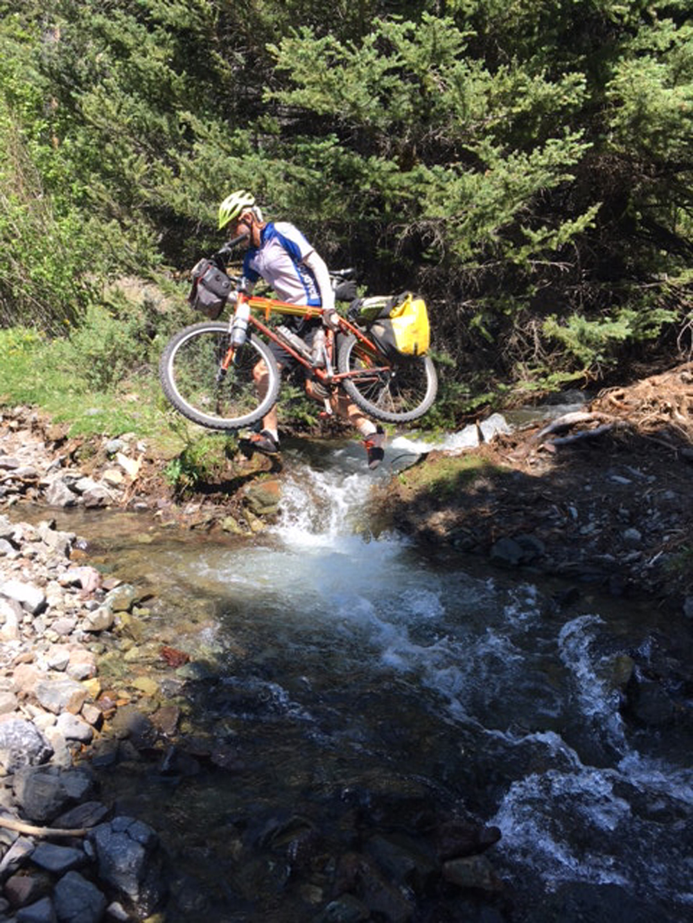
The road ended, the trail began, and the first challenge of the day was to get across the river. The East Fork of the Salmon is big enough that we thought there “had” to be a bridge, but to our surprise the trail ended at one bank and started at the other, with plenty of icy water charging past in between. It looked borderline do-able, so I threw an unloaded bike onto my shoulder, grabbed a stout stick, and started across; what could possibly go wrong? I got about three quarters of the way, the stick got swept out of my hand, and I decided to lunge for the last few feet, and…fell. As the current poured over me I did a sort of sea-lionesque body hurl for the bank and somehow made it to the shore, with the benefit of a huge jolt of adrenaline offsetting the shock of the frigid water. I was not willing to try again without a bike, much less do it with another bike and gear or encourage the much-lighter Ashley to give it a go. Fortunately, an upstream scout revealed a braided section with 2 channels, and with a bit of effort we were successfully across and noodling up a great singletrack towards the mountains.
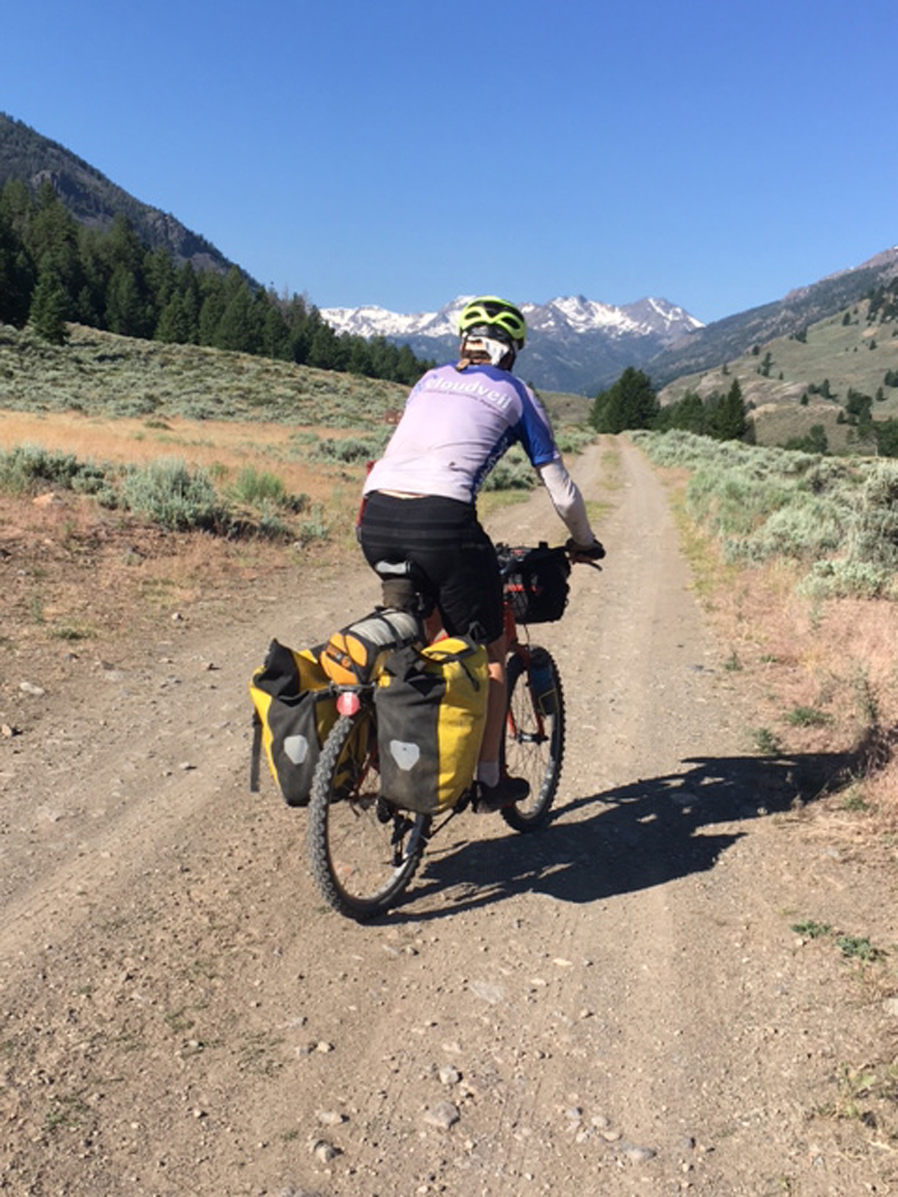
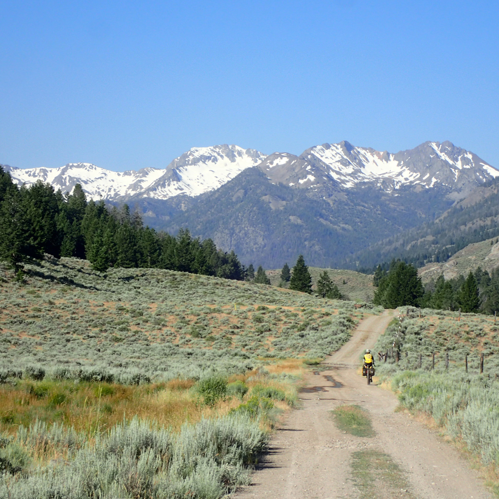
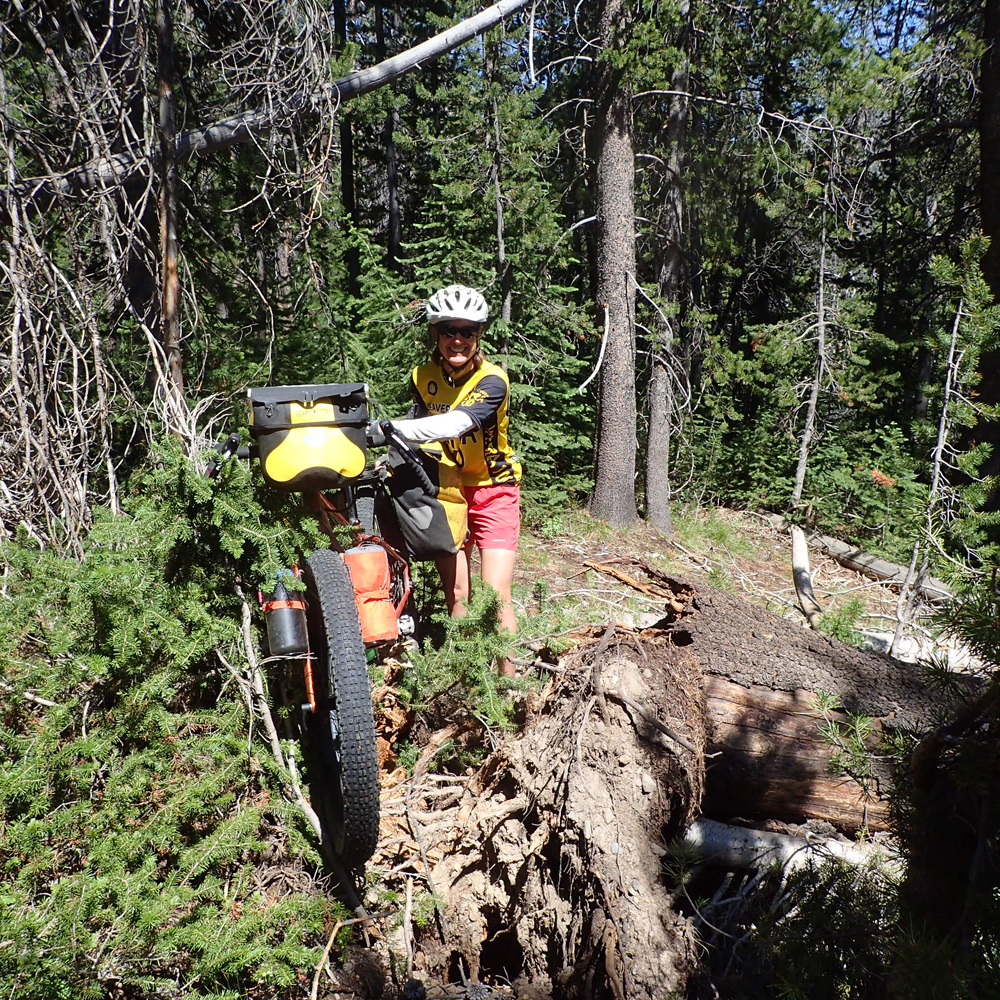
Up high the East Fork is made up of two forks: the South Fork and the West Fork (of the East Fork; Idaho has a lot of these) and our wilderness-free route went up the West. It was only about 1400 feet up to the pass in a few miles; how hard could that be? In a year of big snows and big winds that blew out creeks and blew down trees…pretty hard. It was clear that we were the first folks to go up that trail this year and if we weren’t pushing our bikes up steep, rutted, gravelly trails we were hauling them over and under big logs that needed additional branch trimming to navigate. Though it was challenging, within a couple of hours we reached the top (we knew we were getting close when we hit snow!) and it was clear that motos had come up from the other side, so we had a long, fun, technical descent down into the Salmon Valley. We staged nicely for a diner breakfast at Smiley Creek Lodge by camping in the foothills. After rolling downhill to a fine omelet we headed up the nice dirt road/double track that parallels the north side of the highway up to Galena Summit with its jaw-dropping views of the nearby mighty Sawtooth Mountains. Once on top of Galena a fast zip down to Galena Lodge provided access to the Harriman Trail, the famous doubletrack that acts as the course for the Boulder Mountain Tour Nordic race.
Wilderness designation can be tough on cyclists, but in the case of the Boulder and White Cloud mountain wilderness areas, it was just parceled enough to unlock a stellar bike tour…and a great way to beat the heat!
Nuts and Bolts:
- Start and finish in Ketchum/Sun Valley Idaho
- Mileage – about 160 miles
- Know before you go: the route is about 5% singletrack, 75% gravel roads, and 15-20% paved road
- The only food available is the diner at Smiley Creek Lodge, but there’s water along most of the route; 2-3 bike bottles is fine.
- The quality of the roads is fine and there is almost no traffic.
- It’s easy to stay out of wilderness where bikes are not allowed.
- Are there bears? Maybe, but we didn’t even think of that. Check with the Forest Service to be sure and learn about proper backcountry camping techniques.
- Camping – From above Big Boulder Creek, all land is National Forest, and backcountry camping is allowed. Some land on the East Fork of the Salmon is private and precludes camping.
Tom,
On the south side, or Ketchum side there is a sweet single track over Galena summit call the old toll road. On the north side, or Stanley side the old road is a two track gravel road. We recently rode both on a bike packing trip called the Idaho Hot Springs Mountain Bike Route. Both are ridable with loaded bikes. Way better then dealing with traffic over Galena. BTW this is in my back yard so I am adding it to my must do camp outs. Thanks.
Bill
Hi Bill – thanks for the note. Yes, that side double track to the top of Galena from the north (starting in the flats a mile or two south of Smiley Creek lodge, where the highway crosses the trickle that will become the Salmon river) is a great one. And this summer I rode the Galena trails for the first time and discovered the Toll Road trail, and indeed it’s a fun way to descend down the pass and hook into the Herriman trail.
Tom